Sotina - Sotinski breg (Kugla) (by road)
Starting point: Sotina (241 m)
| Latitude/Longitude: | 46,8213°N 16,0318°E |
| |
Route name: by road
Walking time: 35 min
Difficulty: easy marked way
Elevation gain: 177 m
Elevation difference along the route: 177 m
Map:
Recommended equipment (summer):
Recommended equipment (winter):
Views: 16.283
 | 1 person like this post |
Access to starting point:
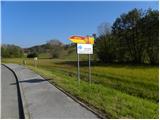
A) First, we drive to Maribor, and then we continue driving on the Pomurska highway towards Murska Sobota. At the exit Sveti Jurij ob Ščavnici we leave the highway and continue driving towards Radenci. In Radenci we continue left towards Gornja Radgona and then soon right in the direction of Gederovci. From Gederovci we continue straight towards Krajna and Skakovci, and in Skakovci left towards Cankova. Further, we drive through the villages Breg, Krašči, Pertoča, Rogašovci, Serdica to the village Sotina. In Sotina we will notice signposts by the inn Sbüll and beside them the first blazes, which lead to Sotinski breg.
B) From Murska Sobota we drive to Gederovci, and then we continue driving towards the settlements Skakovci, Cankova, Krašči, Pertoča, Rogašovci, Serdica to the village Sotina. In Sotina we will notice signposts by the inn Sbüll and beside them the first blazes, which lead to Sotinski breg.
Route description:
By the inn we notice the sign with the inscription Sotina, which directs us left onto a marked road. Already after a few 10 m we come to a smaller crossroad, where we leave the main road and continue right in the direction of Kugla. The still completely gentle road continues past a few houses, and then we arrive at the next crossroad. Here we continue left on an ascending road, which becomes increasingly scenic. Further, we ascend for some time among individual houses on the road, which occasionally ascends quite steeply. Higher, the road flattens a little, and then in a moderate ascent with increasingly beautiful views it brings us to the edge of the border with Austria. Here we continue left and after approximately 100 m we arrive at the wooden lookout tower on Sotinski breg or Kugla.
Photos:
 1
1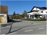 2
2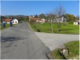 3
3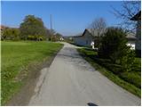 4
4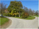 5
5 6
6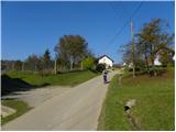 7
7 8
8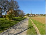 9
9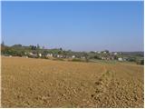 10
10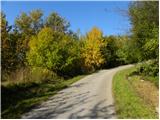 11
11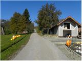 12
12 13
13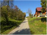 14
14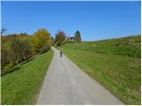 15
15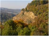 16
16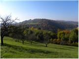 17
17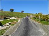 18
18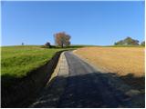 19
19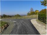 20
20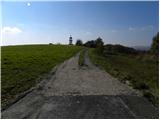 21
21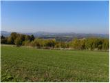 22
22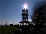 23
23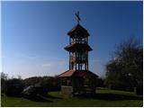 24
24 25
25
Discussion about the trip Sotina - Sotinski breg (Kugla) (by road)
|
| Z Stefan1. 05. 2011 |
What happened to the camera on Kugla?? It's no longer on the internet... please if anyone knows the answer ... Best regards to everyone in Goričko
|
|
|
|
| Borut129. 11. 2015 |
The Pomurska planinska pot stamp is located in the Šbüll inn in Sotina. From the tower you can continue west through the forest to the Sotina - Kalch road, along which you return to the starting point.
|
|
|
|
| Sorok29. 11. 2015 |
I last saw the stamp (August this year) in the box with the logbook, attached to the lower railing at the tower entrance. But have they stolen it again ?! Yes, before it was at Šbüll for a long time. ?! Yes, before it was at Šbüll for a long time.
|
|
|
|
| Lisica30. 01. 2023 19:41:53 |
Zig is on the stand. The tower is no longer there.
|
|
|
|
| ovi27. 11. 2023 18:52:27 |
 afnaLisica- many dogs let loose - and -Rogašovščani have built a new tower (that's about the forum's up-to-dateness), path marked, trodden -was there yesterday - use the path from the former guard post (and don't enter GPS data from the instructions here- because Google will take you to AT)- Sotina, turnoff for Sotinski vrh - right - you continue straight another cca. 3 min. and park next to the ruin/right/ guard post -then right on the path-go - good half hour... afnaLisica- many dogs let loose - and -Rogašovščani have built a new tower (that's about the forum's up-to-dateness), path marked, trodden -was there yesterday - use the path from the former guard post (and don't enter GPS data from the instructions here- because Google will take you to AT)- Sotina, turnoff for Sotinski vrh - right - you continue straight another cca. 3 min. and park next to the ruin/right/ guard post -then right on the path-go - good half hour...
Exceptional views (for MUERCE- Donačka, Pohorje and Koralpe Hungary visible...awesome)...before that still stamp Rotunda in Selu for extended route no, "hikers"Slovenjceljnski-yes, takes 3 hours and more from LJ...driving I mean...
|
|
|
To post a comment you must log in:
If you do not yet have a username, you must first
register.