Sotina - Činčev breg (via Činčev Breg)
Starting point: Sotina (258 m)
| Latitude/Longitude: | 46,83144°N 16,0497°E |
| |
Route name: via Činčev Breg
Walking time: 25 min
Difficulty: easy unmarked way
Elevation gain: 117 m
Elevation difference along the route: 117 m
Map: Pomurje 1:40.000
Recommended equipment (summer):
Recommended equipment (winter):
Views: 209
 | 1 person like this post |
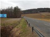
Access to starting point:
A) We drive to Gederovci (to here from Radenci or Murska Sobota) and continue driving in the direction of Kuzma. When we get to the settlement Sotina, we need to pay attention, because at the cemetery the described path begins. We park on a macadam parking lot 50 m ahead of the parking lot at the cemetery.
B) We drive to Kuzma (to here from the settlement Grad, Mačkovci or Petrovci), and then we continue driving towards Sotina and Austria. When Kuzma ends, some ascent follows, then a descent, where from the junction with the priority road we continue left. Subsequently, we quickly arrive in Sotina, where at the cemetery the described path begins. We park about 50 m before the cemetery on a macadam parking lot.
Route description:
From the parking lot, we walk along the main road to the parking lot at the cemetery, and after the cemetery we go right on a side road which starts moderately ascending. At first, we go past a few more houses, where we continue on the road which leads towards the hamlet Činčev Breg. After the panoramic part, the road passes into a strip of forest, and when on the right the forest ends, by the path we notice a rock with a blaze and caption Činčev breg 359 m.
From here we go a few more 10 steps along the road, and then we go left on a cart track which starts ascending through the forest. After a short steeper ascent, the path and the slope flatten out, and we go first right, then left and arrive at the highest point of Činčev breg, which due to the forest does not offer a nice view.
Description and pictures refer to the condition in February 2021.
Along the route: Čurmanov Breg (290m), Činčev Breg (350m)
Photos:
 1
1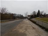 2
2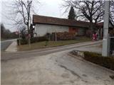 3
3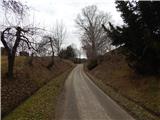 4
4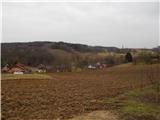 5
5 6
6 7
7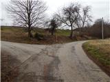 8
8 9
9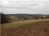 10
10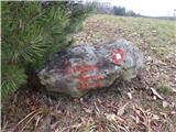 11
11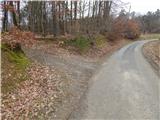 12
12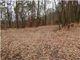 13
13 14
14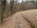 15
15 16
16 17
17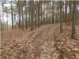 18
18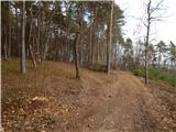 19
19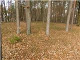 20
20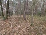 21
21
Discussion about the trip Sotina - Činčev breg (via Činčev Breg)
To post a comment you must log in:
If you do not yet have a username, you must first
register.