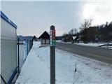
Starting point: Sodna vas (198 m)
| Latitude/Longitude: | 46,17461°N 15,60112°E |
| |
Walking time: 30 min
Difficulty: easy marked way
Elevation gain: 146 m
Elevation difference along the route: 146 m
Map:
Recommended equipment (summer):
Recommended equipment (winter):
Views: 99
 | 1 person like this post |
Access to starting point:
a) Drive to Mestinje, then follow the signs to Podčetrtek. Shortly after the settlement Pristava pri Mestinju, cross the railway track (here a road branches off to the left towards the settlement Sveta Ema, but we drive just a little further to the bus stop Sodna vas, where the described trail begins. There are no designated parking spaces at the starting point.
b) Drive to Brežice, then follow the road towards the settlements Bizeljsko, Bistrica ob Sotli, Podčetrtek and Celje. When Podčetrtek ends, first cross Mestinjščica, then we are already at the bus stop Sodna vas, where the described trail begins. There are no designated parking spaces at the starting point.
Route description:
From the bus stop, continue a few dozen steps along the main road northwards, then turn right to a hamlet of a few houses, directed by the markers. At the end of the hamlet, arrive at the railway line over which the marked trail leads, but crossing is prohibited (the arranged crossing goes along the main road towards Celje, and joins the marked trail from Olimje at the hamlet Marčja vas).
On the other side of the railway line, arrive at the hamlet Marčja vas, which already belongs to the settlement Sveta Ema.
Here, from the marked junction, go right (left, if you crossed the railway line via the main road) and follow the signs to Sveta Ema. Initially pass a few houses, then turn right onto a side road that turns into forest and begins to climb steeply. Follow the ascent through the forest; higher up, upon reaching the ridge, go left, after a further few-minute ascent reach the upper part of the settlement Sveta Ema. Here, at a few smaller intersections, follow the markers and soon arrive at the church of St. Ema, located on the top of the hill.
Description and photos refer to the status in January 2026.

Along the route: Marčja vas (205m)
Photos:
 1
1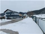 2
2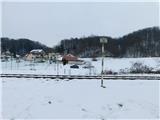 3
3 4
4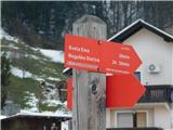 5
5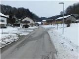 6
6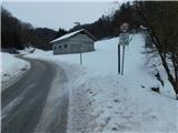 7
7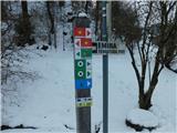 8
8 9
9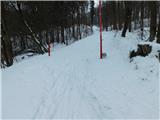 10
10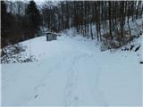 11
11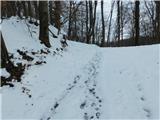 12
12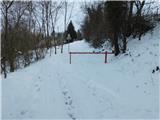 13
13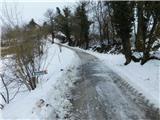 14
14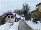 15
15 16
16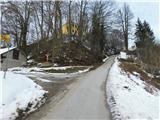 17
17 18
18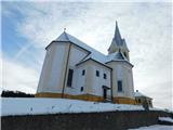 19
19
Discussion about the trip Sodna vas - Sveta Ema
To post a comment you must log in:
If you do not yet have a username, you must first
register.