Smrečje - Plešivec (by road)
Starting point: Smrečje (854 m)
| Latitude/Longitude: | 46,3993°N 14,469°E |
| |
Route name: by road
Walking time: 3 h 30 min
Difficulty: easy unmarked way
Elevation gain: 947 m
Elevation difference along the route: 1000 m
Map: Karavanke - osrednji del 1:50.000
Recommended equipment (summer):
Recommended equipment (winter): ice axe, crampons
Views: 7.458
 | 1 person like this post |
Access to starting point:
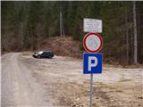
From the highway Ljubljana - Jesenice, we take the exit Kranj-East and follow the road ahead in the direction of Jezersko. From the inn Kanonir, we drive further about a kilometer to the signposts. Here we turn left towards the signs for Krtina Hospital. We follow the road to a large parking lot at the sign prohibiting further driving.
Route description:
From the parking lot, we continue along the road alongside which we parked and already after a few dozen meters we encounter a barrier. The road soon after makes a sharp right turn and brings us to a junction. We take the left road towards Krtina Hospital. The road, which ascends moderately, leads us over a bridge and behind it emerges from the forest. Here a path also branches off to the right to the hospital, but we continue along the road, which in a few hairpin turns brings us to the top of a grassy slope. The road, which then re-enters the forest, continues ascending and after an hour and a half of walking brings us to a larger clearing where the hunting hut Stanič stands.
From the hut we continue ahead along the road, which soon brings us to an intersection. We continue along the right road, which becomes increasingly poor. It brings us after 30 minutes of walking from the hunting hut to the ruins (JLA guard post) at the end of the road.
From here we continue between both ruins ahead. The path enters the forest and ascends slightly along a nice trail. This path after about ten minutes brings us to an unmarked junction, where we continue right onto the upper path. The path then soon emerges from the forest onto steep grassy slopes. Ahead, in the lower part, the path crosses these slopes and brings us into an indistinct valley. There are two paths ahead. We take the right one along the bottom of the valley to a small saddle. At the saddle, we turn left and continue along the border ridge. When the path emerges from the forest onto the summit slope of Mali Pečovnik, a beautiful view opens up. In a few steps we can climb to the summit of Mali Pečovnik.
The path ahead first descends slightly, then reaches the panoramic summit (Veliki Pečovnik) with a gentle ascent.
From the summit of Veliki Pečovnik we continue ahead along the ridge towards the north. After a short descent the path brings us to a meadow, which begins to ascend gently. At the end of the meadow the path turns slightly right and climbs over a short steep step. The path ahead runs among dwarf pines, still along the border ridge. In summer days caution is needed here due to snakes. There are quite a few of them here. The path ahead ascends through the dwarf pines all the way to the summit, where there is a sign for the state border.
Parking lot - hunting hut 1:30, hunting hut - ruins 30 minutes, ruins - Veliki Pečovnik 45 minutes, Veliki Pečovnik - Plešivec 45 minutes.

Photos:
 1
1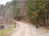 2
2 3
3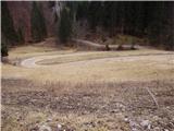 4
4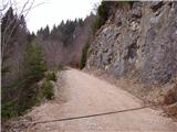 5
5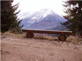 6
6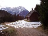 7
7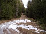 8
8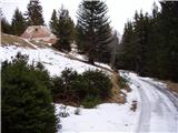 9
9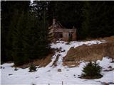 10
10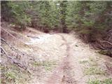 11
11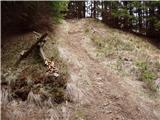 12
12 13
13 14
14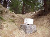 15
15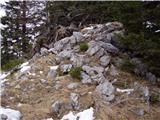 16
16 17
17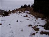 18
18 19
19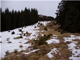 20
20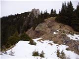 21
21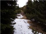 22
22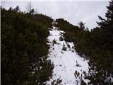 23
23 24
24
Discussion about the trip Smrečje - Plešivec (by road)
|
| tonek76. 01. 2008 |
Nice trip in winter recommended with touring skis, as there is quickly enough snow on meadows and forest roads, and the descent is not too steep. As can be nicely seen from the photos, there are wonderful views of the Grintovce from the Jezerska side. Trip for all lovers of solitary paths, as there are not many visitors except in the mushroom picking season. Cheers ToneK
|
|
|
|
| Gost7. 01. 2008 |
What are the conditions like now. Is there enough snow for touring skis. Thanks, Igor
|
|
|
To post a comment you must log in:
If you do not yet have a username, you must first
register.