Šmartno - Šmarna gora (Šmartinska way)
Starting point: Šmartno (317 m)
| Latitude/Longitude: | 46,1245°N 14,4798°E |
| |
Route name: Šmartinska way
Walking time: 50 min
Difficulty: easy marked way
Elevation gain: 352 m
Elevation difference along the route: 352 m
Map: Ljubljana - okolica 1:50.000
Recommended equipment (summer):
Recommended equipment (winter):
Views: 66.648
 | 6 people like this post |
Access to starting point:
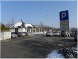
From the highway Ljubljana - Jesenice, we go to the exit Šmartno, and then at the beginning of the settlement Šmartno we drive towards the nearby cemetery, by which it is possible to park.
Route description:
From the parking lot by the cemetery, we go on a one-way road, on which past the church we walk to the next crossroad. Here we continue straight across the road (left Tacen, right inn Bizeljčan) to the nearby hiking signposts. Signs for Šmarna gora point us onto a narrower road which starts ascending between the houses. After a shorter gentle ascent we get to a smaller crossroad, where signs for Šmarna gora point us to the right on a gradually quite steep road which at the last house changes into a forest mountain path. Further we gently ascend through the forest for some time and then we get to a marked crossing, where we continue left in the direction of the Šmartinska pot (right Partizanska pot on Šmarna gora).
The path ahead is ascending diagonally towards the left, and we follow it in a gentle to moderate ascent to the chapel of the Sorrowful Mother of God, where one of the paths from Tacen joins.
Here we continue left upwards, on the path which gradually starts ascending a little steeper. The path which is all the time ascending through the forest first joins another path from Tacen, in a sharp right turn also joins the path from Vikrč, and we continue on a wide path, which past a chapel brings us to a marked crossing, where the marked path to Grmada branches off to the left. Here we continue straight as well, and the path out of the forest brings us on a small saddle between Grmada and Šmarna gora.
Here we step on a road (access from Zavrha) on which we continue the ascent, and which soon splits into two parts. We can continue the ascent on the road, in this case, we get to the summit past a wish bell, or we continue right on a marked footpath which past the chapel of St. Sobota also brings us to the summit of Šmarna gora.

Photos:
 1
1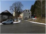 2
2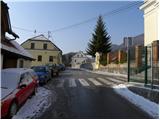 3
3 4
4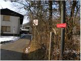 5
5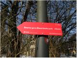 6
6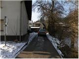 7
7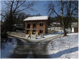 8
8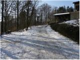 9
9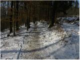 10
10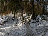 11
11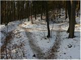 12
12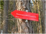 13
13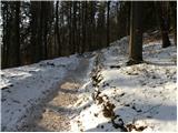 14
14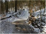 15
15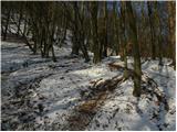 16
16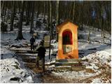 17
17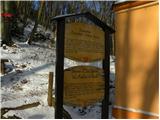 18
18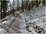 19
19 20
20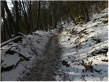 21
21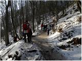 22
22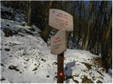 23
23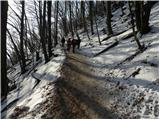 24
24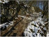 25
25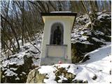 26
26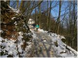 27
27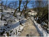 28
28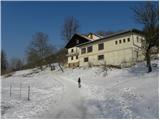 29
29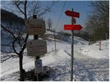 30
30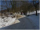 31
31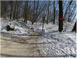 32
32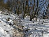 33
33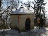 34
34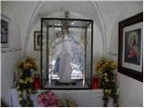 35
35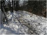 36
36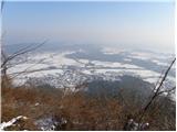 37
37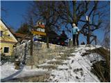 38
38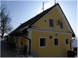 39
39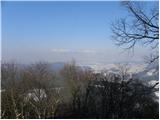 40
40
Discussion about the trip Šmartno - Šmarna gora (Šmartinska way)
|
| Gost11. 09. 2007 |
From the top there is a very nice view of the Julian, Kamnik-Savinja Alps and Karavanke
|
|
|
|
| Gost12. 09. 2007 |
Ugh, tough. Path description to Šmarna gora!?!
Still waiting for a guide to Ljubljana's Rožnik, with a guide to the starting point of this ascent
|
|
|
|
| Gost12. 09. 2007 |
Why not? I'm from Ljubljana, retired, I've been hiking for decades ("serious"), and I'm not ashamed to admit that I didn't know these paths from Šmartno to Šmarna gora - I always went from Tacen or via Peske. And I'm not ashamed to admit that I often go on outings to such "insignificant molehills" as Šmarna Gora, Rožnik, Sv. Lovrenc and the like near Ljubljana.
|
|
|
|
| andrej76712. 09. 2007 |
Yeah, totally fine, after all in the end the hours we spend in the fresh air count for good, not the elevation difference.
|
|
|
|
| magacoprnon11. 03. 2008 |
The path that brings you to the top on the right (opposite the one from Tacen) is also nice, fast and steep. Recommended.
|
|
|
|
| VanSims12. 04. 2010 |
I kindly ask dog owners to keep them on a leash, as it says at least five or six times from the saddle to the summit and another three or four times at the summit. It can't be overlooked, and illiteracy has practically been eradicated here, so no excuses.
|
|
|
|
| EUGEN13. 04. 2010 |
I also agree that every path description is welcome for someone.
Regarding dogs, it's very hard to train owners to keep them on a leash. Thousands of excuses (especially "mine doesn't do anything").
I am a dog owner myself (always on a leash)!
|
|
|
|
| VanSims14. 05. 2010 |
Hi EUGEN! I won't comment, but I can tell you that dogs have bad experiences with "don't worry, it won't do anything to you". Unfortunately, tear gas has become almost mandatory hiking gear.
|
|
|
To post a comment you must log in:
If you do not yet have a username, you must first
register.