Slovenske Konjice - Stolpnik (via castle)
Starting point: Slovenske Konjice (333 m)
| Latitude/Longitude: | 46,3372°N 15,4204°E |
| |
Route name: via castle
Walking time: 2 h 15 min
Difficulty: easy marked way
Elevation gain: 679 m
Elevation difference along the route: 800 m
Map:
Recommended equipment (summer):
Recommended equipment (winter):
Views: 32.100
 | 2 people like this post |
Access to starting point:
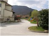
From the highway Ljubljana - Maribor, we go to the exit Slovenske Konjice and follow the road to the mentioned town. In the center of Slovenske Konjice, we leave the main road (we continue left) and go towards the church, near which we park on a large marked parking lot.
Route description:
From the parking lot at the church, we continue on a sidewalk (towards the west), which after a few dozen meters brings us to a school, where we notice signposts for Stolpnik. We continue left on a sidewalk, which is slightly ascending and after a short ascent brings us to mountain signposts right next to the cemetery. Here we continue straight in the direction of Stari grad on the path which leads us on the left side of the cemetery. On the top of the cemetery, we leave the road and continue the ascent on a marked footpath which steeply ascends. After a few minutes of the ascent, the steepness decreases and the path brings us out of the forest on a macadam road which we only cross (right - castle Konjice 5 minutes).
A wide cart track on which we walk, in a few steps brings us to a crossing of paths, where a trail blaze points us left upwards. After a few dozen steps the situation is repeated, the difference is that we don't continue the ascent on a cart track but on a footpath which ascends through the forest. Higher, the path brings us to the next road, where we continue on the road ahead (left - Skala). When the road makes a left turn, we leave it and continue the ascent on a moderately steep footpath (cart track), which again ascends through the forest. After a 15-minute ascent, we again come to the road, which we follow to the right. The road ahead runs past three crosses, and only a little after them we come to the next crossroad, where we continue right. We then for quite some time continue walking on the road, which at first ascends gently, and then in a moderate descent brings us to a crossroad, where there is a path junction. We continue straight upwards on a footpath in the direction of Stolpnik (left - Kamna gora, right - Slovenske Konjice, where we can descend), which moderately ascends. A wide moderately steep path leads us further through the forest, where we cross a smaller partly already overgrown clearing. After the clearing, the path for a short time entirely flattens, and then in a moderate ascent brings us to the summit, where there stands a lookout tower.

The trip can be extended to the following destinations: Stolpnik
Photos:
 1
1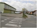 2
2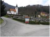 3
3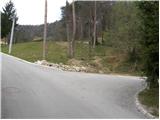 4
4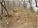 5
5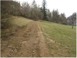 6
6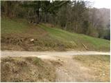 7
7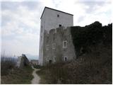 8
8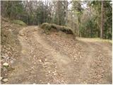 9
9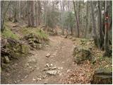 10
10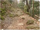 11
11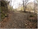 12
12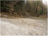 13
13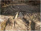 14
14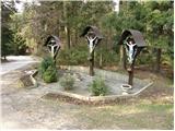 15
15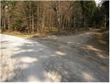 16
16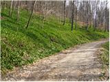 17
17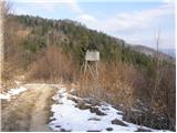 18
18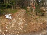 19
19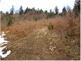 20
20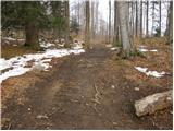 21
21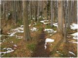 22
22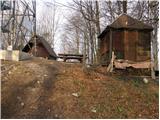 23
23 24
24
Discussion about the trip Slovenske Konjice - Stolpnik (via castle)
|
| godlike21. 05. 2011 |
Today I was on Stolpnik. Nice trip, only at the end you expect the peak after every knoll, but the path continues a bit. Thunder chased us a little but no precipitation.
Down we returned via the described path, up we followed Stolpnik signs appearing at the cemetery for variety. This path isn't described on the site yet. It continues below the cemetery and soon into forest. Joins the mentioned path at junction before last peak. Approaches from right.
|
|
|
|
| pohodnik3823. 09. 2012 |
Yesterday I dashed up Konjiška gora near Slovenske Konjice and customized the tour a bit. Start in the center near the church towards Skala and via the climbing trail. From there continued to the main summit Stolpnik. Very nice, wonderful view, only the wind on the tower summit was quite strong. Met only three hikers the whole lovely day
Video-Konjiška gora-Skala-Stolpnik-1012m
Best regards! Tone
|
|
|
|
| Hribolazec816. 02. 2016 |
Today I did this trail and at the top someone's fingers were itching, there's no stamp anywhere :/
|
|
|
|
| aonuk17. 02. 2016 |
THE STAMP IS ON THE FIRST PLATFORM OF THE VIEWPOINT TOWER (another sheet metal box to which the STAMP is attached)
|
|
|
|
| ivanka.zrna18. 03. 2017 |
It's really nothing unusual to have a cushion with you,
but unusual if the cushion is dry.
|
|
|
|
| dkavcic23. 07. 2020 |
There was no stamp anymore, on Sunday 19.7.2020
|
|
|
To post a comment you must log in:
If you do not yet have a username, you must first
register.