Slovenj Gradec - Gradišče (above Slovenj Gradec)
Starting point: Slovenj Gradec (413 m)
| Latitude/Longitude: | 46,5102°N 15,0817°E |
| |
Walking time: 30 min
Difficulty: easy marked way, easy unmarked way
Elevation gain: 103 m
Elevation difference along the route: 110 m
Map: Pohorje - izletniška karta 1:50.000
Recommended equipment (summer):
Recommended equipment (winter):
Views: 1.380
 | 1 person like this post |
Access to starting point:
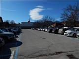
We drive to Slovenj Gradec and park near the roundabout by the Hofer store. Most of the parking lots in the center of the town are paid during the week, and one can mostly park only for two hours, therefore on the mentioned parking lots it is best to park on weekends, and during the week choose another parking lot. A larger free parking lot is by the town's cemetery, which extends the path by a good 10 minutes. The cemetery is situated on the outskirts of the town in the direction towards Velenje.
Route description:
From the spot where we have parked, we walk to the roundabout by the Hofer store, then we head onto the road in the direction of the ski area Kope and the settlement Legen. Initially we walk on the sidewalk, we leave the road towards Kope at the intersection, where the road towards Kope turns right, and we continue straight in the direction of the marked path to Kremžarjev vrh and the road towards Gradišče. We still walk on the sidewalk further on, a little after the road sign which marks the end of Slovenj Gradec, the mountain signposts direct us left onto the path which ascends through a meadow. At a few houses we reach an asphalt road, which we follow to the left (straight continues the marked path to Kremžarjev vrh), along it we quickly arrive at the intersection.
We continue straight onto the side road, alongside which there is a marked parking lot, along it in a good 5 minutes we ascend to the homestead Gradiščar, from it with nice views we walk also to the nearby manor Gradišče, which is from the homestead only a few dozen steps away.
Description and pictures refer to the condition in the year 2019 (February).

Photos:
 1
1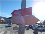 2
2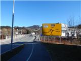 3
3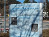 4
4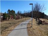 5
5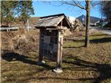 6
6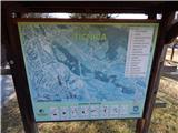 7
7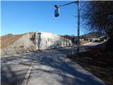 8
8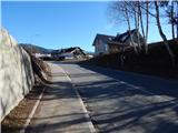 9
9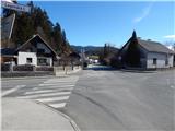 10
10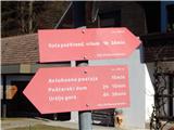 11
11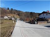 12
12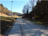 13
13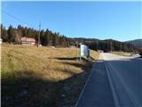 14
14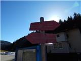 15
15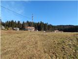 16
16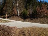 17
17 18
18 19
19 20
20 21
21 22
22 23
23 24
24 25
25
Discussion about the trip Slovenj Gradec - Gradišče (above Slovenj Gradec)
To post a comment you must log in:
If you do not yet have a username, you must first
register.