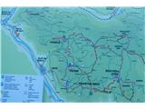
Slap ob Idrijci - Črvov vrh (through Žlebi)
Starting point: Slap ob Idrijci (180 m)
| Latitude/Longitude: | 46,7126°N 13,4816°E |
| |
Route name: through Žlebi
Walking time: 4 h
Difficulty: easy unmarked way, easy marked way
Elevation gain: 794 m
Elevation difference along the route: 794 m
Map:
Recommended equipment (summer): lamp
Recommended equipment (winter): crampons, lamp
Views: 977
 | 2 people like this post |
Access to starting point:
From Tolmin, past Most na Soči towards Idrija 11 km. Or from Idrija in the direction towards Tolmin 35 km.
Route description:
At the bus stop Slap ob Idrijci, we turn in the direction of the Šentviška planota. After about 100 meters of walking on the road, we notice a footpath that turns right uphill. Along the footpath, we return to the road we previously left. On the other side of it, we notice signs for the path towards the Planota. We continue along a narrower asphalt road to an abandoned mill in a gully. Soon after the mill, we notice signs for Žlebi. After a few steps, a well-trodden footpath begins through a steep forest. When we reach the signs for the caves Nosnica and Zidanica, it is worth taking some time to rest and explore these attractions. Continuing, we soon reach a turn-off for the village Roče. We proceed upwards towards the Planota. Shortly after, there is another turn-off leading to the village Pečine. Here, we turn upwards towards Ponikve. When we emerge from the forest near a hayloft, we follow the cart track below it. After a few hundred meters, we reach wide meadows where the footpath disappears. If we walk when the grass is low or mowed, we can head slightly left upwards through the meadows towards the highest point. There stands Plečnik’s church, though it is obscured by trees. We notice only a cable that provides electrical power to it. We see the church when we are almost at the summit. After visiting this attraction, we descend to the village Ponikve. Through the village, we follow a road that soon begins to rise slightly. At the end of the village, when the road dips into a valley, we turn left towards Gorski vrh. Here, we can choose the right variant past Ostrožnik and Penček, or go straight past the ski slope and the hunting cottage. From here, it is approximately 5 kilometers to Črvov vrh. Both mentioned variants are approximately the same length.

Along the route: Kraške jame v Žlebeh (350m), Marjina cerkev na Ponikvah (673m)
Photos:
 1
1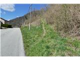 2
2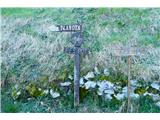 3
3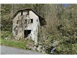 4
4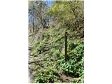 5
5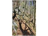 6
6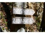 7
7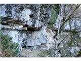 8
8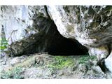 9
9 10
10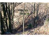 11
11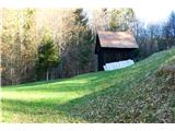 12
12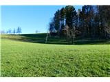 13
13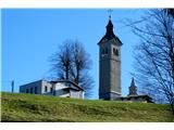 14
14 15
15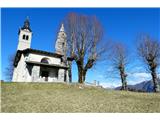 16
16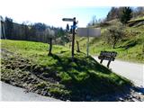 17
17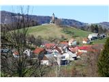 18
18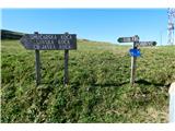 19
19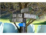 20
20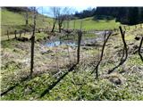 21
21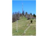 22
22
Discussion about the trip Slap ob Idrijci - Črvov vrh (through Žlebi)
|
| navdušena22. 02. 2023 09:16:09 |
Thanks for this description. I'm already looking forward to the tour!
|
|
|
|
| navdušena28. 03. 2023 20:54:14 |
Beautiful path. Tone, thanks for the description and guiding through these wonderful areas!
|
|
|
|
| ločanka1. 04. 2023 13:28:16 |
Tone, next time we'll join
|
|
|
|
| črow1. 04. 2023 15:49:40 |
Oh ločanka, gladly go again sometime. Plan for autumn, soon there will be lots of wet grass on the meadows!
|
|
|
To post a comment you must log in:
If you do not yet have a username, you must first
register.