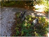
Starting point: Škrbina (1227 m)
| Latitude/Longitude: | 45,9863°N 13,8871°E |
| |
Walking time: 1 h 15 min
Difficulty: easy marked way
Elevation gain: 253 m
Elevation difference along the route: 265 m
Map: Goriška 1:50.000
Recommended equipment (summer):
Recommended equipment (winter): ice axe, crampons
Views: 5.571
 | 1 person like this post |
Access to starting point:
First, we drive to Idrija and then we continue driving in the direction of Vojsko. After approximately 14 km of driving from Idrija, along an initially quite ascending road we arrive at the center of the village, from there we continue driving left towards Mrzla Rupa, Hudo Polje and Lokve. The road soon starts to descend more noticeably and descends for approximately 200 meters of elevation, then it flattens and brings us to Mrzle Rupe (we can also get here from Gorenja Trebuša). We continue driving in the direction of Hudo Polje and the village of Lokve on the road which again starts to ascend moderately. Higher up we arrive at Hudo Polje, but we continue driving on the asphalt road which past Sončni rob brings us to a crossroads of several roads, where the asphalt ends. Here we park in a suitable place near the mentioned crossroads.
Route description:
From the crossroad, we continue on the macadam road past the gate following the signs »Golaki«. At the first left turn we leave the road and the blazes direct us right onto the footpath.
In the following, a relatively narrow and in some places also slightly overgrown path leads us through the forest. At the beginning the path is quite level and on short sections it even descends slightly. Later we begin to ascend somewhat more steeply and the path also becomes less overgrown, only occasionally do we still have to cross some fallen tree. The path then leads us through the forest for quite some time and in the last part brings us to the main ridge of the Golaki. Here the path turns right and ascends slightly along the ridge through the forest. Higher up the path brings us out of the forest into dwarf pines and shrubbery. Here beautiful views of the surrounding hills begin to open up. In fine weather the sea, the Julian Alps and even the Dolomites are very clearly visible.
After a short ascent through the dwarf pines we soon reach the indistinct summit of Srednji Golak.

Photos:
 1
1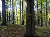 2
2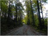 3
3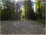 4
4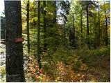 5
5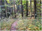 6
6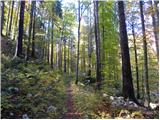 7
7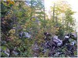 8
8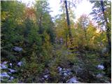 9
9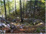 10
10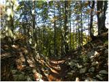 11
11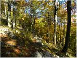 12
12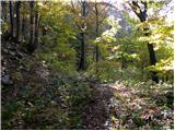 13
13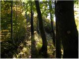 14
14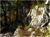 15
15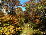 16
16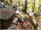 17
17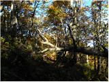 18
18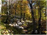 19
19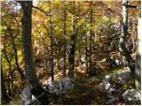 20
20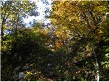 21
21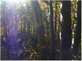 22
22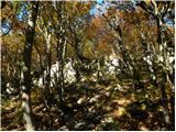 23
23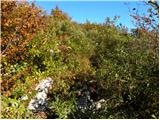 24
24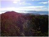 25
25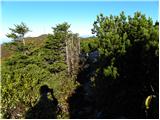 26
26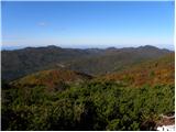 27
27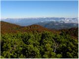 28
28
Discussion about the trip Škrbina - Srednji Golak
|
| anka 7. 10. 2010 |
The intersection proposed as the starting point of the hike is called Škrbina, Sončni rob is a rocky promontory above Hudim polje. The proposed route is part of SPP.
|
|
|
|
| Swiss2. 12. 2011 |
Hello!
According to my knowledge, the above description refers to Veliki Golak 1480m. If we follow the above description, we first reach Veliki Golak 1480m, not Srednji. The path and names on the map are also misleading. People in these areas use the name Mali Golak for the peak at 1495 m a.s.l., not Veliki Golak as written. There is no independent path or trail from this direction to Srednji Golak.
Best regards and happy hiking in the mountains!
|
|
|
|
| anka 2. 12. 2011 |
There is some confusion around the naming of the Golaks. The path from Škrbina (SPP Idrija - Čaven) leads us to the saddle between Veliki and the double-summited Srednji Golak named Vratca. Veliki Golak is to the left, further east, and the path to it is not marked; it needs to be well searched for, as the summit is overgrown with brushwood. The marked path then turns right westward to Srednji Golak, which has two indistinct summits. Many confuse them for Veliki and Srednji Golak. The description is correct. Good luck.
|
|
|
|
| julius2. 12. 2011 |
Swiss!
You're right about Mali Golak. This path bypasses Veliki Golak and goes directly to Srednji Golak. Here too, Mali is higher than Srednji and Veliki.
In the PZS Nanos map, all errors are corrected.
|
|
|
|
| Swiss20. 12. 2011 |
Hello!
Fans of Golaks, surrounding hills and ridges. I can't help but chime in again in the debate. Namely, it doesn't seem right to me that the path starting at Škrbina bypasses Veliki Golak and goes further away from it. If they made it onto it (from the military side), it would be an extremely scenic (360 deg.) ridge path or trail. It would cover all three Golaks. There is already a trail from the south side to Veliki Golak, which then leads along the ridge to Srednji and Mali Golak. In winter conditions, this path is feasible because the dense scrub is snow-covered. But in summer, it's tough to push through it. If there's no other alternative, I'll make it myself early in summer. I think it won't be hard to turn a bit left from the current path and join the southern trail at its top.
What do you think?
Best regards and happy trails!
|
|
|
To post a comment you must log in:
If you do not yet have a username, you must first
register.