Starting point: Skadanščina (550 m)
| Latitude/Longitude: | 45,5468°N 14,0119°E |
| |
Walking time: 1 h 40 min
Difficulty: easy marked way
Elevation gain: 478 m
Elevation difference along the route: 500 m
Map: Slovenska Istra - Čičarija, Brkini in Kras 1:50.000
Recommended equipment (summer):
Recommended equipment (winter): ice axe, crampons
Views: 57.988
 | 2 people like this post |
Access to starting point:
We leave the Primorska highway at the Kozina exit, and then follow the road towards Ilirska Bistrica and Reka. After the settlement of Materija, we stay alert, as the road soon branches off to the right towards Skadanščina. We continue on this road, following it to a marked parking lot located shortly before the settlement of Skadanščina.
Route description:
From the parking lot, we head onto a marked footpath toward Skadanščina and Slavnik, which ascends through a strip of forest, and when the forest ends, we quickly reach the church of St. Rok, located on the outskirts of the settlement of Skadanščina.
We bypass the church on the right side, then begin descending through the village, following the trail markers. Lower, we reach a marked crossroads in the middle of the village, and we choose the road with signs for Slavnik SPP, Mala Vrata, and Plešivec (to the right, Jegno pasture). The road after the village loses its asphalt covering and after a few minutes of walking splits into two parts. We continue on the right upper road towards Slavnik (the left road leads towards Mala Vrata), and it gradually enters the forest and slowly turns into a cart track. We continue the ascent on a gentle cart track, and it leads us past numerous and well-marked crossings. A little higher, the cart track entirely flattens, and then it gradually starts ascending steeper. A moderately steep cart track higher crosses a forest road and then gradually starts changing into a wide and easy-to-follow footpath. The path ahead brings us to the information board, which marks the beginning of the natural monument Slavnik, and only a few steps further it comes out of the forest on panoramic grassy slopes. Here the path turns slightly towards the right and after approximately 10 minutes of additional walking brings us to the summit of Slavnik.
Starting point - sv. Rok 0:05, sv. Rok - Slavnik 1:35.

Photos:
 1
1 2
2 3
3 4
4 5
5 6
6 7
7 8
8 9
9 10
10 11
11 12
12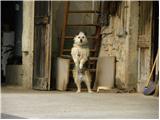 13
13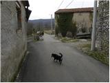 14
14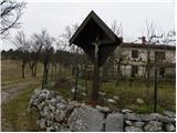 15
15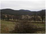 16
16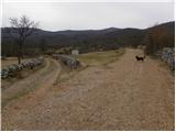 17
17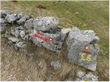 18
18 19
19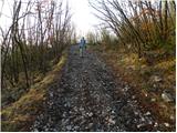 20
20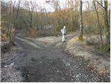 21
21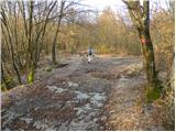 22
22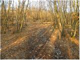 23
23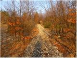 24
24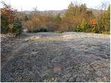 25
25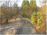 26
26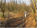 27
27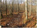 28
28 29
29 30
30 31
31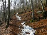 32
32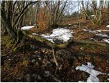 33
33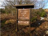 34
34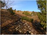 35
35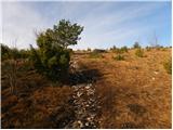 36
36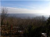 37
37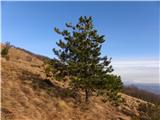 38
38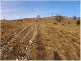 39
39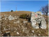 40
40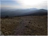 41
41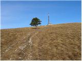 42
42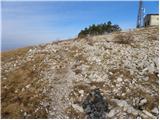 43
43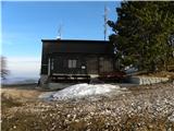 44
44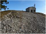 45
45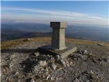 46
46 47
47
Discussion about the trip Skadanščina - Slavnik
|
| balon22. 09. 2013 |
Hello!
I'm interested if it's possible to reach picture 8 by car?
Thanks for the answer
|
|
|
|
| bruny22. 09. 2013 |
Up to photo 8  I assume it's certainly possible by car - this is also hinted at by the path representative in the first two sentences of the description, but out of respect for the settlement residents, I would park and start walking where the trip describer did, and he already knew why!?... It's nice and respectful to stroll, look at some curiosity, which judging by the photos there are, maybe buy a jar of honey or a loaf of sheep cheese, a piece of pogaca...say... and talk or chat with the locals who keep the Slovenian countryside inhabited. Their dialect is pleasant and firmly carved in the more rugged Karst land of the bora... This way we force even more additional ideal starting points and gain 500/600 meters and five/ten minutes judging by this case, which would just additionally ,,warm us up,, for the pleasant continuation of the uphill walk while glimpses of life pass us by...The writing is well-intentioned, certainly not polemical...Best regards I assume it's certainly possible by car - this is also hinted at by the path representative in the first two sentences of the description, but out of respect for the settlement residents, I would park and start walking where the trip describer did, and he already knew why!?... It's nice and respectful to stroll, look at some curiosity, which judging by the photos there are, maybe buy a jar of honey or a loaf of sheep cheese, a piece of pogaca...say... and talk or chat with the locals who keep the Slovenian countryside inhabited. Their dialect is pleasant and firmly carved in the more rugged Karst land of the bora... This way we force even more additional ideal starting points and gain 500/600 meters and five/ten minutes judging by this case, which would just additionally ,,warm us up,, for the pleasant continuation of the uphill walk while glimpses of life pass us by...The writing is well-intentioned, certainly not polemical...Best regards
|
|
|
|
| repika22. 09. 2013 |
A walk through the village doesn't take more than 15 minutes, from what I've seen so far everyone parks right in front of / in the immediate vicinity of the sign. Nicely written bruny!
|
|
|
|
| balon23. 09. 2013 |
I'm asking because of two younger hikers, for whom at about 2 hours of walking in one direction the additional 10-15 min. are already very noticeable.
Thanks for the answer
|
|
|
|
| repika23. 09. 2013 |
Don't worry, we and our little hiker got up in a good hour even though we stopped a lot, looked for photo motifs, talked about flowers, with locals... We absolutely don't like rushing, running etc. We always take time for everything and always arrive last at the goal, even in a group. Children find it very interesting when we know how to entertain them along the way. Pleasant trail... Children can do more than we think.
|
|
|
|
| spet_jaz1. 05. 2017 |
We were there 29.4. 1.5 hours is just right; well marked, went with child. Path is excellently signposted.
Some more photos on the link: Slavnik
|
|
|
|
| nacka.2. 05. 2017 |
In the photo gallery you're wondering what you were looking at: with your gaze you embraced the entire Čičarija, starting on Slavnik and ending with Učka.
Best regards
|
|
|
|
| spet_jaz3. 05. 2017 |
Thank you very much for the information @nacka.
|
|
|
|
| mornar17. 12. 2017 |
I'm interested in how the access to Slavnik is and where the SPP stamp is located. Best regards and thanks for the info.
|
|
|
|
| piotr17. 12. 2017 |
There is quite some information on the club page:Enter here
|
|
|
|
| Enka31. 05. 2018 |
Is the SPP stamp really only in the hut and thus can only be stamped on weekends when the hut is open?
|
|
|
|
| turbo31. 05. 2018 |
Enka,
I was up there end of December 2017 and the stamp was on the pillar at the top. Whether it's the real stamp unfortunately I don't know ?! I don't remember if there's also a logbook and ink pad there, so bring an ink pad with you. I'm attaching a picture where the stamp is clearly visible above the dog.
http://shrani.si/f/7/Yh/4ONCpS7C/img3052.jpg
|
|
|
|
| Enka31. 05. 2018 |
Turbo, thanks! Not SPP stamp, but this one will do too. I stamp for my own joy anyway
|
|
|
|
| Ninđa1. 06. 2018 |
@enka the stamp is in the box in front of the hut. Under the balcony. Last time I checked there were x stamps but none from SPP
Best, Nino
|
|
|
|
| Enka1. 06. 2018 |
Ninđa, just in your report on the SPP path I read (and saw) that the real stamp outside the hut is not available .
I kind of understand, because apparently they even steal those in the huts (well, that someone steals a stamp, I don't understand that!), on the other hand it's a bit tricky if the SPP point is a hut that operates only two days a week all year. Luckily there are apparently enough other stamps around
|
|
|
|
| ločanka27. 02. 2024 14:05:01 |
Now it's no longer necessary to go along the road in the first picture, but you can step onto the footpath right above the parking lot.
We did a circular route by descending from Slavnik to Mala vrata (about one hour, two according to the signs) and from there back to Skadanščina (about one hour). It's longer than the ascent itself, but worth it. I think there's no description of this here.
|
|
|
|
| Tadej24. 05. 2024 13:56:44 |
I corrected the initial part in the description because there is now an arranged parking lot there.
Ločanka, the description via Malih Vrat will come soon too.
|
|
|
To post a comment you must log in:
If you do not yet have a username, you must first
register.