Sevski gozd - Sveta Trojica
Starting point: Sevski gozd (820 m)
| Latitude/Longitude: | 45,7195°N 14,2528°E |
| |
Walking time: 45 min
Difficulty: easy marked way
Elevation gain: 286 m
Elevation difference along the route: 286 m
Map: Snežnik 1:50.000
Recommended equipment (summer):
Recommended equipment (winter):
Views: 23.968
 | 3 people like this post |
Access to starting point:
From the highway Ljubljana - Koper, we take the Postojna exit. We follow the road ahead in the direction of Ilirska Bistrica but only to the village Pivka. In the middle of Pivka, a road branches off sharply to the left towards the village Trnje. We follow this road through the village Trnje and further to a crossroads near the military area, where we continue left. Further, we drive on the road, which gently ascends along the military area. We follow it to the parking lot by the road, where we notice signs for Sveta Trojica.
Route description:
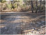
From the parking lot, we go on the path in the direction of Sveta Trojica. After a few steps of walking, we step out of the forest onto grassy slopes, where we notice a hunting observatory and the next signposts. Further, we continue on a wide cart track in the direction of Sveta Trojica 45 minutes.
The cart track initially ascends gently and has quite a few crossings, so we carefully follow the blazes. The path then gradually starts to ascend a little more steeply and a little higher joins the path from Vlačno. The path ahead ascends moderately and after a short ascent crosses a forest road. Further, we continue in the direction of Sveta Trojica on the path, which ascends more steeply. After that, the path emerges from the forest onto the upper grassy slope of the mountain. Here the path turns slightly to the left and in a moderate ascent quickly brings us to a panoramic peak.
Photos:
 1
1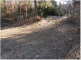 2
2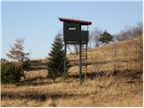 3
3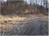 4
4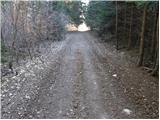 5
5 6
6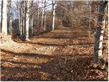 7
7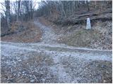 8
8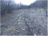 9
9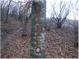 10
10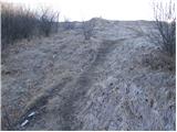 11
11 12
12
Discussion about the trip Sevski gozd - Sveta Trojica
|
| pohodnik0123. 02. 2008 |
Today 23.02.2008 we were at Sveta Trojica. The day was quite nice and pleasant for strolling. We left the car in the valley so we had a pleasant two-hour walk. From the top there was no really nice view due to the haziness of the air. I recommend to those who maintain this summit to provide a stamp, because what hangs on the chain doesn't resemble a stamp! Enjoy Sveta Trojica.
http://www.hribi.net/slike/smile.gif
smile
|
|
|
|
| korab1. 01. 2012 |
Yesterday morning we were at Sveta Trojica or Lonica. It was really pleasant. An hour of walking for an unforgettable view from the top, Triglav, Nanos, Snežnik, Učka... like on the palm of the hand. Snow was crunching, sunshine caressing... and there wasn't a big crowd either, New Year's Eve surely kept someone in the valley.
Tip to those maintaining the path, at path intersections there are no direction signs, or not on all, well.. locals already know.
Definitely a nice path and worth the hike.
|
|
|
|
| ožep12. 07. 2014 |
Today, 12.07.2014, I was at Sv. Trojica from the Trnja direction. The path is well marked, the stamp is attached to a stone at the top of Sv. Trojica, the little church is nicely renovated. There are many different flowers among them also edelweiss - which is of course protected, the view due to the mists did not extend very far.
|
|
|
|
| sebaseba3. 08. 2015 |
GPS coordinates of the starting point are probably wrong.
I think more correctly it is 45.72456 14.25792 or a bit further there's a larger parking lot 45.71687 14.24677.
|
|
|
|
| aljoša11. 06. 2017 |
Does anyone know where the stamp for Sveta Trojica is down in the villages, because the one at the top is really bad?
|
|
|
|
| prepihec3. 03. 2019 |
today, between 13 and 15 o'clock on the trail from Sevski gozd to Sv. Trojica, I lost my wallet. If someone found it, please call 041/601949, Predrag Hluchy, Vrhnika
|
|
|
To post a comment you must log in:
If you do not yet have a username, you must first
register.