Šentviška Gora - Črvov vrh
Starting point: Šentviška Gora (648 m)
| Latitude/Longitude: | 46,1169°N 13,8712°E |
| |
Walking time: 1 h 10 min
Difficulty: easy unmarked way
Elevation gain: 326 m
Elevation difference along the route: 335 m
Map:
Recommended equipment (summer):
Recommended equipment (winter):
Views: 5.554
 | 4 people like this post |
Access to starting point:
From the road Idrija - Most na Soči, in the settlement Slap ob Idrijci we turn right (from the direction Most na Soči sharply left) in the direction of settlements Ponikve, Šentviška Gora and Pečine. We then begin to ascend, at the crossroads we follow the signs for Šentviška Gora. When we get to the mentioned settlement we park at a suitable place near the parish church of St. Vid.
Route description:
We bypass the church on the right, and the cemetery on the left side, and continue on the asphalt road in the direction of Gorski Vrh. After the last houses, the asphalt ends, and the gentle road gradually becomes a little steeper. Higher, the road makes two hairpin turns and past the chapel brings us to an asphalt road, which we follow to the right. For a few minutes we ascend on the asphalt road, then from the junction we continue left in the direction of the village Ponikve and Gorski Vrh (straight ahead Bukovski Vrh and Police).
After the junction, the road temporarily flattens, then it starts to ascend more steeply and leads us past the homestead Travnikar, and a little higher it brings us to the next junction.
To the left the road continues towards the settlement Ponikve, to the right the road towards the settlement Bukovski Vrh, and we continue straight on a beaten unmarked footpath, which at first ascends through a meadow, then temporarily passes into the forest, where we cross the first pasture fence; when we step out of the forest we cross the fence two more times.
Here we join the path from the village Ponikve, and we continue straight towards Črvov vrh, where we already see the antenna tower on it. A few minutes of moderate ascent follow, after crossing the pasture fence only a few steps of easy walking separate us from the top.
Description and pictures refer to the condition in the year 2019 (December).

Along the route: Gorski Vrh (827m)
Photos:
 1
1 2
2 3
3 4
4 5
5 6
6 7
7 8
8 9
9 10
10 11
11 12
12 13
13 14
14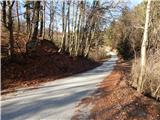 15
15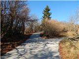 16
16 17
17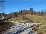 18
18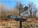 19
19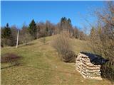 20
20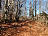 21
21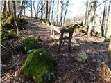 22
22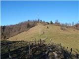 23
23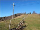 24
24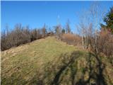 25
25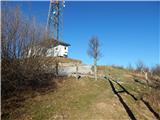 26
26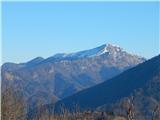 27
27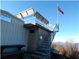 28
28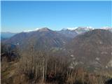 29
29 30
30
Discussion about the trip Šentviška Gora - Črvov vrh
To post a comment you must log in:
If you do not yet have a username, you must first
register.