Nevejski preval - Rifugio Corsi
Starting point: Nevejski preval (1170 m)
| Latitude/Longitude: | 46,3908°N 13,4755°E |
| |
Walking time: 2 h 50 min
Difficulty: easy marked way
Elevation gain: 704 m
Elevation difference along the route: 900 m
Map: Julijske Alpe - zahodni del 1:50.000
Recommended equipment (summer):
Recommended equipment (winter): ice axe, crampons
Views: 18.638
 | 1 person like this post |
Access to starting point:
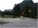
From Kranjska Gora over the border crossing Rateče we drive to Trbiž / Tarvisio. In Trbiž we continue left in the direction of Bovec and we follow the road to the crossroad near the lake Rabeljsko jezero. Here we continue right in the direction of Nevejski preval / Sella Nevea. This road, which is mostly ascending, we follow to the saddle, where we will notice on the right side of the road a smaller ski slope. We park on the macadam parking lot below the ski slope.
From Bovec, we drive to the border crossing Predel, from which we descend to the Italian side. Only a little after the lake Rabeljsko jezero we come to the crossroad, where we continue left in the direction of Nevejski preval / Sella Nevea. Further, follow the above description.
Route description:
From the parking lot, we continue on the asphalt road (on the left side of the ski slope - ski track on the northern side of the main road), which on the saddle branches off from the main road. By the road, we will also notice a sign which marks the path 625 towards the mountain hut Corsi and a detailed map. In a left turn we leave the road and go right on a poorly beaten footpath which brings us to a macadam road which is ascending on the right side of the ski slope. For some time we are then ascending on the road, and then the blazes point us to the left into the forest. After a short ascent, we come to a crossroad, where we continue right on the path 625 and the path towards the mountain pasture Pecol and mountain hut Brazza branches off to the left. The path is then still ascending through the forest and crosses the mountain road a few times and brings us to a crossroad, where another path, which runs towards the mountain hut Brazza, branches off to the left. The path then turns to the right and starts crossing slopes towards the east. We soon come out of the forest onto grassy slopes and an ascent towards the saddle Passo degli Scalini (2022m) follows, where there are usually many ibex. From the saddle then follows a shorter descent, which brings us to a crossroad, where the path towards the saddle Lavinal dell'Orso (2138m) branches off to the left. At the crossroad, we continue right and soon from the right side joins the path 628, which leads past the bottom station of a cargo cableway. A relatively wide path then leads us below overhanging walls and past some military trenches from the First World War. To the mountain hut Corsi then follows only a shorter descent on grassy terrain.

Along the route: Passo degli Scalini (2022m)
Photos:
 1
1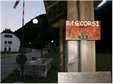 2
2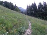 3
3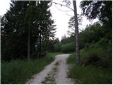 4
4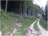 5
5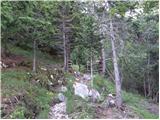 6
6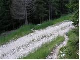 7
7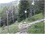 8
8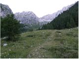 9
9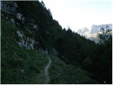 10
10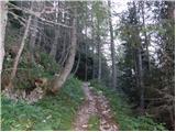 11
11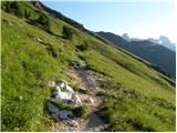 12
12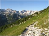 13
13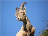 14
14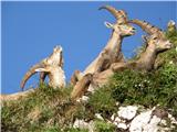 15
15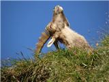 16
16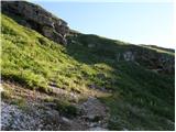 17
17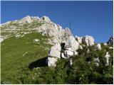 18
18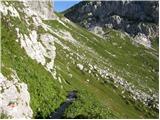 19
19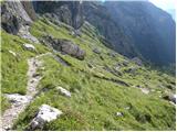 20
20 21
21 22
22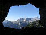 23
23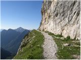 24
24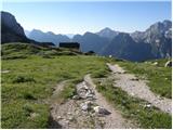 25
25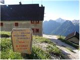 26
26
Discussion about the trip Nevejski preval - Rifugio Corsi
|
| planinec alex19. 09. 2010 |
I haven't been to Rifugio Corsi, but I've heard it has a very nice view
|
|
|
|
| grega_p22. 09. 2010 |
So just keep your feet on the path until the snowflakes descend lower.
|
|
|
|
| di17. 08. 2025 05:19:27 |
The practical starting point is the end of the ski slope.
The analog (paper) map was inadequate;
their (Italian) markings are misleading;
the digital map shows way too much overlapping of routes – according to it, the correct route is now either overgrown or fenced with wire mesh and a house next to it.
Around the saddle (pictures 14–16) this time (midweek, when there are fewer human visitors on these paths) not a single chamois was visible (encounter only with two returning hikers – 1 hour wasted at the start due to searching for the official path beginning, described in the first part).
|
|
|
To post a comment you must log in:
If you do not yet have a username, you must first
register.