Nevejski preval - Monte Robon (via 637)
Starting point: Nevejski preval (1190 m)
| Latitude/Longitude: | 46,3907°N 13,4839°E |
| |
Route name: via 637
Walking time: 2 h 40 min
Difficulty: partly demanding unmarked way
Elevation gain: 790 m
Elevation difference along the route: 850 m
Map: Julijske Alpe - zahodni del 1:50.000
Recommended equipment (summer):
Recommended equipment (winter): ice axe, crampons
Views: 10.143
 | 1 person like this post |
Access to starting point:
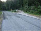
From Kranjska Gora over the border crossing Rateče we drive to Trbiž / Tarvisio. In Trbiž we continue left in the direction of Bovec and we follow the road to the crossroads near Rabeljsko Lake. Here we continue right in the direction of Nevejski preval / Sella Nevea. Further, we drive on an ascending road which higher makes a few hairpin turns, after that only a few tens of meters before the road starts barely noticeably descending, on the left side we notice a poor forest road which from the main road branches off sharply to the left (at the crossroads there is a traffic sign and next to it a rock with blazes - beginning of our path). Because at the crossroads there are no appropriate parking spots, we drive a good 100 meters further and then we park on an appropriate place by the road.
From Bovec, we drive to the border crossing Predel, from which we descend to the Italian side. Only a little after Rabeljsko Lake we come to the crossroads, where we continue left in the direction of Nevejski preval / Sella Nevea. Further, we follow the description above.
Route description:
From the starting point, we return a little back, and then we go on footpath number 637, which at first runs on a poor forest road. After a few minutes of easy walking, blazes point us to the right on a footpath which with the help of numerous smaller stairs starts ascending steeply. A little higher a nice view opens up on surrounding peaks, and the path flattens and returns into the forest. The path ahead in a moderate ascent (in between it also slightly descends a few times) crosses slopes towards the left, then for a short time ascends a little steeper and from the steep slopes brings us into transitional more level terrain. The increasingly panoramic path which runs on an old military mule track then leads us over a series of short valleys, crossings and a few shorter descents. The mentioned path after a time brings us to the foot of the steep, smooth and on some spots even overhanging western walls of Velika Bavha. Just by the foot of the wall the marked path turns to the right and then ascends diagonally over a shorter scree. Only a little further the path turns a little more to the right, where after a short crossing it brings us to the edge of a torrent gully. Here we turn sharply left and by the edge of the torrent we ascend to its mouth. Here through some sort of natural door we enter a beautiful high mountain cirque, where the path entirely flattens, and if we are quiet we can also notice numerous marmots.
Through the mentioned cirque we walk slightly towards the left and then we join the path from the mountain hut Rifugio Gilberti. We follow the mentioned path to the left, and in a few hairpin turns it brings us to the panoramic saddle Vrh Laških brežičev (in Italian Sella Robon), where there stands an information board and next to it a table with two benches.
On the saddle, we continue left (straight Jerebica 6 hours) and we continue the ascent on an easy-to-follow but further unmarked path. The path ahead ascends diagonally across a quite steep slope, then it flattens and brings us to numerous military fortifications. We bypass the mentioned fortifications on the left side along a wide artificial ledge, after that only a short ascent follows and the path brings us to the caving bivouac Modonutti - Savoia.
From the bivouac, we continue left on an at-first still easy-to-follow path, which soon crosses a short exposed ledge, then turns to the right and very steeply ascends through a smaller notch, where rocky stairs help us. Higher, the path flattens and starts to get lost among numerous limestone slabs and abysses, but because numerous cairns show the further path, orientation at least in nice weather is not difficult. Higher, the path starts turning a little more to the right and leads us past numerous abysses. A little below the summit we come to a mighty abyss, along the edge of which on a short section runs a damaged path. Here instead of crossing the exposed passage over rotten wood, it is much safer to climb the solid rock on the right side or to crawl through it in the lower part. When we step on the other side of the mentioned passage, the path flattens and past yet another exposed but wide ledge quickly brings us to the panoramic summit.

Photos:
 1
1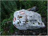 2
2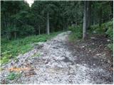 3
3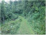 4
4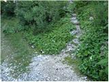 5
5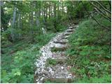 6
6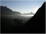 7
7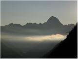 8
8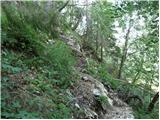 9
9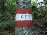 10
10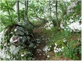 11
11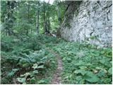 12
12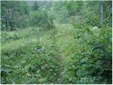 13
13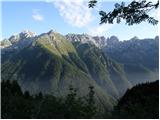 14
14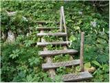 15
15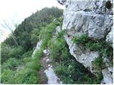 16
16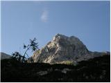 17
17 18
18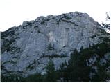 19
19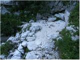 20
20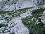 21
21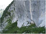 22
22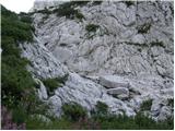 23
23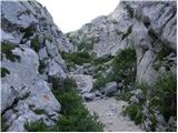 24
24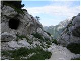 25
25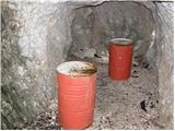 26
26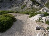 27
27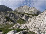 28
28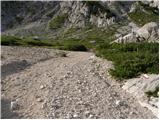 29
29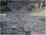 30
30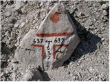 31
31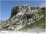 32
32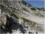 33
33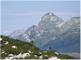 34
34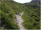 35
35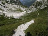 36
36 37
37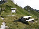 38
38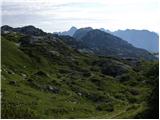 39
39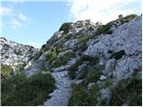 40
40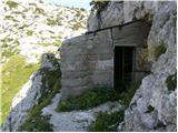 41
41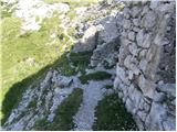 42
42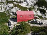 43
43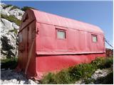 44
44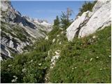 45
45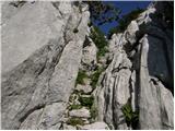 46
46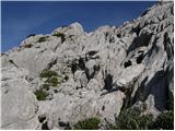 47
47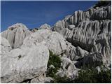 48
48 49
49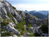 50
50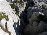 51
51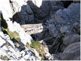 52
52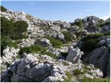 53
53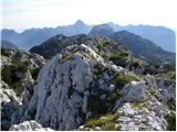 54
54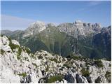 55
55
Discussion about the trip Nevejski preval - Monte Robon (via 637)
|
| damijanp21. 08. 2014 |
On Saturday we did a circular route - up via path 637, back via 636. Both paths are interesting, but on the first part of path 637 there is quite a lot of fallen trees, which don't cause major difficulties. Otherwise, a highly recommended trip to what seems to be a not very visited peak.
Photos:
Velika Bavha
|
|
|
|
| haridautovic6. 07. 2020 |
Today 5.7.2020 we chose an exploratory tour (the tour is actually tailored for lovers of history and beginnings between the two wars). We chose Velika Bavha - The summit stands in the background of Rombona - Velika and mala Črnelska špica and hudega vršiča, here the war left an indelible mark and a big stain on the entire area. The summit itself is a dream vantage point to which two paths lead, the best is that the tour can be done circularly which is a special charm. For the ascent we chose the mountain road approx 500m, before Sella Nevea path 637. The path initially follows the road after which we soon leave the road and climb on a forest path under the foot of Lopiča. When we cross the natural gate we enter the wonderful cirque under Črnelska špica, soon we arrive at Sella Robon - Vrh laških brežičev, after which only the ascent to the summit follows along the military fortifications. We descended on the incredibly beautiful mule track towards Prevali and Koči Gillberti, but we left the mentioned mule track at Monte Poviz / Pobič and descended to Sella Nevea, 300 meters from the starting point,, because we just walked along the road to the car full of enthusiasm,,,,,
|
|
|
To post a comment you must log in:
If you do not yet have a username, you must first
register.