Scicchizza - Spodnje Mangartsko jezero
Starting point: Scicchizza (857 m)
| Latitude/Longitude: | 46,4819°N 13,6749°E |
| |
Walking time: 10 min
Difficulty: easy marked way
Elevation gain: 67 m
Elevation difference along the route: 67 m
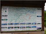
Map: Julijske Alpe - zahodni del 1:50.000
Recommended equipment (summer):
Recommended equipment (winter):
Views: 1.040
 | 1 person like this post |
Access to starting point:
A) First, we drive to Kranjska Gora, then continue driving towards Rateče and further into Italy. When we arrive at the settlement Fužine / Fusine in Valromana, immediately after crossing the Jezerski potok stream, we will notice signs for Mangartska jezera / Laghi di Fusine (there are signs in Italian by the road). We continue left in the mentioned direction and continue driving on a narrower asphalt road, which we follow to the hamlet Scicchizza. We park at the parking lot by the road, immediately after the cycling road joins from the left.
B) Via the Predel border crossing, we drive to Italy, then continue driving towards Trbiž / Tarvisio and further towards Rateče. When we arrive at the settlement Fužine / Fusine in Valromana, just before the road crosses the Jezerski potok stream, we will notice signs for Mangartska jezera / Laghi di Fusine (there are signs in Italian by the road). We continue right in the mentioned direction and continue driving on a narrower asphalt road, which we follow to the hamlet Scicchizza. We park at the parking lot by the road, immediately after the cycling road joins from the left.
Route description:
At the end of the parking lot, we notice a well-maintained tourist path, which branches off slightly to the right from the road. The pleasant path continues along the Jezerski potok stream and leads us in a gentle to moderate ascent past several stronger karst springs. Higher up, we arrive at a junction at the small dam of Spodnje Mangartsko jezero lake, where we continue right and in a minute or two of further walking arrive at the nearby refreshment stand, from where there is a nice view towards Mangart.
Description and pictures refer to the condition in the year 2015 (June).
Photos:
 1
1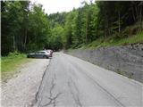 2
2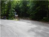 3
3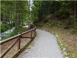 4
4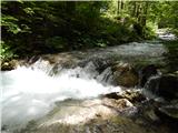 5
5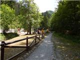 6
6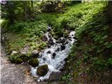 7
7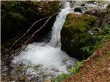 8
8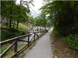 9
9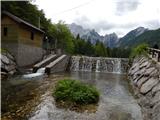 10
10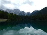 11
11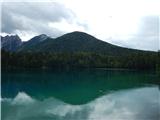 12
12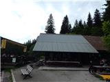 13
13
Discussion about the trip Scicchizza - Spodnje Mangartsko jezero
To post a comment you must log in:
If you do not yet have a username, you must first
register.