Starting point: Šalamenci (225 m)
| Latitude/Longitude: | 46,72765°N 16,12914°E |
| |
Walking time: 45 min
Difficulty: easy unmarked way
Elevation gain: 97 m
Elevation difference along the route: 97 m
Map: Pomurje 1:40.000
Recommended equipment (summer):
Recommended equipment (winter):
Views: 278
 | 1 person like this post |
Access to starting point:
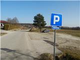
We leave the Pomurska motorway at the Murska Sobota exit, then initially follow the signs for Murska Sobota, then the signs for Murska Sobota east. From the roundabout between the stores Lidl and Hofer we continue in the direction of Markišavci and Puconci. After Markišavci we cross a railway track (we don't go right into Puconci), then we go right towards Šalamenci. In Šalamenci we go left and drive to the marked parking lot at the cemetery in Šalamenci.
Route description:
From the parking lot, we continue along the main road, which continues towards the west, and when we arrive in Bodonci, the road turns more towards the northwest. With views of fields and nearby houses and hills, after approximately 20 minutes we arrive at the spot where we leave the wider asphalt road and continue right (right after the house with house number Bodonci 113) on a narrower asphalt road, which starts to ascend lightly along the edge of the forest. A little further on, we go slightly left from the road onto a wider cart track, or initially still a macadam road, which near the nearby vineyard starts to ascend more steeply. The path levels out higher up, and from the upper part of the vineyard a nice view opens towards the flat part of Prekmurje.
Just a few 10 steps further, the path returns to the forest and takes us in a light ascent to the hunting observatory on Griški vrh.
The description and pictures refer to the condition in February 2021.

Along the route: Griže (243m)
Photos:
 1
1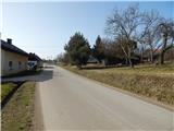 2
2 3
3 4
4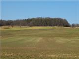 5
5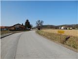 6
6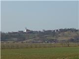 7
7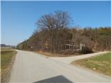 8
8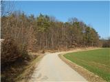 9
9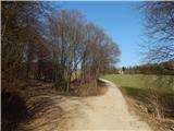 10
10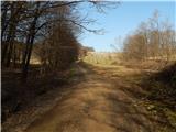 11
11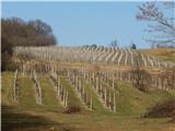 12
12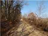 13
13 14
14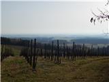 15
15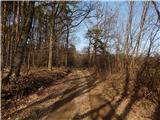 16
16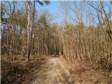 17
17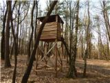 18
18
Discussion about the trip Šalamenci - Griški vrh
To post a comment you must log in:
If you do not yet have a username, you must first
register.