Sedlo nad Lohačo - Špilnik (upper path - via Lipovec)
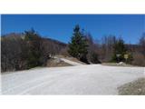
Starting point: Sedlo nad Lohačo (829 m)
| Latitude/Longitude: | 45,83758°N 14,20469°E |
| |
Route name: upper path - via Lipovec
Walking time: 40 min
Difficulty: easy marked way
Elevation gain: 189 m
Elevation difference along the route: 293 m
Map: Snežnik 1:50 000 PZS
Recommended equipment (summer):
Recommended equipment (winter):
Views: 3.170
 | 2 people like this post |
Access to starting point:
To the starting point, we can drive: a) from central Slovenia we drive on the highway to exit Unec, and then we go right towards Planina. When we get to the settlement, we turn left towards Postojna, then we need to pay attention at the end of the settlement, where signposts point us to the right towards Strmci and Predjama. We follow this road straight at the next crossroad and quite soon we get to the settlement Lohača, where we turn right uphill. An asphalt road changes into a macadam, and we continue to the saddle, where there are signposts and a cross. We park nearby. b) From Primorska we drive to Postojna, where we continue towards Predjama. We drive past village Zagon, and then we turn right towards Studenec and Strmci. We follow this road to the settlement Lohača, where we turn left uphill. An asphalt road changes into a macadam, and we continue to the saddle, where there are signposts and a cross. We park nearby.
Route description:
At the starting point, we turn left in the direction of Sv. Lovrenc. After approximately a minute of walking, at the rock we turn right on a grassy cart track (information board about the path). Ahead of us there is Lipovec (1005m) and a steep path, which with increasingly beautiful views brings us to the panoramic summit. Then we descend on the ridge towards the west, where we already see our destination. We descend to a saddle, where we cross the cart track (bottom path). For a short time, we still continue straight upwards and then the trail blazes and cairns point us right to the secondary peak of Špilnik. We follow the path past a rope fence. Through visible consequences of the ice storm after a few minutes we ascend to the secondary peak, and then the path goes towards the north and we soon reach the main peak.
Along the route: Lipovec (1005m)
Photos:
 1
1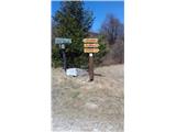 2
2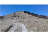 3
3 4
4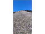 5
5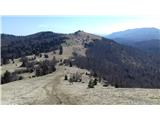 6
6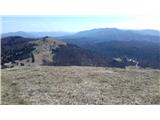 7
7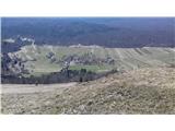 8
8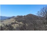 9
9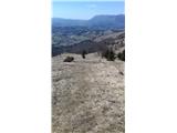 10
10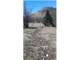 11
11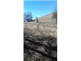 12
12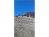 13
13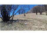 14
14 15
15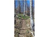 16
16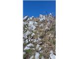 17
17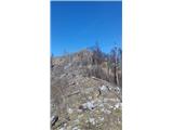 18
18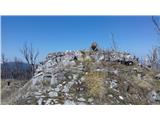 19
19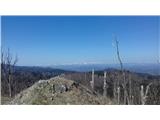 20
20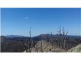 21
21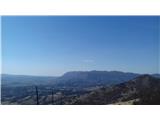 22
22
Discussion about the trip Sedlo nad Lohačo - Špilnik (upper path - via Lipovec)
|
| Acibujl27. 03. 2025 18:40:55 |
27. 3. 2025
From the saddle directly up to Lipovec and onwards towards Špilnik. The markings guide you nicely, you recognize Špilnik and its forepeak by the fallen timber... on the way to Špilnik lots of wild garlic, further towards Sv. Lovrenc/Gora, really extensive clearings. Slightly less visited peaks. Today visited three peaks, despite windy weather nicely spent hours on remote paths... from the saddle to Gora/Sv. Lovrenc marked two hours.
|
|
|
To post a comment you must log in:
If you do not yet have a username, you must first
register.