Rutarski gozd - Jehlc (Špičasta kupa)
Starting point: Rutarski gozd (1030 m)
| Latitude/Longitude: | 46,2156°N 13,8895°E |
| |
Walking time: 2 h
Difficulty: easy unmarked way
Elevation gain: 632 m
Elevation difference along the route: 700 m
Map: TNP 1:50.000
Recommended equipment (summer):
Recommended equipment (winter): ice axe, crampons
Views: 6.743
 | 2 people like this post |
Access to starting point:
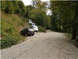
From Podbrdo we drive towards Tolmin or vice versa, but only to the village of Koritnica. In Koritnica we will notice a sign for the village Rut, which directs us right (from Tolmin sharply left). We then follow the mostly ascending road to the mentioned village, where there is also a smaller crossroad. We continue straight (left village Grunt) on the road, which soon loses the asphalt covering. The wide macadam road quickly ascends above the village and turns right. Three serpentines follow; at the third or second left, the marked path from Stržišče also joins us from the right, and from here onwards we pay attention to possible parking by the road, because driving from the next crossroad onwards is forbidden.
Route description:
From the parking lot we continue on the macadam road, then we quickly arrive at an unmarked crossroad, where we continue on the upper right road, by which there is a ramp and a traffic sign prohibiting further driving. Further on we ascend steeply; the ever-worsening road slowly turns into a wide mostly rocky cart track, which past the hunting observatory soon brings us to a junction, where we continue right in the direction of Rodica (straight Planina Razor). Further we ascend on a relatively well-preserved mule track, first through the forest, then through dwarf pines. Moderately steep and increasingly scenic path, then it crosses a few gullies and gets closer and closer to the summit (Jehlc), which we have been seeing in front of us for some time. After approximately an hour and a half of walking, the marked path gets almost completely close to the ridge. Here at an altitude of approximately 1700m, where along the path we notice a cairn and a worse footpath that ascends left to the ridge, we leave the marked path leading to Rodica.
Further, in a few steps we ascend to the mentioned ridge and follow it to the left, where we quickly step onto the panoramic head (Peči or Greben 1727 m). From the head a nice view opens towards Jehlc, to which a short steep descent and then a gentle ascent along the scenic ridge separate us. From the point where we left the marked path to the summit of Jehlc we follow a worse track that runs on and partly along the ridge.
The path is not difficult, but orientation is tricky in fog.

Photos:
 1
1 2
2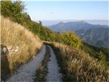 3
3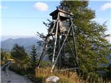 4
4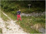 5
5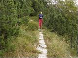 6
6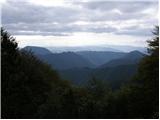 7
7 8
8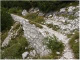 9
9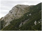 10
10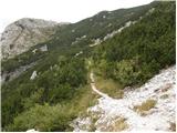 11
11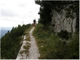 12
12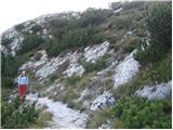 13
13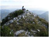 14
14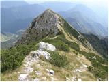 15
15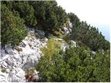 16
16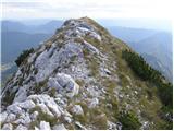 17
17 18
18
Discussion about the trip Rutarski gozd - Jehlc (Špičasta kupa)
|
| grega_p7. 09. 2014 |
I'm really pleased that on this forum there are descriptions of individual unusual peaks which often receive far less visits than the red lines on maps, even though they are nearby.
Today's trip to the southern part of the Bohinj Mountains was really nice. Without too intense sun, pleasant path and full of raspberries along it (do people overlook them when searching for the goal with their eyes?)
A few comments nonetheless:
- you can't drive by car all the way to the end as described here (there's a no-driving sign before, ramp is open though), so (by rules) we start from around 1050m
- the last short steep section on the ascent to the ridge when wet requires some care (if we opt for ascent at the first stone cairn, ca 1620 m.a.s.l.)
- on the Bohinj map (Sidarta, 1:25.000) Jehlc is marked one peak higher at 1727 (next summit in the ridge), that one has the name Špičasta kupa
- due to locals' problems with wild boars (they say they like gardening) and deer (which nibble fruit trees), hunters are in the area. From conversation with one of them, they hunt late afternoon/evening, best time. Just for warning.
With love and heart.
This applies to mountains too,
good luck...
|
|
|
To post a comment you must log in:
If you do not yet have a username, you must first
register.