Ruski križ - Špik (via Kačji graben)
Starting point: Ruski križ (1036 m)
| Latitude/Longitude: | 46,4444°N 13,7746°E |
| |
Route name: via Kačji graben
Walking time: 4 h 45 min
Difficulty: difficult marked way
Elevation gain: 1436 m
Elevation difference along the route: 1585 m
Map: TNP 1:50.000
Recommended equipment (summer): helmet
Recommended equipment (winter): helmet, ice axe, crampons
Views: 38.362
 | 1 person like this post |
Access to starting point:
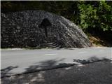
First we drive to Kranjska Gora, then continue driving towards the Vršič pass. Just a little before the 3rd serpentine of the Russian or Vršič road, we will notice the Ruski križ on the right side, and a smaller parking lot on the left, where we park. Because the parking lot is relatively small and fills up quickly, we can also park a bit higher at the larger parking lot a little above the 4th serpentine (in this case we have to descend a bit to our starting point at the Ruski križ).
We can also reach the starting point from the Primorska side, namely via the Vršič pass.
Route description:
A little before the 3rd serpentine of the Russian road we will notice mountain signs for Koča v Krnici by the road, which direct us slightly left onto a wide cart track that immediately begins to descend moderately. Soon we cross a torrent stream over a bridge, and we descend all the way to the bed of Suha Pišnica, where we have two options for continuation.
We can reach the beginning of the path to Špik through Kačji graben if just a few meters before the marked path or road crosses Suha Pišnica we continue left onto a wide unmarked cart track, which first continues through the forest, then brings us to a larger meadow. Across the meadow we continue in the northeast direction, walking along it all the way to the bed of Velika Pišnica. We cross the river at a suitable place, then step onto the marked road, which we follow to the left (right to Koča v Krnici), and walk along it to the marked turnoff for the path through Kačji graben.
The other option is to simply cross Suha Pišnica (when there is a lot of water it is not exactly easy) and continue along the road that leads towards Koča v Krnici. Just a little after we cross the mentioned stream, the path turns slightly to the left and brings us out of the forest onto the expansive grassy slopes of Planina v Klinu, where we notice an isolated hut on the right, and a smaller memorial park Mali Tamar on the left. The path ahead becomes completely flat, then joins the forest road that comes from the former Hotel Erika or the bridge over Velika Pišnica. Here we continue left (right to Koča v Krnici) and walk along the road to the marked turnoff for the path through Kačji graben.
The path from the junction onwards leaves the road and initially ascends through overgrown forest, higher up it crosses the lower part of the mentioned graben and then ascends steeply. The ascent along Kačji graben is very steep and especially when wet dangerous for slipping, and we are also helped by some fixed protection. The path then becomes somewhat easier and enters dense forest, through which we ascend to an altitude of approximately 1600 m. The forest then becomes sparser and the path brings us to the foot of mighty scree slopes. When we climb up to the scree, the path turns slightly to the left and begins to ascend through the gravelly world of the scree. Walking on the relatively steep scree takes quite a lot of energy.
Higher up, the path turns to the right, crosses a gully exposed to falling rocks and then brings us to a smaller cirque between Špik on the left and Lipnica (on some maps also marked as Liprtica) on the right. Here the path levels out for a short time and in the next few steps brings us to the place where the path over Grunt or the path over Lipnica joins us.
Here we continue left, along the path that ascends very steeply up the summit slope of Špik, there are no protections on this section. After about 15 minutes of walking on the summit slope, across which we climb over broken rock, we reach the panoramic summit.
In the last part of the path there is a very high danger of falling rocks.
Starting point - Planina v Klinu 0:20, Planina v Klinu - turnoff for Kačji graben 0:25, turnoff for Kačji graben - junction below the summit of Špik 3:45, junction below the summit of Špik - Špik 0:15.

Along the route: Mali Tamar (996m), Planina v Klinu (980m), Odcep za Kačji graben (916m), Razpotje pod vrhom Špika (2401m)
Photos:
 1
1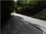 2
2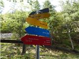 3
3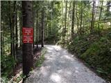 4
4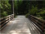 5
5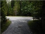 6
6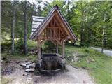 7
7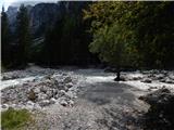 8
8 9
9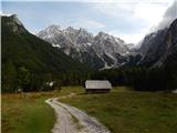 10
10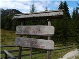 11
11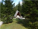 12
12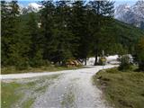 13
13 14
14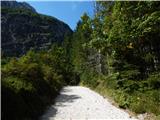 15
15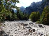 16
16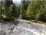 17
17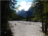 18
18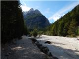 19
19 20
20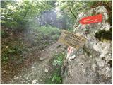 21
21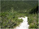 22
22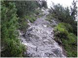 23
23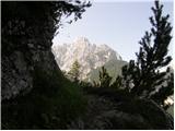 24
24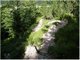 25
25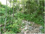 26
26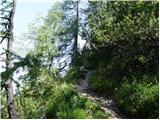 27
27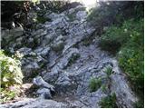 28
28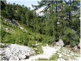 29
29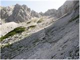 30
30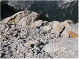 31
31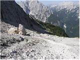 32
32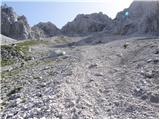 33
33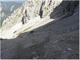 34
34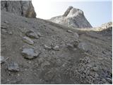 35
35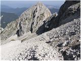 36
36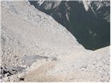 37
37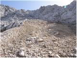 38
38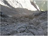 39
39 40
40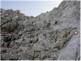 41
41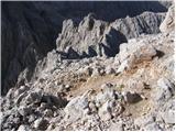 42
42 43
43
Discussion about the trip Ruski križ - Špik (via Kačji graben)
|
| emze8. 08. 2014 |
From Ruski križ: The first sign for Kačji graben is at the entrance to Kačji graben.
Also the path from Kačji graben towards Ruski križ has no signposts. Only shabby signs for the Koča v Krnici.
The shortcut path between Krnica and Kačji graben marked on older maps, which saves descent and ascent, is destroyed. It can be seen from the graben, I couldn't find it from Krnica.
Shortcut to parking: On the path Kačji graben -- Krnica, when you spot the meadow with the hut on the other side and manage to cross the stream, go left to the top of the meadow. The road goes past the unofficial parking with spring towards the 3rd hairpin.
|
|
|
|
| Gregorvu28. 10. 2014 |
On Thursday we're heading to Špik..
But does anyone know what the path is like...Is there snow?
Do we need crampons etc... Is it safe to go?
|
|
|
|
| Lenore3. 10. 2021 20:38:23 |
I went up via Krnica, down via Kačji graben.. and if I had to choose again, I'd go down via the Krnica hut too (even though it wouldn't be circular).
Kačji graben is great for descent as long as there's scree.. but when the scree ends.. it's horribly steep through the forest, rocks slide, roots slide, long and unpleasant path for descent there.
But I can't imagine going up there (because of the scree).
|
|
|
To post a comment you must log in:
If you do not yet have a username, you must first
register.