Rudno polje - Veliki Selišnik (via Kačji rob)
Starting point: Rudno polje (1347 m)
| Latitude/Longitude: | 46,3458°N 13,9236°E |
| |
Route name: via Kačji rob
Walking time: 2 h 15 min
Difficulty: easy pathless terrain
Elevation gain: 605 m
Elevation difference along the route: 625 m
Map: TNP 1:50.000
Recommended equipment (summer):
Recommended equipment (winter): ice axe, crampons
Views: 14.401
 | 3 people like this post |
Access to starting point:
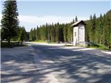
From the Ljubljana - Jesenice motorway, take the Lesce exit and continue following the road towards Bled. In Bled, at the traffic lights, signs for Pokljuka direct us to the right. We continue driving through Gorje and past the abandoned Zatrnik ski resort to Rudno polje on Pokljuka (large parking lot, barracks and shooting range).
Route description:
At the end of the parking lot a gravel road branches off to the right with signposts for Triglav along it. We turn onto this road which ascends gently and brings us to the ski slope after ten minutes.
On the other side of the ski slope, next to the ski lift, we will notice a marked hiking path that continues to the right from the road. We take this path which leads us in a moderate ascent through a strip of forest to a gravel road (up to here also possible by road), which we follow to the right but only a few steps. Just before the road crosses the ski slope, a marked hiking path branches off to the left which first crosses a pasture fence and then ascends along the edge of the ski slope. At the top of the first ski lift the marked path turns left and then begins to ascend more steeply along the edge of the second, steeper ski slope. The second ski lift soon ends as well and we continue on the path which turns into a smaller relatively steep valley. Towards the top of this valley the path ascends quite steeply, then suddenly levels out and takes us past an abandoned hunting lookout to a junction.
Here we leave the usual path to Viševnik and turn right onto a poorly visible trail that gently ascends across the meadow. A little higher up the trail becomes more visible and enters the dwarf pines. The path ahead crosses the side ridge of Viševnik called Kačji rob and then enters the high mountain terrain. A beautiful path with many karst features then leads us to a junction where the path to Srenjski preval and Viševnik branches left, while we continue right towards Blejska koča na Lipanci.
The path ahead runs almost horizontally. At the spot where the path starts to descend, we leave the marked path.
We turn right and find the best passage through the dwarf pines that will lead us onto the ridge of Veliki Selišnik which we see slightly to the right in front of us. When we reach the ridge, we continue between the precipice on the left and the dwarf pines on the right. Where the passage above the precipice is too exposed we head into the dwarf pines and continue upwards in the same direction. Climbing through the dwarf pines is not long and takes only a few minutes. After crossing the belt of dwarf pines we reach the open part of the path where we turn left upwards onto the ridge. We follow the ridge which is occasionally slightly exposed and sometimes overgrown to the summit. The ridge has only a few short descents. The off-trail section lasts about 20 minutes.
The off-trail section is orientationally somewhat more difficult, and in fog the orientation is quite challenging. When ascending through the dwarf pines and tall grass one should also watch out for snakes.
Rudno polje - Planinski taborni prostor 0:10, Planinski taborni prostor - Planina Krasca 0:05, Planina Krasca - Zlata voda 0:50, Zlata voda - razpotje nad Srenjskim jezercem 0:45, razpotje nad Srenjskim jezercem - odcep za Veliki Selišnik 0:05, odcep za Veliki Selišnik - Veliki Selišnik 0:20.

Along the route: Planinski taborni prostor (1369m), Planina Krasca (1402m), Zlata voda (1717m), Kačji rob (1809m), Srenjsko jezerce (1864m), Razpotje nad Srenjskim jezercem (1904m), Odcep za Veliki Selišnik (1894m)
Photos:
 1
1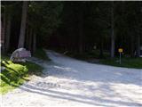 2
2 3
3 4
4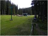 5
5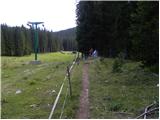 6
6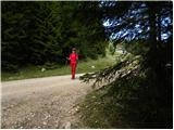 7
7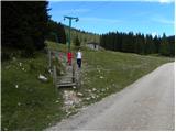 8
8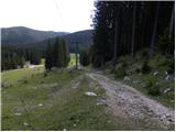 9
9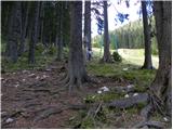 10
10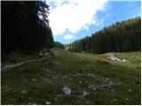 11
11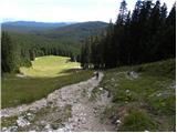 12
12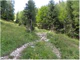 13
13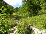 14
14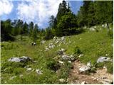 15
15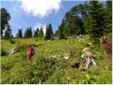 16
16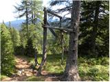 17
17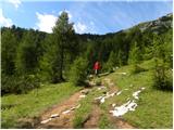 18
18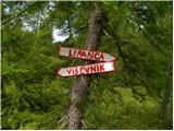 19
19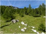 20
20 21
21 22
22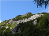 23
23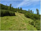 24
24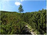 25
25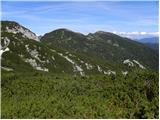 26
26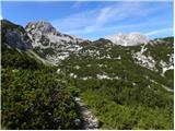 27
27 28
28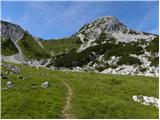 29
29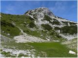 30
30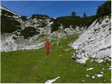 31
31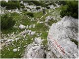 32
32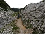 33
33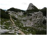 34
34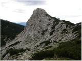 35
35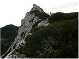 36
36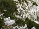 37
37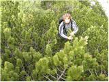 38
38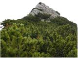 39
39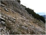 40
40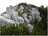 41
41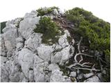 42
42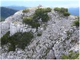 43
43
Discussion about the trip Rudno polje - Veliki Selišnik (via Kačji rob)
|
| zajko14. 10. 2013 |
On 13.10.13 we climbed this peak for the first time. Wonderful weather, excellent view, real enjoyment. The junction from the marked path towards Blejska koča is not hard to find.
|
|
|
To post a comment you must log in:
If you do not yet have a username, you must first
register.