Rudno polje - Veliki Draški vrh (via Kačji rob)
Starting point: Rudno polje (1347 m)
| Latitude/Longitude: | 46,3458°N 13,9236°E |
| |
Route name: via Kačji rob
Walking time: 3 h 30 min
Difficulty: difficult marked way, partly demanding unmarked way
Elevation gain: 896 m
Elevation difference along the route: 940 m
Map: Triglav 1:25.000
Recommended equipment (summer): helmet
Recommended equipment (winter): helmet, ice axe, crampons
Views: 42.589
 | 3 people like this post |
Access to starting point:
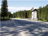
From the Ljubljana - Jesenice motorway, take the Lesce exit and follow the road towards Bled. In Bled, at the traffic lights, the signs for Pokljuka direct us to the right. We then drive through Gorje and past the abandoned Zatrnik ski resort to Rudno polje on Pokljuka (large parking lot, barracks and shooting range).
Route description:
From the parking lot, we head to the forest road (direction Triglav), along which, in ten minutes of gentle ascent, we climb to the Viševnik ski resort. Here, the signs lead us to the right (the path to Triglav continues along the road) on a marked footpath, which then moderately ascends along the edge of the forest and along the drag lift of the nearby ski resort. Higher up, we step onto the road again, but only cross it, as the signs for Viševnik direct us over the pasture fence to a nice traceable path that continues in the immediate vicinity of the drag lift. At the end of the drag lift, the path turns left into a strip of forest and then joins another, slightly steeper drag lift. For some time we continue under the drag lift, then the path moves to the ski slope, along which we climb to the upper part of the ski resort.
The path then moves into a small valley, along which we climb amid blooming flowers (applies to spring and summer months) to a decaying hunting observation tower.
Here, or a few tens of meters further (there are two turn-offs) we continue to the right (straight Viševnik), on a less visible path, along which we continue the ascent. Higher up, the path becomes more distinct and first turns slightly to the right, then from the sparse forest it moves into a strip of dwarf pines and gradually turns to the left. After a while, we cross Kačji rob and the path brings us to the high mountain world northeast of Viševnik. We continue for a short time to the west and the scenic path quickly brings us to a small grassy basin, where it turns to the right. From the basin, or the intermittent Srenjsko jezerce, the path begins to climb more steeply and in a few minutes brings us to a marked junction, where the path to Srenjski preval and Viševnik branches off to the left. We continue in the mentioned direction (right Lipanca) and continue the ascent along the path, which in good ten minutes of traverse ascent, climbs to Srenjski preval. We climb to the right side of the pass to the signposts under Mali Draški vrh.
At the signposts, we continue following the signs "Studorski preval". The path first descends slightly, then becomes more demanding and crosses exposed slopes with a steel cable. When the safeguards end, the path begins to ascend slightly and continues to cross steep slopes to the west. The path is not secured in the continuation and therefore requires some more caution. When we come to the western side of Mali Draški vrh, a beautiful view of Triglav opens up. Here the slopes become less steep and a short descent follows to the saddle between Veliki and Mali Draški vrh.
The marked path turns left here, but we continue straight on a less trodden path. Soon our path also turns slightly to the left, then ascends along the eastern slopes of Veliki Draški vrh. The path is poorly visible in places, but orientation is not overly difficult due to numerous cairns. In the continuation, the slope becomes slightly steeper for a short time. In the last part of the ascent, the path brings us to a grassy slope and the last ascent to the summit follows, which we reach from the eastern side.
Rudno polje - Planinski taborni prostor 0:10, Planinski taborni prostor - Planina Krasca 0:05, Planina Krasca - Zlata voda 0:50, Zlata voda - razpotje nad Srenjskim jezercem 0:45, razpotje nad Srenjskim jezercem - Srenjski preval 0:15, Srenjski preval - Srenjska Krma 0:35, Srenjska Krma - Veliki Draški vrh 0:50.

Along the route: Planinski taborni prostor (1369m), Planina Krasca (1402m), Zlata voda (1717m), Kačji rob (1809m), Srenjsko jezerce (1864m), Razpotje nad Srenjskim jezercem (1904m), Srenjski preval (1959m), Na kontah (1950m), Srenjska Krma (1945m)
Photos:
 1
1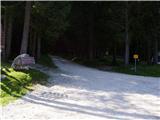 2
2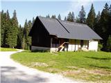 3
3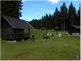 4
4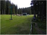 5
5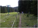 6
6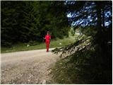 7
7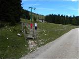 8
8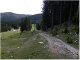 9
9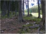 10
10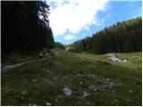 11
11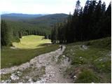 12
12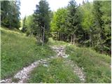 13
13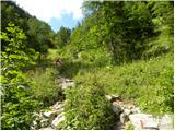 14
14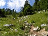 15
15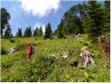 16
16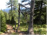 17
17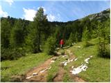 18
18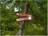 19
19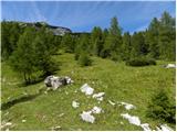 20
20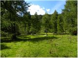 21
21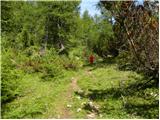 22
22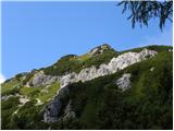 23
23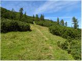 24
24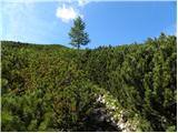 25
25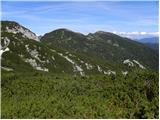 26
26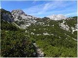 27
27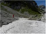 28
28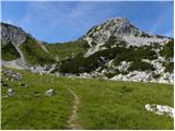 29
29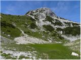 30
30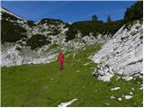 31
31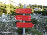 32
32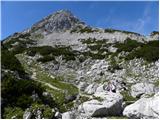 33
33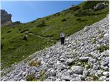 34
34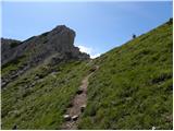 35
35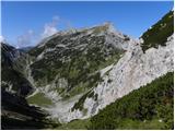 36
36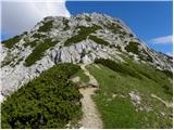 37
37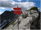 38
38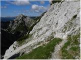 39
39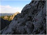 40
40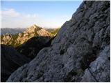 41
41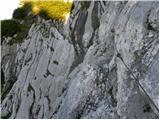 42
42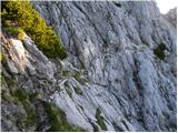 43
43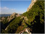 44
44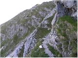 45
45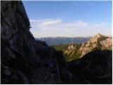 46
46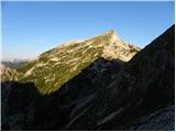 47
47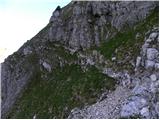 48
48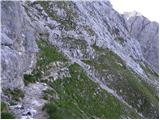 49
49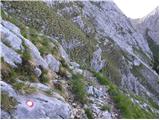 50
50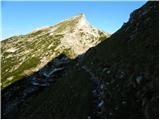 51
51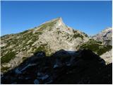 52
52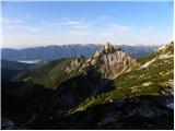 53
53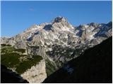 54
54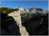 55
55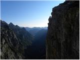 56
56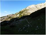 57
57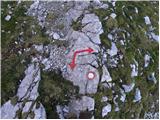 58
58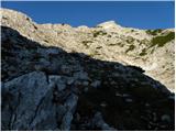 59
59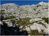 60
60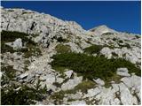 61
61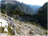 62
62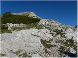 63
63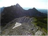 64
64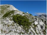 65
65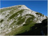 66
66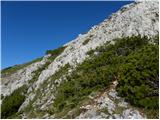 67
67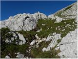 68
68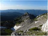 69
69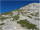 70
70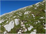 71
71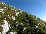 72
72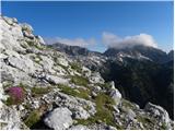 73
73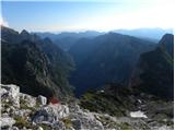 74
74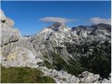 75
75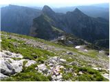 76
76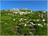 77
77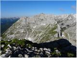 78
78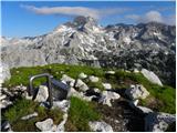 79
79
Discussion about the trip Rudno polje - Veliki Draški vrh (via Kačji rob)
|
| ruševec7. 09. 2011 |
I'm interested in the timetable from the end of the road at the ski slope above Rudno polje - Viševnik - Srenjski preval - Veliki Draški vrh? Meaning the same path as described, but also via Viševnik. Is that about half an hour longer? Is the path from Srenjski preval towards Studorski really so exposed and strenuous? Do you recommend descent to Jezerca and then up instead? Thanks for answers.
|
|
|
|
| otiv8. 09. 2011 |
@ruševec
A bit more and it'll be like half an hour over Viševnik, especially if it's a nice day and you'll enjoy the summit I went the other way though. As for difficulty, no problems if you're used to secured, exposed paths. Not the whole path is like that, only the section from Srenjski preval towards Studorski preval. I went the other way though. As for difficulty, no problems if you're used to secured, exposed paths. Not the whole path is like that, only the section from Srenjski preval towards Studorski preval.
Best regards!
|
|
|
|
| ruševec11. 09. 2011 |
I walked the mentioned variant in the reverse direction. Rudno polje - Studorski preval - Veliki Draški vrh - Srenjski preval - Viševnik - start point. Altogether a pleasant hike. From Veliki Draški vrh to Viševnik only 1 hour and a half, descent from Viševnik only 1 hour. The secured section and traverse is not as dangerous as I expected. Sure need to watch out and not for dizzy people, otherwise more demanding than very demanding path. It was another beautiful day in the mountains.
|
|
|
|
| Hribolazec8110. 06. 2022 09:09:54 |
What's the condition of the path like, any snow etc?
|
|
|
To post a comment you must log in:
If you do not yet have a username, you must first
register.