Rudno polje - Mali Draški vrh (via Viševnik)
Starting point: Rudno polje (1347 m)
| Latitude/Longitude: | 46,3458°N 13,9236°E |
| |
Route name: via Viševnik
Walking time: 3 h
Difficulty: difficult unmarked way
Elevation gain: 785 m
Elevation difference along the route: 900 m
Map: Triglav 1:25.000
Recommended equipment (summer): helmet
Recommended equipment (winter): helmet, ice axe, crampons
Views: 49.408
 | 6 people like this post |
Access to starting point:
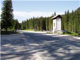
From the Ljubljana - Jesenice motorway we turn off at the Lesce exit and continue following the road towards Bled. At Bled, at the traffic lights, the signs for Pokljuka direct us to the right. We continue driving through Gorje and past the abandoned Zatrnik ski area to Rudno polje on Pokljuka (large parking lot, barracks and shooting range).
Route description:
At the end of the parking lot a gravel road branches off to the right, along which there are signposts for Triglav. We head onto this road, which gently ascends and after ten minutes brings us to the ski area.
On the other side of the ski area, next to the ski lift we will notice a marked footpath that continues from the road to the right. We head onto the mentioned path, which in a moderate ascent through a belt of forest brings us to a gravel road (up to here also possible by road), which we follow to the right, but only a few steps. Just before the road crosses the ski slope, however, a marked footpath branches off to the left, which first crosses a pasture fence, then ascends along the edge of the ski slope. At the top of the first ski lift the marked path turns left and then begins to ascend more steeply along the edge of the second, steeper ski slope. The second ski lift also ends soon, and we continue on the path that transitions into a smaller, relatively steep valley. Towards the top of the mentioned valley the path ascends relatively steeply, then suddenly flattens and brings us past an abandoned hunting observation post to a junction.
We continue straight in the direction of Viševnik (right Lipanca and Viševnik via Kačji rob) on an again steeper path, which after a few minutes of further walking brings us to a smaller saddle, from which a nice view opens to the Bohinj - Tolmin mountains, sometimes called the Lower Bohinj mountains.
At the saddle we continue to the right along the wide mountain path, which then ascends through a belt of dwarf pines. We soon leave the dwarf pines and the path brings us to relatively steep grassy slopes, across which we then climb to the ridge of Viševnik. This is followed by a short traverse of a rocky slope, then we pass under the summit of Viševnik itself. Here the path steeply ascends and after a few more steps of walking brings us to the panoramic summit.
From the summit of Viševnik we continue along the ridge, which begins to descend towards the west. The path at the beginning crosses a very steep grassy slope, then turns somewhat to the right, where the steepness of the slopes eases. This is followed by a traversing descent, then the path returns to the ridge and continues along the right side of it. This is followed by a somewhat more difficult crossing over a ragged slope, then the path flattens and brings us to Srenjski preval.
Here we continue along the ridge towards the north (left downhill unmarked path towards Jezercem, right Lipanca and Kačji rob) on the path which after a slight ascent brings us to a marked crossroads.
We continue straight (left Studorski preval) along an unmarked and less visible path, which begins to ascend ever more steeply along and beside an indistinct gully. The path in the lower part ascends somewhat to the right of the gully, then for a short time crosses to its left side (viewed in the direction of ascent). Higher up the gully becomes even steeper, and the path begins to disappear. Further we ascend straight up the gully steeply upwards (carefully due to the great crumbiness) and along the "path" we will notice some very old and already completely faded markings. After a good 20 minutes of ascent we step onto a precipitous ridge, from which a nice view opens to the valley of Krma and the peaks that surround it.
From here we can climb to the nearby eastern peak, to which we are separated by a few meters of easier climbing along the exposed ridge, or to the somewhat more distant, but a few meters higher western peak. To it we must first descend a little, then climb in a few dozen steps along a quite exposed ridge to the panoramic summit.
Rudno polje - Planinski taborni prostor 0:10, Planinski taborni prostor - Planina Krasca 0:05, Planina Krasca - Zlata voda 0:50, Zlata voda - sedlo pod Plesiščem 0:10, sedlo pod Plesiščem - Viševnik 0:45, Viševnik - Srenjski preval 0:20, Srenjski preval - Mali Draški vrh 0:40.

Along the route: Planinski taborni prostor (1369m), Planina Krasca (1402m), Zlata voda (1717m), Sedlo pod Plesiščem (1780m),
Viševnik (2050m), Srenjski preval (1959m)
Photos:
 1
1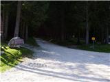 2
2 3
3 4
4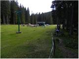 5
5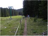 6
6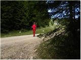 7
7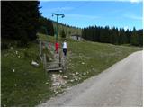 8
8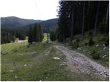 9
9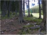 10
10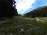 11
11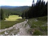 12
12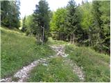 13
13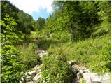 14
14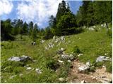 15
15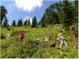 16
16 17
17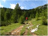 18
18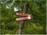 19
19 20
20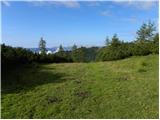 21
21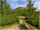 22
22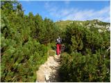 23
23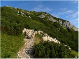 24
24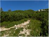 25
25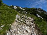 26
26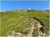 27
27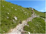 28
28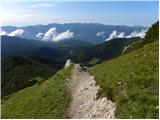 29
29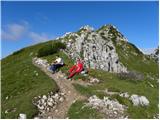 30
30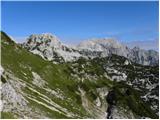 31
31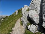 32
32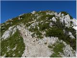 33
33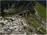 34
34 35
35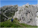 36
36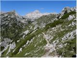 37
37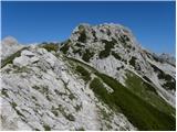 38
38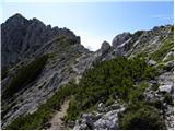 39
39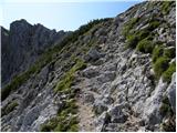 40
40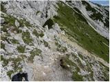 41
41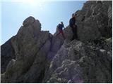 42
42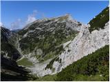 43
43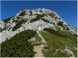 44
44 45
45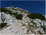 46
46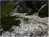 47
47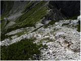 48
48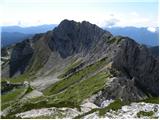 49
49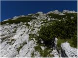 50
50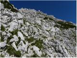 51
51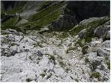 52
52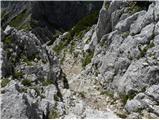 53
53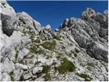 54
54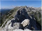 55
55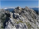 56
56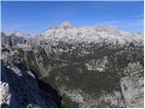 57
57
Discussion about the trip Rudno polje - Mali Draški vrh (via Viševnik)
|
| Gost11. 08. 2006 |
This is a short but very beautiful path. To Viševnik, there's nothing special. To Mali Draški vrh, be careful because rocks are falling. Someone told me that you can't go directly from Mali to Veliki Draški vrh, that it's too dangerous, so I didn't continue the path.
|
|
|
|
| Gost17. 08. 2006 |
At the end of this June, I experienced rocks during the ascent to Mali Draški vrh. When I grabbed a fairly large rock with my right hand, it broke off and fell a few cm past my head. I got away with just a small scratch. Yes, it's really crumbly!!
|
|
|
|
| Gost5. 09. 2006 |
What is the connection from Mali Draški vrh to Veliki Draški vrh and to Viševnik here? Is it for average mortals who walk in the mountains?
|
|
|
|
| Gost5. 09. 2006 |
Viševnik is fairly easy from both sides. Mali Draški vrh is quite steep and crumbly - some caution is needed. What the direct passage to Veliki Draški vrh is like, I don't know. From Studorski preval it's not particularly demanding.
|
|
|
|
| urshy22. 09. 2009 |
Does anyone perhaps know what the path from Viševnik over Mali and then to Veliki Draški vrh is like?
|
|
|
|
| viharnik22. 09. 2009 |
The path over the mentioned peaks is not marked and has already been used by bold mountaineers. The path to Mali Draški vrh is a classic with some climbing in the summit part, where the difficulty does not exceed I st, climbing. On descent towards Vel. Draški vrh we encounter a drop towards the deep northern-exposed areas, where downward climbing reaches good II st, climbing (5m). Further there are no problems. The path is scenic and beautiful.
|
|
|
|
| damijanp26. 10. 2009 |
Beautiful trail, also in autumn colors. Mali Draški vrh is indeed quite crumbly.
Pictures at:
Viševnik-MDV
|
|
|
|
| anzegrom24. 04. 2011 |
Yesterday my friend and I set off up there,.. conditions are far from ideal - VERY crumbly, so extreme caution is really needed!
|
|
|
|
| vreset25. 03. 2012 |
Has anyone perhaps been to Mali Draški vrh recently? What are the conditions on the path?, snow? Thanks for the info.
|
|
|
|
| Flora125. 03. 2012 |
Just yesterday from Pleše (Krma) I saw someone descending from MDV towards the pass below VDV. Maybe that person will report.
|
|
|
|
| iomejc12. 08. 2013 |
With a buddy we were yesterday at MDV. Ascent without issues, just a bit crumbly in places.
We descended along the ridge to VDV. As viharnik describes, right away a 5m drop that is really exposed - view towards Krma  . Above the drop there are also two pegs you can use for descent (if you have a rope) . Above the drop there are also two pegs you can use for descent (if you have a rope)
From there on it's pure enjoyment. View into Krma and S. wall of MDV is magnificent. Follow the path right to the end of the ridge and then descend to the path towards VDV.
|
|
|
|
| katja875. 11. 2013 |
On Friday, 1.11.2013, we set off for four Pokljuka two-thousanders. The day was wonderful and the views fantastic 
We did a circular tour: Rudno polje - Viševnik - Srenjski preval - Mali Draški vrh - Srenjski preval - Veliki Draški vrh - Studorski preval - Ablanca - Studorski preval - Rudno polje.
The whole tour took us 8.5 hours, with stops at the summits.
The entire tour is extremely beautiful, but requires quite some fitness, as you're constantly ascending and descending between summits.
For Mali Draški vrh and Ablanca I recommend a helmet, as they are quite crumbly. Otherwise, the path from Srenjski preval to Veliki Draški vrh is very nicely secured
You can view pictures from the hike on the website of Planinsko društvo Matica Murska Sobota: http://www.mojalbum.com/pdmaticams/20131101-visevnik-m-in-v-draski-vrh-ablanca/zacetek-pri-smuciscu-na-rudnem-polju/21227391
|
|
|
|
| Lisica11. 08. 2015 |
On Sunday I did a tour to Viševnik then via MDV to VDV and Tosc. From MDV I went via the ridge towards VDV, where I got a bit tangled on the descent  and after a few attempts found the right path, MDV is very very crumbly, it seemed poorly marked with cairns to me. Not for everyone. VDV is super marked. For Tosc this time I didn't opt for the climbing route anymore and went via the normal path. Next time... Otherwise a beautiful path, unique views! and after a few attempts found the right path, MDV is very very crumbly, it seemed poorly marked with cairns to me. Not for everyone. VDV is super marked. For Tosc this time I didn't opt for the climbing route anymore and went via the normal path. Next time... Otherwise a beautiful path, unique views!
|
|
|
|
| matej71215. 07. 2017 |
Today to Viševnik and MDV. There was quite a bit of a crowd on Viševnik, further to MDV almost none. Ascent to MDV is a real treat. Shame that from the top there weren't great views of the surrounding peaks, but at least the valley was nicely visible. Who would have thought that it's just a stone's throw from the Triglav 'highway' such peace. The descent via Kači rob is also wonderful.
|
|
|
|
| anak7. 07. 2019 |
Yesterday we walked across four two-thousanders above Pokljuka. First Viševnik, then descent to Srenjski preval. From the comments I was a bit afraid of the crumbly Mali Draški vrh, but it gave us no trouble. It's grassy, but where you have to grab the rock it's solid. A helmet is recommended though! We returned to the pass and continued to Veliki Draški vrh. Since there was still plenty of time, we also popped over to Ablanco.
|
|
|
|
| Trox12. 06. 2023 15:28:56 |
Today went along this path, the path is completely dry throughout.
But it's unmarked, crumbly path. Caution should not be amiss.
|
|
|
|
| magic2k25. 08. 2023 17:41:12 |
today went Rudno polje - Viševnik - Mali Draški vrh - Veliki Draški vrh - Studorski preval - Jezerca and back to Rudno polje. very careful only on Mali Draški vrh and descent to saddle where half nice path to Veliki Draški vrh
|
|
|
To post a comment you must log in:
If you do not yet have a username, you must first
register.