Rudno polje - Debeli vrh above Lipanca (via Kačji rob)
Starting point: Rudno polje (1347 m)
| Latitude/Longitude: | 46,3458°N 13,9236°E |
| |
Route name: via Kačji rob
Walking time: 2 h 45 min
Difficulty: easy marked way
Elevation gain: 615 m
Elevation difference along the route: 750 m
Map: TNP 1:50.000
Recommended equipment (summer):
Recommended equipment (winter): ice axe, crampons
Views: 17.864
 | 2 people like this post |
Access to starting point:
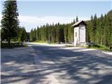
From the Ljubljana - Jesenice motorway, we turn off at the Lesce exit and continue following the road towards Bled. In Bled, at the traffic lights, the signs for Pokljuka direct us to the right. We continue driving through Gorje and past the abandoned Zatrnik ski resort to Rudno polje on Pokljuka (large parking lot, barracks and shooting range).
Route description:
At the end of the parking lot, a gravel road branches off to the right, along which there are signposts for Triglav. We head onto this road, which gently ascends and after ten minutes brings us to the ski area.
On the other side of the ski area, next to the ski lift, we will notice a marked footpath that continues from the road to the right. We head onto the mentioned path, which in a moderate ascent through a belt of forest brings us to a gravel road (up to here also possible by road), which we follow to the right, but only a few steps. Just before the road crosses the ski slope, a marked footpath branches off to the left, which first crosses a pasture fence, then ascends along the edge of the ski slope. At the top of the first ski lift the marked path turns left and then begins to ascend more steeply along the edge of the second, steeper ski slope. The second ski lift soon ends as well, and we continue along the path that turns into a smaller relatively steep valley. Towards the top of the mentioned valley the path ascends relatively steeply, then suddenly levels out and brings us past an abandoned hunting observation post to a crossroads.
At this point we leave the usual path to Viševnik and head right onto a poorly visible trail that ascends gently upwards across the meadow. A bit higher the trail becomes more noticeable and enters the dwarf pines. The path ahead crosses the side ridge of Viševnik named Kačji rob and then enters the high-mountain world. A beautiful path with numerous karst phenomena then brings us to a crossroads, where to the left a path branches off to Srenjski preval and Viševnik, and we continue right in the direction of Blejska koča na Lipanci.
The path ahead runs almost horizontally. Further on the path begins to descend on the slopes north of Veliki Selišnik. The path then levels out and brings us to partially grassy slopes, where we come to the area of marmot habitat. If we are quiet enough and have started early enough, we can see them. The path ahead gently ascends and brings us to the main ridge of the mountains between Krma and Pokljuka. After just a few meters the path turns again to the southern side of the mountain, where we still continue towards Lipanci. Soon we encounter a signpost for Debeli vrh, which directs us left upwards (straight Mrežce and Blejska koča).
We head onto the marked, but in places poorly visible trail, which ascends between a belt of dwarf pines and sparse forest. The trail, which becomes increasingly faint, then brings us to the summit grassy slopes of the mountain. So that orientation is not too easy, a belt of dwarf pines stops the direct approach to the summit. Before the dwarf pines we head somewhat to the right, then back to the left. The path on the summit section is marked but the markings are very sparse.
Rudno polje - Planinski taborni prostor 0:10, Planinski taborni prostor - Planina Krasca 0:05, Planina Krasca - Zlata voda 0:50, Zlata voda - razpotje nad Srenjskim jezercem 0:45, razpotje nad Srenjskim jezercem - odcep za Veliki Selišnik 0:05, odcep za Veliki Selišnik - odcep za Debeli vrh 0:25, odcep za Debeli vrh - Debeli vrh 0:25.

Along the route: Planinski taborni prostor (1369m), Planina Krasca (1402m), Zlata voda (1717m), Kačji rob (1809m), Srenjsko jezerce (1864m), Razpotje nad Srenjskim jezercem (1904m), Odcep za Veliki Selišnik (1894m), Odcep za Debeli vrh (1805m)
Photos:
 1
1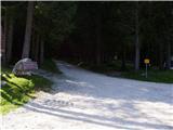 2
2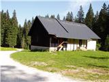 3
3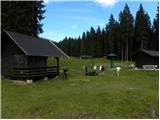 4
4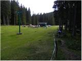 5
5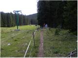 6
6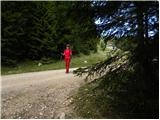 7
7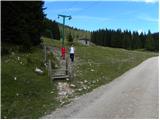 8
8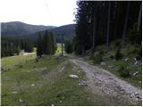 9
9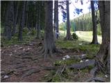 10
10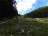 11
11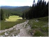 12
12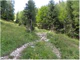 13
13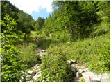 14
14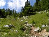 15
15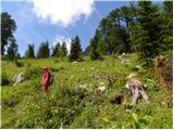 16
16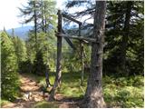 17
17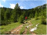 18
18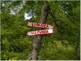 19
19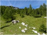 20
20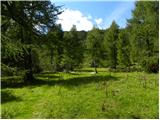 21
21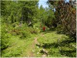 22
22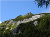 23
23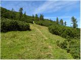 24
24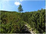 25
25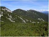 26
26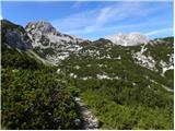 27
27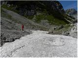 28
28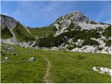 29
29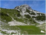 30
30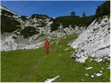 31
31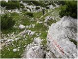 32
32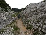 33
33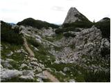 34
34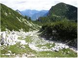 35
35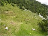 36
36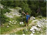 37
37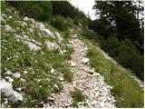 38
38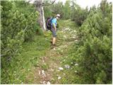 39
39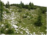 40
40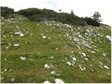 41
41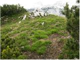 42
42 43
43
Discussion about the trip Rudno polje - Debeli vrh above Lipanca (via Kačji rob)
|
| mukica15. 04. 2008 |
I visited the summit returning from Mali Draški vrh - circular Mrežce - Lipanski vrh. It was a wonderful autumn tour with golden larches and I know I will go again this year too.
|
|
|
|
| iztok.maltar7. 09. 2008 |
The alarm rings. Ooo no not yet. I quickly turn it off and wrap myself in the blanket.
A ray of sunshine wakes me a little after seven. I open the window.
Karavanke are in clouds. I lean as far as possible over the edge and gaze at the Julians. Surprisingly, Pokljuka is in the sun.
Although I hurry, time flies. I throw the backpack in the car just as the bells start inviting to morning mass. Instead of church, I head towards Bled. In forty minutes I park at Rudno polje. Since last year I visited both Draški vrh and Viševnik, today's goal is Debeli vrh.
I ascend via smučišče towards Viševnik, to Plesišče and there turn to Kačji rob. I have long wanted to visit the valley east of Viševnik. Below Srenjski preval I turn east. I walk under the north face of the big Selišnik, which I visited in winter. Through the marmot valley I reach below Debeli vrh. Through the bushes along a modest path steeply to the top, where I disturb cows at their midday nap.
At the top it starts blowing terribly, so I quickly descend and find shelter behind rocks for a snack.
For the return I choose the path through the half-abandoned Planina Razor, which rarely sees people. That's why it's all the nicer, because when I come through the bushes, I spot three beautiful chamois on the path. When they see me, they dash headlong across the rocks towards Selišnik.
In the end, I picked just enough mushrooms along the road to the car for one dinner.
|
|
|
|
| irska21. 07. 2013 |
It's been a very long time since anyone commented on this trip, but it's really fun  . New markings do ease orientation, but the little path under the summit gets lost and gives this trip a touch of off-trail hiking . The view from the top is still wonderful . . New markings do ease orientation, but the little path under the summit gets lost and gives this trip a touch of off-trail hiking . The view from the top is still wonderful .
|
|
|
|
| Majdag13. 08. 2018 |
Beautiful and pleasant path, well marked. "Soon we come across a signpost," not so soon. You have to walk for quite some time. The sign is down under the scree and can be missed from the direction of V. Selišnik. Views from the top are beautiful and there aren't many visitors. Suitable for big and small and also furry cubs.
http://jelenkamenmajdag.blogspot.com/2018/08/debeli-vrh-in-visevnik.html
|
|
|
|
| Majdag26. 07. 2019 |
24.7. Nice trail, at this time there are many blooming flowers. The valley via Kačji rob is always interesting and beautiful. A few switchbacks before the sign for Debeli vrh, there is a large cairn by the path. There we approached the summit, the paths are poorly visible. We descended a bit further left and reached the path at the Debeli vrh sign. It is still under scree. Beautiful, little visited mountain, Debeli vrh.
https://jelenkamenmajdag.blogspot.com/2019/07/debeli-vrh-pozabljena-gora-nad-lipanco.html
|
|
|
To post a comment you must log in:
If you do not yet have a username, you must first
register.