Rožna dolina - Šišenski hrib (Rožnik) (via Cankarjev vrh)
Starting point: Rožna dolina (300 m)
| Latitude/Longitude: | 46,0559°N 14,4812°E |
| |
Route name: via Cankarjev vrh
Walking time: 40 min
Difficulty: easy marked way
Elevation gain: 129 m
Elevation difference along the route: 150 m
Map: Ljubljana 1:20.000
Recommended equipment (summer):
Recommended equipment (winter):
Views: 17.363
 | 3 people like this post |
Access to starting point:
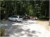
From Ljubljana Zoo we drive towards Tivoli. We will soon get to a crossroad, where to the left, slightly upwards, a road branches off towards Rožnik. We head onto this road and follow it to a suitable parking space.
Route description:
From the parking lot, we continue on a macadam road which already after a few meters brings us to the information board, which marks the landscape park Tivoli, Rožnik and Šišenski hrib. At the board the road turns to the left and starts ascending steeper. After approximately 15 minutes of ascent the road flattens and brings us to the edge of the forest. Here we leave the road and continue right on a wide footpath, on which in a few dozen steps of ascent we ascend to the church on Rožnik.
From the church, we continue ahead and the path brings us to the inn on Rožnik, where we again step on a macadam road (to here it is also possible by the road which bypasses the church). We continue on the road, which a little ahead turns slightly to the right and starts descending. After a short descent, the road ascends steeply and brings us higher to a crossroad beside which we notice the monument to the fallen in the war for Slovenia. We continue left (straight to Tivoli) on the road which after a good 5 minutes of further walking brings us to the summit of Šišenski hrib, which is the highest peak of Rožnik (ascent to the very peak is prevented by the fence).

Along the route: Cankarjev vrh (394m)
Photos:
 1
1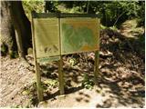 2
2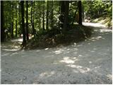 3
3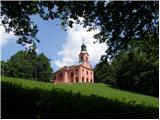 4
4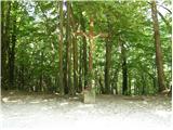 5
5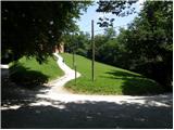 6
6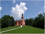 7
7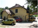 8
8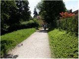 9
9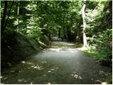 10
10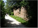 11
11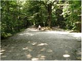 12
12 13
13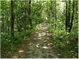 14
14 15
15
Discussion about the trip Rožna dolina - Šišenski hrib (Rožnik) (via Cankarjev vrh)
|
| Lapuh20718. 04. 2020 |
When in recent weeks I look from the capital towards the snowy KSA, I often remember the notes of mountain lovers from those distant times when Ljubljana was fenced with wire. Now I can really relive their feelings. And since I can't get it into my head that the relief of my municipality allows me only a couple of hundred meters of ascent, I did an experiment that satisfied me, recharged my physical and mental batteries and - as far as I understand the current regulations – didn't violate anything. Early in the morning I climbed from Rožna dolina to Šišenski hrib (429 m), the highest peak of the Ljubljana mountain range, then descended to Tivoli, and from the other side back to Šišenski hrib … and repeated it five times, each time from a different starting point (Koseški bajer, behind the zoo, Gozdarski inštitut). Along the well-known and popular Rožnik main paths, there are also quite a few corners that feel like Kočevski gozd. In the end, I accumulated well over 600 meters of ascent, and visited all the peaks of this mountain range, some of them for the first time. I recommend it; maybe we'll meet! 
P.S. Rožnik has been close to me for decades; what has noticeably changed on it now are much more trampled paths and – very unpleasant – toilet paper that sticks out almost from every bush!  Everyone concerned: please!!! Everyone concerned: please!!! 
|
|
|
|
| nina418. 04. 2020 |
Similarly, you can accumulate ascent on Golovec, but don't forget our highest municipal peak Janče with surroundings. My hikes in those areas always bring at least 800 m of ascent and 15 to 30 km. Some parts are really empty, others have lots of cyclists, in between lots of asphalt somewhere... And yes, where there are many people, there are also white piles. Let's clean up after ourselves !
|
|
|
To post a comment you must log in:
If you do not yet have a username, you must first
register.