Rovte - Sveti Primož in Felicijan (Jamnik)
Starting point: Rovte (483 m)
| Latitude/Longitude: | 46,2797°N 14,2372°E |
| |
Walking time: 1 h 15 min
Difficulty: easy marked way
Elevation gain: 348 m
Elevation difference along the route: 370 m
Map: Škofjeloško in Cerkljansko hribovje 1:50.000
Recommended equipment (summer):
Recommended equipment (winter): ice axe, crampons
Views: 8.580
 | 3 people like this post |
Access to starting point:
A) From the highway Ljubljana - Jesenice, we take the Naklo exit (also possible the exit for Tržič), then we follow the signs for Kropa. In Podnart, after crossing the Sava River, we continue left, then past the turnoff for Ovsiše; in a few kilometers we arrive at a crossroads, where we turn left toward Češnjica pri Kropi. This is followed by crossing the Lipnica, then at the crossroads we choose the road toward Na Kajžah (right toward Na Kmetih). When Češnjica ends, we descend into a smaller valley; when the road ascends again, we quickly arrive in Rovte, where we park in an appropriate place by the crossroads and the recycling spot.
B) From the highway Jesenice - Ljubljana, we take the Lesce or Radovljica exit, then continue driving toward Radovljica and later the villages Lancovo, Lipnica, Kamna Gorica, and Kropa, into which we do not drive. We continue toward Podnart, then a few kilometers before the mentioned settlement we turn right toward Češnjica pri Kropi. This is followed by crossing the Lipnica, then at the crossroads we choose the road toward Na Kajžah (right toward Na Kmetih). When Češnjica ends, we descend into a smaller valley; when the road ascends again, we quickly arrive in Rovte, where we park in an appropriate place by the crossroads and the recycling spot.
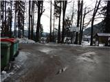
C) From the Dražgoše - Zgornja Besnica road, near the hamlet of Log (Log is a hamlet belonging to the settlement Njivica), we turn onto the side road toward Njivica and Rovte. At the end of the Rovte settlement, we arrive at a smaller crossroads by which there is a recycling spot, where we park in an appropriate place.
Route description:
From the recycling spot we continue in the direction of Besnica, then before the houses we notice a mark on the tree, which directs us right onto a narrower road that ends behind the nearby house. We continue on the footpath, then past the next house we reach another road, which we follow to the right. When the settlement ends we continue on the forest road, which behind the hunting observation post takes us into the forest. In the forest, at the smaller crossroads we continue right toward Jamnik; we continue the ascent on a rougher macadam road, which higher up increasingly turns into a wide cart track.
When we arrive below the peak Špile (811 m) we choose the left cart track, from it we soon go right onto the marked footpath, which ascends diagonally to an indistinct saddle between the already mentioned peak on the right and Mali vrh (821 m) on the right.
From the saddle follows a short descent, then toward the left we cross the quite steep slopes of the peak Špila, where especially with frozen snow there is a risk of slipping. When the crossing ends we step onto a forested ridge, and the path widens into a cart track. A little further, another path from Jamnik joins us from the left; we continue straight ahead on the path that brings us from the forest onto an increasingly scenic ridge, along which we quickly ascend to the little church of St. Primož and Felicijan on Jamnik.
The description and pictures refer to the conditions in 2017 (January).

Photos:
 1
1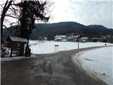 2
2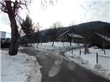 3
3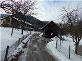 4
4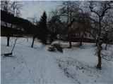 5
5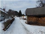 6
6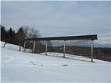 7
7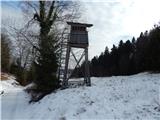 8
8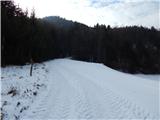 9
9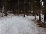 10
10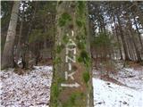 11
11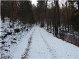 12
12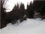 13
13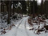 14
14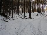 15
15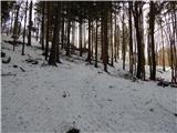 16
16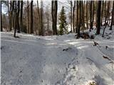 17
17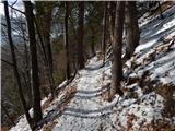 18
18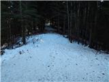 19
19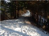 20
20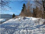 21
21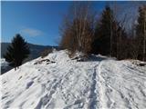 22
22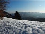 23
23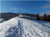 24
24 25
25 26
26 27
27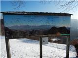 28
28 29
29 30
30
Discussion about the trip Rovte - Sveti Primož in Felicijan (Jamnik)
|
| margu5026. 01. 2017 |
Looking at the map of Škofjeloško and Cerkljansko hribovje and I see a marked path from Sv. Primož to Jamnik, to Njivice. From there it's not far to Rovte, such a circular path could be made. Can any expert help? Thanks for any reply. Lp
|
|
|
|
| Tadej26. 01. 2017 |
I don't know what the path to Njivica is like because I haven't hiked it yet. However, a circular route can be made with a descent to Češnjica near Kropa. Between Češnjica and Rovte it's a good 10 minutes walk.
Description with pictures will most likely be posted tomorrow.
|
|
|
|
| Sue11117. 08. 2020 |
We do not recommend this path, perhaps it was well-marked in 2017, in August 2020 unfortunately no longer so. Too few markers and signs, you can get lost quickly.
|
|
|
To post a comment you must log in:
If you do not yet have a username, you must first
register.