Rogovilec - Velika Raduha (via Grohat on the climbing path)
Starting point: Rogovilec (590 m)
| Latitude/Longitude: | 46,3985°N 14,7069°E |
| |
Route name: via Grohat on the climbing path
Walking time: 4 h 30 min
Difficulty: very difficult marked way
Elevation gain: 1472 m
Elevation difference along the route: 1500 m
Map: Kamniške in Savinjske Alpe 1:50.000
Recommended equipment (summer): helmet
Recommended equipment (winter): helmet, ice axe, crampons
Views: 33.198
 | 2 people like this post |
Access to starting point:
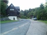
From Mozirje or over Kranjski Rak we drive through Luče and further past Igla to Rogovilec a little before Solčava. There on the left side by the main road is space for parking.
Route description:
From the parking lot, the first kilometer leads us along the main road towards Solčava. After the sign Ključavničarstvo Klemenšek we turn right and the path soon turns into a footpath and into the forest. The footpath to farmer Tolstovršnik is very steep. At Tolstovršnik a nice view opens up on Solčava and Olševa above it.
From Tolstovršnik we continue on a steep forest road through the mountain pasture Javorje. Further, the road descends and in the upper part it goes for some time even downwards. When the path turns from the road to a footpath, the long traverse to Grohat begins. This part of the path slowly almost unnoticeably ascends all the time, several times for a short time even descends. It runs on a nice footpath with a nice mountain wall above it. The end of the traverse is on the mountain pasture Grohat. Here we can rest and have a snack in the hut on Grohat.
At the hut, we turn right on the footpath to Raduha. The path first through the pasture leads past the GRS cottage. Here the path starts to ascend a little steeper and soon brings us to a junction, where we turn right on a very demanding climbing path. The left easier path leads to Raduha over Durce. The path then ascends through a sparse forest and crosses steep slopes below Mala Raduha. The path soon brings us to the first steel cables. A well-secured path over the northern face first leads us along the left side of the steep gully, then crosses the gully and follows a somewhat exposed but well-secured ascent towards the ridge of Raduha. On the ridge, we join the path from Koča na Loki and the path from Grohat over Durce. To the top of Raduha we then have only a few minutes of easy ascent.
We can descend along the approach route or over mountain pasture Arta, past the Snežna jama cave to Rogovilec, to Grohat we can also descend over Durce.

Photos:
 1
1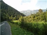 2
2 3
3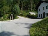 4
4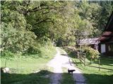 5
5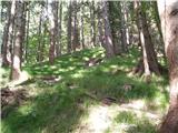 6
6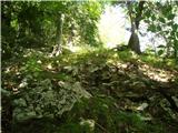 7
7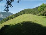 8
8 9
9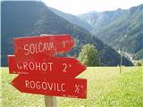 10
10 11
11 12
12 13
13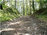 14
14 15
15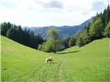 16
16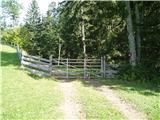 17
17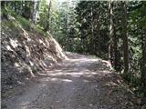 18
18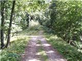 19
19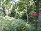 20
20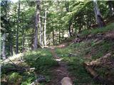 21
21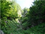 22
22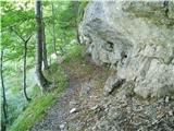 23
23 24
24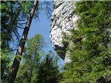 25
25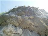 26
26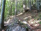 27
27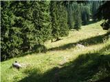 28
28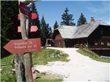 29
29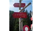 30
30 31
31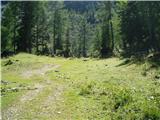 32
32 33
33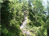 34
34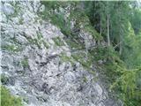 35
35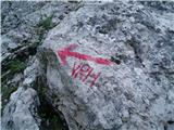 36
36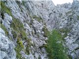 37
37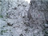 38
38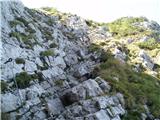 39
39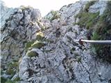 40
40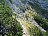 41
41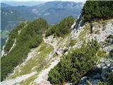 42
42 43
43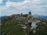 44
44 45
45 46
46 47
47 48
48 49
49 50
50 51
51 52
52
Discussion about the trip Rogovilec - Velika Raduha (via Grohat on the climbing path)
|
| davorin14. 09. 2009 |
Is this really "very difficult"?
|
|
|
|
| aljoša114. 09. 2009 |
No, somewhat difficult. I've been on it twice already, and it didn't seem difficult to me.
|
|
|
|
| lepenatka14. 09. 2009 |
In dry conditions this path is really nice, in wet it can be very tricky.
And sometimes you need slightly longer legs )) ))
|
|
|
|
| JTrogar14. 09. 2009 |
The path rating is completely appropriate in my opinion, as a path is rated by its most difficult section. The hardest part is really only a few meters, but to reach the summit you have to get past it, not to mention winter conditions. Best, Janez.
|
|
|
|
| turi 110. 02. 2011 |
On Sunday we plan to go through Grohot to Raduha, first time on this path and I'm interested if it's really very dangerous in winter, this path probably without ice axe won't do, thanks in advance
best regards.
|
|
|
|
| Lenko11. 02. 2011 |
Winter ascent via climbing route to Raduha is a serious mountaineering feat requiring an experienced mountaineer and complete winter gear. Access to the wall goes through some steep snowfields, incline in the wall itself is quite steep in places and allows no mistakes. Also consider that fixed protections are mostly under snow. I would rather choose another route for the first time... safe steps and good luck.
|
|
|
|
| redbull2. 03. 2012 |
has anyone been on this climbing trail at this time, I'm interested in where the fixed protection is, if there's a lot of snow, now that it's warmer, if you can normally grab them
thanks
|
|
|
|
| Domch2. 03. 2012 |
There is definitely a lot of snow, since the entire wall is in the shade and sheltered position. From my information, there should be snow towards Durc at least up to the waist, so accordingly, you can't expect much less in your direction either.
|
|
|
|
| lakkon20. 07. 2013 |
Hello.
Never been to Raduha. For this path it says it's a very demanding marked path, but the recommended gear does not list the via ferrata set. Is there really no need for it or is it a mistake in the description? Maybe because it's really a short section that needs 'aid', but it can still be overcome without? This part is mentioned by 'Jtrogar' here on 14.9.2009:
''The path rating is in my opinion completely appropriate, as the path is rated by its most difficult part. The most difficult part is really just a few meters, but to reach the summit you have to get over it''.
For someone (not myself) who already has experience with semi-climbing on demanding marked paths without via ferrata set, but not on very demanding paths, will this part of the path go through without major difficulties or without via ferrata set?
Thanks for help.
|
|
|
|
| zico1020. 07. 2013 |
With all respect to the mountains, on this path in good weather without a via ferrata set it's perfectly fine. But I recommend a helmet.
|
|
|
|
| tina bork10. 08. 2013 |
Hey! Looking for company for the mountains (last week of August). Would go via Grohat to Raduha.
|
|
|
|
| pohodnik388. 05. 2015 |
The path is closed until further notice
|
|
|
|
| bo_zl4. 07. 2015 |
Today walked this path. Warning signs about closure nowhere. Then I learn the landslide isn't new at all, but already 4 years old. I'd say it holds, as the path through the landslide is already well worn.
|
|
|
|
| bo_zl4. 07. 2015 |
Nice circular tour that I completed today. Rogovilec-Grohat-Raduha (via climbing path)- Loka pod Raduho-Rogovilec (past planina Arta and snežna jama.
Start to Tolstovršnik warms you up well , then mostly mountain stroll to Grohat. Climbing path despite heat in valley quite wet and slippery. From snežna jama to Rogovilec very long. Shortly to snežna jama several new forest roads (logging) cross the path, many places newly felled trees. So somewhat difficult to find path again in middle of forest. Hope they clean up soon and mark properly  . Then path becomes very exposed in several places. Really don't recommend in wet, today grass and leaves dry But section from Rogovilec to Grohat and from snežna jama to Rogovilec perfect for peace lovers. Didn't meet a single person on either section despite nice Saturday . Then path becomes very exposed in several places. Really don't recommend in wet, today grass and leaves dry But section from Rogovilec to Grohat and from snežna jama to Rogovilec perfect for peace lovers. Didn't meet a single person on either section despite nice Saturday
|
|
|
|
| JanezKog12. 09. 2015 |
Today on this trail I noticed new directional signs, on which the times are more suitable for walkers than for hikers (who they should be intended for). Now the trail from the parking lot at Rogovilcu to Koča v Grohotu should take 4 hours and 20 minutes! The old signs showed much more realistic times. The time on the sign in front of the Tolstovršnik farm has changed from 2 to 3.5 hours to Koča v Grohotu. Probably such times on the sign deter some hikers from this trail.
|
|
|
|
| 30620. 08. 2018 |
Hi. Yesterday 20.8. I did this trail. Very nice, quiet (at least to Grohot), quite strenuous. I agree with the previous one that the time estimates are a bit high. At medium pace I was at Grohot in 2h. But in the mountains we don't watch the clock, we enjoy ourselves there.
I would like to appeal to people, hikers, mountaineers who are aware of the dangers in the rocks and are properly equipped, to warn tourists about the dangers that lurk for them as much as possible, namely yesterday I also managed to see quite a few ''opportunities'' for a helicopter visit in the mountains. The most surprising was a couple with two dogs on flexi-leashes, in sneakers, shorts and without helmets. I can only say bravo. Two older couples equally without proper protection didn't ''know'' how demanding it is here even though it says very demanding trail at the junction below. Sometimes I really am speechless but people, seriously, I understand you're supermen and today you surely feel super and surely the sky won't slip... but what about the hikers below you, above you, next to you... Next time it could be you under someone who accidentally knocks a stone down......
Best, R
|
|
|
|
| pohodnik3820. 08. 2018 |
Yesterday, 19.8., I did the mentioned path, which is quite interesting; I'll go again sometime. But I would especially mention that in the initial part from the 5th picture onwards there is no path for at least 100 m, forest gone probably due to windthrow, so you have to slalom a bit between stumps and roots and then catch the marked path again above. Marking on a thick spruce. Later on the path there is also a landslide that requires caution.
PICTURES and personal impressions from the path
Cheers! Tone
|
|
|
|
| Janezs20. 08. 2018 |
Yes, the newly made path to Durce is already quite damaged. Again I get the feeling. Made, photographed, praised, then suffering on the shoulders. Paths, parks and everything made, as if made for the media, then it starts to decay, maintenance is forgotten. Cheers.
|
|
|
|
| martin421. 08. 2018 |
True, what Janez wrote. I was surprised when descending over Durc a few days ago how rundown the path was. Broken steps, missing boards... cheers m4
|
|
|
|
| dprapr21. 08. 2018 |
Those who walk around there at night could repair paths during the day.
Joke aside. I feel that lately only path equipment is being criticized. How many of these are volunteers for such work?
Somewhere I saw data that in December 2017, 137 PD received 20,000 euros. Of course to those PD who submitted the required documentation on time and met the conditions.
So, if this data is accurate and if all had received the same, which they didn't, each PD would get about 145 euros. Find me someone who will maintain paths promptly for that money.
|
|
|
|
| mirank21. 08. 2018 |
Indeed, quite a few years have passed since the last visit to those parts, but I remember the most demanding jump over the fence in front of a bull somewhere near the hut. Various steps made of planks in my opinion do not belong on more demanding terrain. But if someone is unable to follow the path through natural passages with the help of safety gear, it's better to choose another approach.
|
|
|
|
| Janezs21. 08. 2018 |
Already when I saw it years ago, when it was newly made, the overbuilt path, steps and everything made of spruce wood, I knew it wouldn't last long. But that doesn't bother me so much. What bothers me more is that junipers are growing on the path. And for that, no action is needed, let alone permission, to cut it with scissors.
|
|
|
|
| Janezs22. 08. 2018 |
Pleasantly surprised I was on the descent, at Loka. The "mower" made an effort and nicely mowed along the path. Praiseworthy, because I've already seen abroad in many places that the path was maintained up to the hut. Further towards the summit, however, it's overgrown.
|
|
|
|
| ambrozd13. 08. 2020 |
Klemenšek Locksmithing is now a large modern factory. The path to Tolstovršnik is little used.
|
|
|
|
| biba19. 08. 2020 |
I first walked this path from Grohot to Rogovilec on 6.7.2020 (descent). From Grohot down there's soon a new logging track (clearing), the path goes straight across the track. It's a bit visible, later a bit overgrown and you have to cross fallen trees, then normally traceable. Through the forest, under the walls. Past the landslide. Nice, somewhat wild, solitary. Under Tolstovršnik, where a watchdog loudly greeted me, I first strayed a bit to the viewpoint. After the steep path down through the forest there was again some walking through annoying tall grasses, blackberries (overgrowth after clearing or storm) and when I stepped onto the forest track, I preferred to descend along it to the main road, past newly built houses (before Solčava). Since I was in a hurry, I didn't even look for the path to Klemenška (overgrown). Interesting and pleasant.
|
|
|
|
| Robie22. 08. 2021 13:10:52 |
At the road there is no longer a sign for locksmith Klemenšek and markings for Raduha ... A larger probable parking lot is being built above the Eltras factory but not yet completed. Caution - the parking lot at Rogovilec is private property and intended only for Rogovilec guests.
The safety gear on the climbing path is in solid condition, helmet more than recommended also on the section to planina Grohat (active rockfall and walking under the wall). Self-belay kit in my opinion not necessary.
|
|
|
|
| gamsek126. 05. 2024 16:40:58 |
Where can one park now, given that at Rogovilec it is private property? At the Eltras factory?
|
|
|
|
| Roberto-MMLM11. 08. 2024 12:32:14 |
Yesterday 10.8.2024 I went to this mentioned climbing trail and since it was our first time, we wasted more than 1 hour to find this trail, checked all signs and disappointedly concluded that there would be no climbing, the only path was over pl. Arta, later at the junction to pl. Loke the trail is impassable, closed. But this trail is difficult to very difficult, rises steeply all the time, without respite, if you have a 15kg backpack have at least 3 liters of water, because you'll hardly find drinking water here, except more at the beginning of the trail. But this trail is veeery long and strenuous.
In short, at the beginning everything is very poorly marked, no signs for the climbing trail where to turn. In addition, at this guesthouse there is no more parking, because it's only private for guesthouse customers. (PRIVATE)
|
|
|
|
| zokipoki11. 08. 2024 15:15:59 |
Roberto, first you must go along the main road towards Solčava, then at the direction signs right past the houses, uphill all the way to Tovstovršnik farm, from there on marked to Grohot, then higher at the junction right on the climbing trail! I don't know where you were looking?!
|
|
|
|
| turbo11. 08. 2024 15:45:55 |
15 kg backpack 
|
|
|
|
| Vinetou_13. 08. 2024 09:30:41 |
If you ended up at Planina Arta, you probably went in the wrong direction from the starting point? From the parking lot downstream along the Savinja and left up the hill, instead of upstream along the Savinja towards Solčava and at the first houses right up the hill towards Tolstovršnik, Grohot and further into the wall.
This is quite an orientation blunder, but this path is also very nice, although not a climbing path. This way you also discover new paths
|
|
|
|
| Janez Seliškar13. 08. 2024 11:08:44 |
If only there was the good old paper hiking map.
|
|
|
|
| dprapr13. 08. 2024 15:31:22 |
Nobody takes maps anymore. Even us old folks have stopped taking them along. There are too many other, more convenient tools.
But to go to Raduha with a 15kg backpack and 3 liters of liquid, you have to miss the path a bit to use it all up.
|
|
|
|
| sla13. 08. 2024 17:45:43 |
Some of us still carry them
|
|
|
|
| bbugari113. 08. 2024 17:52:39 |
That's not true Drago. I never go to the mountains without a hiking map and I don't need anything else, although I don't need the map for orientation, but to check the course of this or that path and for a broader overview of the entire area.
|
|
|
|
| dprapr13. 08. 2024 20:02:03 |
On Maps you have the exact location and a broader view of the area.
For mushroom picking there's also additional Parked car to get back to the car.
|
|
|
To post a comment you must log in:
If you do not yet have a username, you must first
register.