Rogovilec - Račka vrata (hunting path)
Starting point: Rogovilec (590 m)
| Latitude/Longitude: | 46,3985°N 14,7069°E |
| |
Route name: hunting path
Walking time: 2 h 15 min
Difficulty: difficult unmarked way
Elevation gain: 860 m
Elevation difference along the route: 860 m
Map: KSA z Obirjem in Peco
Recommended equipment (summer): helmet
Recommended equipment (winter): helmet, ice axe, crampons
Views: 11.524
 | 3 people like this post |
Access to starting point:
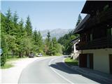
From Mozirje or over Kranjski Rak we drive through Luče and further past Igla to Rogovilec a little before Solčava. There on the left side by the main road is a space for parking.
Route description:
To the farm Račnik the path is marked. The first two hundred meters of the path run on asphalt to the bridge over Savinja. Then we continue on a footpath above the left bank of Savinja. A little higher we arrive at a cart track which brings us to the farm Račnik. When we step on the road at Račnik we continue left upwards on a cart track through a meadow. The cart track immediately in the forest turns sharply right upwards, and we continue left on a hunting footpath. The path then runs almost flat through a dry riverbed past a big rock on the left side of the path. Here the path starts to ascend. Soon we arrive at the salt lick for wild animals. The path turns behind the salt lick right steeply upwards along the ridge towards Tolsta peč. Higher we cross the road which we left lower on the edge of the meadow and just continue steeply upwards along the ridge. The path nowhere strays far from the ridge. When we arrive at the collapsed shepherd's Račkeg hut we continue another approximately 100 m upwards along the ridge, then 10 m above two larches (rocky part of the path) the path turns right past several fallen trees. The path then crosses to the right for a long time through several smaller gullies, slightly ascending, and occasionally even descending. When we cross the second larger rocky slide, on the other side on the trunk of a spruce there is a red letter L, which means that we must continue right along the slide upwards. We climb about 50 m to the hunting salt lick, above which the path crosses more than 100 m to the right all the way to the magnificent Račka vrata.
The path is exposed in many places and therefore dangerous for slipping. Due to the orientational difficulty, one needs quite some adventurous and exploratory spirit, for which we are then richly rewarded.
The arch above the gates is passable but requires considerable climbing skills from us. It can be climbed from both sides. Crossing is safer from the lower side, as it is much more demanding in the opposite direction due to friability, great steepness and the narrowness of the arch in the lower part.
The wonderful panorama from the arch rewards us for the walked path.
We descend in the direction of the approach.

Photos:
 1
1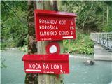 2
2 3
3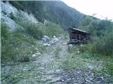 4
4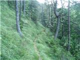 5
5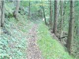 6
6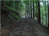 7
7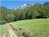 8
8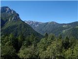 9
9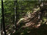 10
10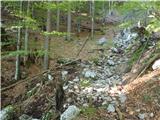 11
11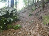 12
12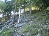 13
13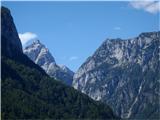 14
14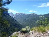 15
15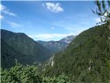 16
16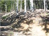 17
17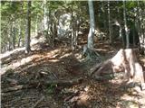 18
18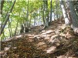 19
19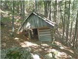 20
20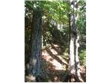 21
21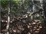 22
22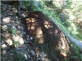 23
23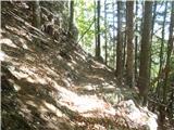 24
24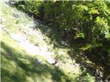 25
25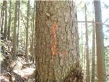 26
26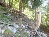 27
27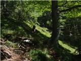 28
28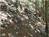 29
29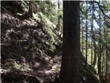 30
30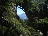 31
31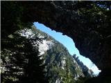 32
32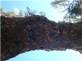 33
33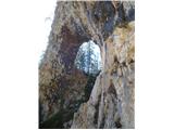 34
34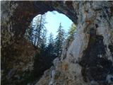 35
35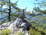 36
36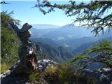 37
37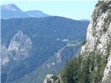 38
38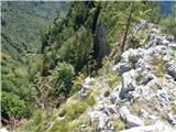 39
39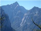 40
40
Discussion about the trip Rogovilec - Račka vrata (hunting path)
|
| garmont30. 12. 2012 |
To the path description I would add that the letter "L" on the trees continues all the way to the Vrata themselves, though the letters are less visible. With some care, they can be followed.
|
|
|
|
| dprapr20. 05. 2013 |
On picture 21 there is a larch and a pine!
|
|
|
|
| andi217. 07. 2014 |
Very nice path, orientation is not too difficult with a good description, but it's a good fitness test and many beautiful semi-exposed sections. My opinion - the last rocky scree is completely washed away and a very demanding spot. Middle smooth, steep entry and exit on scree without real possibility for stable footing. When you see stones flying where, you get a bit goosebumps... safe steps I wish.
|
|
|
|
| Ninđa22. 04. 2016 |
What happened to the bridge in the second picture?
Thanks for info.
Best, Nino
|
|
|
|
| garmont22. 04. 2016 |
The bridge is still there where it was.
It is true that it is possible to start the path already earlier on the left bank, so that you avoid the above-mentioned footbridge.
|
|
|
|
| Ninđa22. 04. 2016 |
Not true. That bridge (picture 2) is no longer at that location!
|
|
|
|
| Ninđa22. 04. 2016 |
Now I know or you know 
On 5.22 Solčava was gripped by heavy rainfall, consequently the watercourses also rose
... In Robanov Kot the stream destroyed the footbridge for pedestrians and cyclists too.
Link:
http://www.sos112.si/db/priloga/p15361.pdf
Best, Nino
|
|
|
|
| Matjaz_6513. 08. 2019 |
collapsed shepherd's hut is no longer there ... since there's a road there now ... some remains are visible only under it ...
otherwise the trail is nicely traceable 
photos of the trail ... and climbing continuation on the western ridge
|
|
|
To post a comment you must log in:
If you do not yet have a username, you must first
register.