Rogla (Hotel Planja) - Koča na Pesku (via Rogla)
Starting point: Rogla (Hotel Planja) (1474 m)
| Latitude/Longitude: | 46,4531°N 15,3325°E |
| |
Route name: via Rogla
Walking time: 35 min
Difficulty: easy marked way
Elevation gain: -88 m
Elevation difference along the route: 45 m
Map: Pohorje 1:50.000
Recommended equipment (summer):
Recommended equipment (winter):
Views: 16.833
 | 1 person like this post |
Access to starting point:
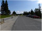
A) From the Ljubljana–Maribor highway, we take the exit for Slovenske Konjice and continue driving towards the mentioned settlement. From Slovenske Konjice, we continue towards Zreče, while further following the road in the direction of Rogla. When we arrive at Rogla, we park on the large parking lot near the Hotel Planja.
B) First, we drive to Lovrenc na Pohorju (to this point from the Maribor–Dravograd road), then continue driving towards Rogla and Koča na Pesku. The macadam road further first takes us to Mašinžaga and then to Koča na Pesku. From Koča na Pesku, we continue along the asphalt road, ascending to the large parking lot near the Hotel Planja.
Route description:
From the parking lot, we continue on the road towards Koča na Pesku. The road first leads between the football field on the left and the church on the right. Immediately when the field ends, we leave the road and continue slightly to the left on the initially parallel mountain path. The path ahead leads past the NOB monument, after which we gradually enter a thin spruce forest. There follow a few junctions, where we follow the signs for the tower on Rogla. The fairly level path, running along the winter cross-country ski track, brings us after about 15 minutes of walking from the starting point to the summit of Rogla, where a 30-metre-high lookout tower stands.
If there is no danger of thunderstorms, we can climb the mentioned tower at our own risk, from which a nice view opens onto a larger part of Pohorje, and with good visibility also onto the Karawanks, Kamnik–Savinja Alps and Triglav.
From the tower on Rogla, we continue left into the forest on the footpath marked Pesek. Further on, the path first gently, then more moderately descends through the forest. Lower down, it joins a wider cart track, which brings us in a gentle descent to a larger grassy clearing, where we join the asphalt road from Rogla. Here we continue straight ahead and after a few further steps arrive at Koča na Pesku.

Photos:
 1
1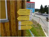 2
2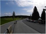 3
3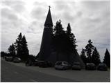 4
4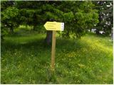 5
5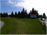 6
6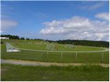 7
7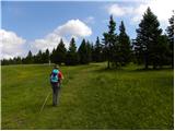 8
8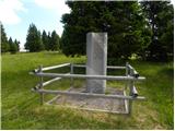 9
9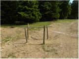 10
10 11
11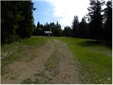 12
12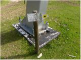 13
13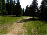 14
14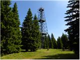 15
15 16
16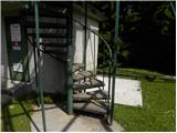 17
17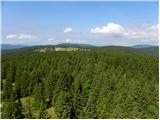 18
18 19
19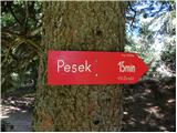 20
20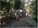 21
21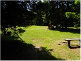 22
22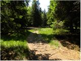 23
23 24
24 25
25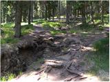 26
26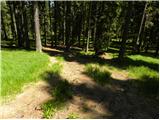 27
27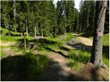 28
28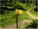 29
29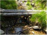 30
30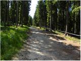 31
31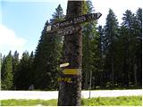 32
32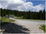 33
33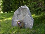 34
34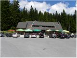 35
35
Discussion about the trip Rogla (Hotel Planja) - Koča na Pesku (via Rogla)
|
| balon18. 03. 2014 |
I'm wondering if there's a path from Koča na Pesku to Koča na Klopnem vrhu? And how long does it take to walk.
Best regards,
Balončki
|
|
|
|
| dejan6818. 03. 2014 |
There's a path between the huts, we're going this Saturday, if my memory from half a year ago doesn't deceive me then it's 1.45h.
|
|
|
|
| balon8. 07. 2014 |
Thank you for the tips.
Balončki
|
|
|
|
| zdejan21. 03. 2021 |
I've been missing the Slovenian mountain trail stamp from this hut for at least half a year, since corona. It would be nice if it were available outside the hut.
|
|
|
To post a comment you must log in:
If you do not yet have a username, you must first
register.