Rogarjev rovt - Rosenbachsattel/Rožca
Starting point: Rogarjev rovt (1175 m)
| Latitude/Longitude: | 46,464°N 14,0111°E |
| |
Walking time: 1 h 10 min
Difficulty: easy unmarked way
Elevation gain: 412 m
Elevation difference along the route: 412 m
Map: Karavanke - osrednji del 1:50.000
Recommended equipment (summer):
Recommended equipment (winter): ice axe, crampons
Views: 7.573
 | 2 people like this post |
Access to starting point:
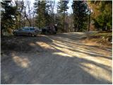
A) From the highway Ljubljana - Jesenice, we take the exit Jesenice - east (Lipce), and then we continue driving towards Jesenice. In the traffic-light crossroads in Slovenski Javornik, we continue left towards the center of Jesenice and Kranjska Gora, and on the main road we drive to the crossroads, where signs for Golica and Planina pod Golico point us to the right on an ascending road. We follow the road towards Planina pod Golico to the sharp right turn, where we turn left in the direction of Plavški Rovt. Above Plavški Rovt the asphalt ends, and the road for some time even descends a little. A little higher we arrive at a crossroads, where signs for Dovje 9 km point us sharply left on a steeper macadam road again. From the crossroads onwards, we follow the road for a good 2 km, or more precisely to Rogarjev rovt, which we recognize by some holiday cottages. We park at an appropriate place by the smaller crossroads, where an unmarked and worse forest road branches off to the right towards Hruška planina.
B) First, we drive to Kranjska Gora, and then we continue driving towards Jesenice. In Dovje we leave the main road and turn left towards the center of the village, from where we follow the signs for Dovška Baba. The road soon after the village brings us to a crossroads, where we continue on the right road (sharply left Kepa and Borovje). Further, we drive for quite some time to the next crossroads, where a road branches off to the left towards the mountain pasture Dovška Rožca (in descriptions starting point Ravne), and we continue straight towards Plavški Rovt. Soon after the crossroads we cross the stream Presušnik, and then the road ascends a little more. When the road flattens it still crosses slopes towards the right, and then it brings us to a smaller saddle, after which it starts descending diagonally. Next follows the crossing of the stream Dobršnik, and then we pay attention, because we will soon arrive at Rogarjev rovt, which we recognize by a bigger hay meadow, smaller parking lot and turn-offs of a cart track to the left.
Route description:
From the starting point, we head onto a worse macadam road, which first gently ascends across Rogarjev rovt. On the other side of the rovt, the road goes into the forest and behind the barrier starts to ascend steeply. Higher, the road brings us onto the ridge north of the lesser-known Suhega vrh (1339 m), from where for a short time a view opens towards Stol, Vajnež and Struška. The road quickly returns to the forest, through which we walk for a few minutes, and then we arrive at the expansive pastures of Hruška planina. From here we continue on a fairly gentle road, along which, with a view of Hruški vrh, we walk to the nearby shepherd hut on Hruška planina (also Hruščanska planina).
From the hut, we continue right past the larger watering place for animals and across the larger pasture to the edge of the forest, where for a short time we still continue on the wide cart track. Immediately after the path enters the forest, we leave the cart track and continue the ascent on a well-trodden but still unmarked path, which branches off to the left from the cart track. The path ahead begins to ascend diagonally through the forest and quickly brings us to a larger gully, which we cross and then on the other side of it begin to ascend more steeply. A little higher we step out of the forest and turn slightly to the right, and then ascend over increasingly panoramic grassy slopes. Higher, the path levels out and brings us to Makotova bajta on Rožca.

Photos:
 1
1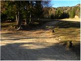 2
2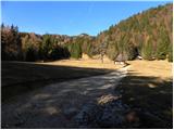 3
3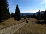 4
4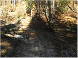 5
5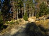 6
6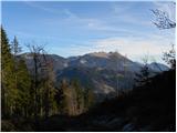 7
7 8
8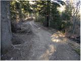 9
9 10
10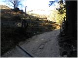 11
11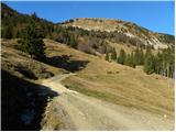 12
12 13
13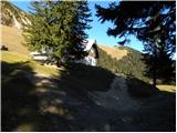 14
14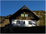 15
15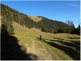 16
16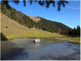 17
17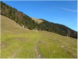 18
18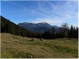 19
19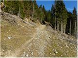 20
20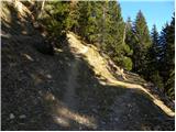 21
21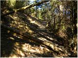 22
22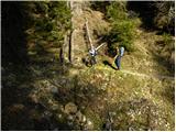 23
23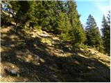 24
24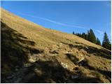 25
25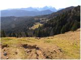 26
26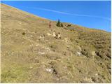 27
27 28
28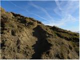 29
29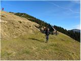 30
30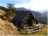 31
31
Discussion about the trip Rogarjev rovt - Rosenbachsattel/Rožca
|
| kofetarca1. 05. 2014 |
Today nice and warm morning hike from Rogarjev rovt towards Hrušćanska planina, where on the plain opening view to Golica and Stol range, the path is crossed by the "notorious" wild rooster. He strutted a lot and followed us along the road almost to Hrušćanska planina. We went further to Rožca and Klek and on return he waited almost at the same spot and "intimidated" two more hikers. He stood in the middle of the road, didn't let us pass until we fended him off with sticks 
|
|
|
|
| Cochana26. 06. 2015 |
Probably it's the alpine myth about the so-called Ruševec Terror. It's also known in English-speaking areas as Terrorchicken, in Latin America as the notorious El Pollo Terroro.
|
|
|
|
| sandy29. 12. 2018 |
Is there still the wild rooster?
|
|
|
To post a comment you must log in:
If you do not yet have a username, you must first
register.