Robanov kot (Belšek) - Križevnik (via Belšekova planina)
Starting point: Robanov kot (Belšek) (587 m)
Route name: via Belšekova planina
Walking time: 4 h
Difficulty: difficult pathless terrain
Elevation gain: 1322 m
Elevation difference along the route: 1322 m
Map:
Recommended equipment (summer):
Recommended equipment (winter): ice axe, crampons
Views: 2.560
 | 4 people like this post |
Access to starting point:
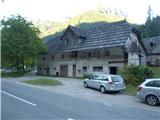
We drive to Luče (from Mozirje or over the Volovljek pass) and onwards towards Logarska dolina. Approximately 100 m after the wooden sign "Robanov kot" on the left side by the road is the farm Belšek. We park at the bridge; there is space for one car.
Route description:
After the farm Belšek we go on the road left gently upwards. We walk on the road about 25 minutes. The road turns right and passes into a cart track; at the crossing of cart tracks we go right. The cart track is becoming increasingly steep. From the main cart track, side cart tracks are branching off; we stick to the main cart track. In zig-zags we are ascending upwards; after a good hour of walking first a cart track branches off to the right, then to the left, we go all the time straight. The cart track flattens, and then slightly descends. Right below the cart track we can hear a spring or a well. A few meters further below the cart track there are remains of a hut; we are at the remains of the mountain pasture Belšekova planina. To here 1h 20min.
Above the spring at the big rock (above the cart track) right from the rock we can see a gully. We head upwards. We walk by the gully on the right side without a path steeply upwards. At first the gully is indistinct, higher it becomes more and more distinct. When we get almost to the upper walls we will notice a footpath left into the gully (from the road good 200 altitude meters). By it we descend into the gully and walk upwards along it. From the road we can also go left by the gully to the rock barrier and on a game trail right into the gully (into the gully we enter somewhat lower than if we go right by the gully). In the gully there are several smaller jumps which we can climb (I) or bypass through dwarf pines. Through the gully we walk approx. 200 altitude meters, we stick more to the right. On the top of the gully we step on the edge of the plateau. To here 2h 40min.
We will notice cut dwarf pines. At first there is no footpath; we walk approximately in the direction south/southwest. After approx. 50 m the footpath becomes more visible. We follow a well-beaten footpath on basin terrain through cut dwarf pines among larches all the way to the mountain pasture Polšakova planina. (When returning, the direction is exactly towards Raduha). On the mountain pasture we turn sharply right; on its edge we will notice a footpath. Along it on a well-beaten footpath. At the big grassy hollow right towards the edge and then right upwards along the ridge. The path is cut through dwarf pines and runs somewhat below the ridge; we stick more to the right. On the top there used to be a miniature Aljaž tower; now there is a wooden cross.

Photos:
 1
1 2
2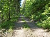 3
3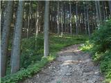 4
4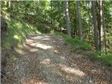 5
5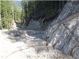 6
6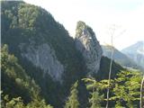 7
7 8
8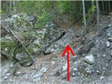 9
9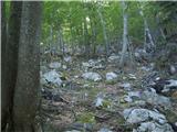 10
10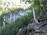 11
11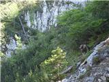 12
12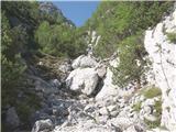 13
13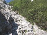 14
14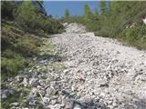 15
15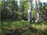 16
16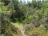 17
17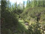 18
18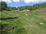 19
19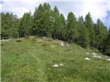 20
20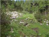 21
21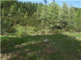 22
22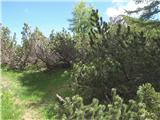 23
23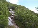 24
24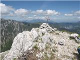 25
25
Discussion about the trip Robanov kot (Belšek) - Križevnik (via Belšekova planina)
|
| geppo16. 06. 2020 |
With this forest road they destroyed one of the most beautiful access paths to the pasture.
One other access variant remains, which is a bit harder in one section (very unpleasant forest traverse). I'll have to check sometime what's left of it? Since this road was built, this area no longer appeals to me.
|
|
|
|
| panoramik16. 06. 2020 |
Where is the mini tower on the summit?
|
|
|
|
| Ninđa7. 06. 2021 13:49:34 |
@geppo, have you ever gone from the Vrsnik-Govc farm towards Belšekova planina? Yesterday I saw a logging track up there. I went along it but the rain drove me back to the valley.
Best regards, Nino
|
|
|
|
| geppo7. 06. 2021 14:23:24 |
I've walked this path several times. It was the old logging track, not the new one as now. To Belškov stan there were two paths. One branched right from the track - cairn. This one was quite demanding in one place - steep. Uphill ok, downhill very carefully. This path is supposed to still exist partly.
The other path branched from the track upwards along the ridge and wasn't demanding. It was also connected to the path over Kačjek. The new logging track is supposed to follow this path now. I only saw marked trees that they then felled and made the track. After that I haven't been to that area anymore.
Colleagues told me that this track now takes you directly to the former stan. What about the spring on the planina, I don't know either?
https://www.hribi.net/trenutne_razmere/slo/belsekova_planina/3/7454
best regards
|
|
|
To post a comment you must log in:
If you do not yet have a username, you must first
register.