Rifugio Passo Sella - Rifugio Vicenza (path 525)
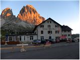
Starting point: Rifugio Passo Sella (2183 m)
| Latitude/Longitude: | 46,50944°N 11,7573°E |
| |
Route name: path 525
Walking time: 2 h 10 min
Difficulty: easy marked way
Elevation gain: 70 m
Elevation difference along the route: 510 m
Map: Tabacco 05 1:25.000
Recommended equipment (summer):
Recommended equipment (winter): ice axe, crampons
Views: 4.171
 | 3 people like this post |
Access to starting point:
From Kranjska Gora over Korensko sedlo to Austria, where at the first larger intersection we continue left towards Podklošter / Arnoldstein and Trbiž / Tarvisio. At the end of the settlement Podklošter signs for Šmohor / Hermagor point us right onto a regional road, on which past the mentioned settlement we drive to the end of the Gailtal valley, or more precisely to the settlement Kötschach-Mauthen, where we turn right towards the settlement Oberdrauburg. The route ahead leads us over the Alpine pass Gailbergsattel (982 m), after which we descend into the mentioned settlement. After we cross the bridge over the river Drau, we continue left towards the settlement Lienz. In the main roundabout in Lienz we continue "left" in the direction of the settlement Sillian and Italy. Further, we cross the border between Austria and Italy, and we follow the main road past settlements Dobbiaco / Toblach, Villabassa / Niederdorf, Monguelfo - Tesido / Welsberg - Taisten, Brunico / Bruneck. Only a little after the last-mentioned settlement, past which leads a bypass road, we turn left into the Alta Badia valley. Further, we drive through the mentioned valley and in the settlement La Villa we turn right towards the pass Passo Gardena. Further, we follow the ascending road following the signs for Passo Gardena. From the pass Passo Gardena we descend on the other side and then we continue left towards the pass Passo Sella. On the pass Sella we park at the hut Rifugio Passo Sella or on one of the smaller parking lots by the road. The parking lot at the hut is payable (July 2012 – 4€).
Route description:
At the hut Rifugio Passo Sella we head across the parking lot to the lower station of the cable car, which goes towards the hut Demetz on the saddle Forcella Sassolungo. We continue on a wide footpath and at the first intersection signposts direct us left onto a macadam road. After a few tens of meters we are again at a junction and continue right. The road then turns into a path and begins to ascend towards the scree below the precipitous peaks of the Sassolungo group. The path further turns slightly right and takes us to the slopes below the cable car. Here we begin to ascend in zigzags through the scree towards the saddle Forcella Sassolungo. From the path we have all the time a very nice view of the precipitous walls of the nearby peaks in the Sassolungo group, very nice is also the view towards the Sella group and Marmolada. The path then runs all the time near the cable car and continues ascending in zigzags on the steep scree. Such a path continues all the way to the hut Rifugio Toni Demetz.
From the hut we continue towards the northwest and begin descending through the valley between the peaks Sassolungo and Piza de Dantersasc. The path here constantly descends on scree and then turns slightly left towards the hut Rifugio Vicenza / Langkofel Hütte. From the saddle Forcella Sassolungo we descend more than 400 meters of altitude.
To the starting point we can return along the approach path or continue towards the northeast and along path 526 circle the Sassolungo peak and return to the starting point at the pass Passo Sella.

Photos:
 1
1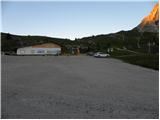 2
2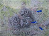 3
3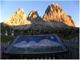 4
4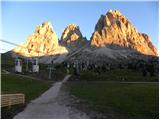 5
5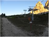 6
6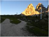 7
7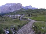 8
8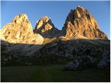 9
9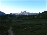 10
10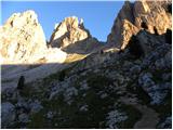 11
11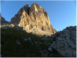 12
12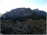 13
13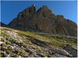 14
14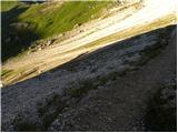 15
15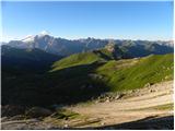 16
16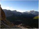 17
17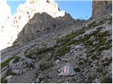 18
18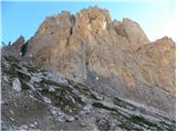 19
19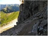 20
20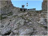 21
21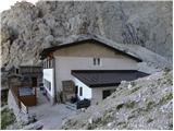 22
22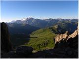 23
23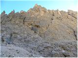 24
24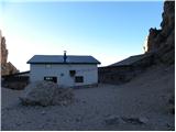 25
25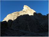 26
26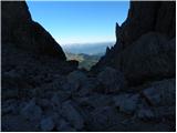 27
27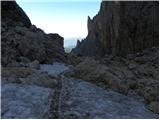 28
28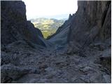 29
29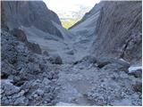 30
30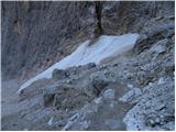 31
31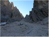 32
32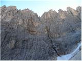 33
33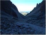 34
34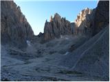 35
35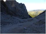 36
36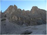 37
37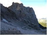 38
38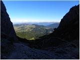 39
39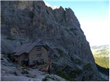 40
40
Discussion about the trip Rifugio Passo Sella - Rifugio Vicenza (path 525)
|
| augustus3331. 07. 2012 |
solid views, but the path itself looks boring
|
|
|
|
| BorStenar25. 12. 2022 15:13:01 |
Looks awesome to me
|
|
|
|
| Macesna29. 12. 2022 19:12:49 |
Up to Rif. Toni Demetz (i.e., most of the ascent) can also be done by cable car. The old gondola is quite adrenaline-pumping.
To the mentioned hut it is also possible via the new via ferrata.
|
|
|
|
| BorStenar30. 12. 2022 15:38:37 |
How difficult is this via ferrata?
|
|
|
|
| BorStenar1. 01. 2023 19:18:28 |
I can see it already.
Thanks for the information.
|
|
|
To post a comment you must log in:
If you do not yet have a username, you must first
register.