Rifugio Nordio - Planina Bistrica (Hutte Oisternig) (direct way)
Starting point: Rifugio Nordio (1210 m)
| Latitude/Longitude: | 46,5506°N 13,4824°E |
| |
Route name: direct way
Walking time: 1 h 25 min
Difficulty: easy marked way
Elevation gain: 512 m
Elevation difference along the route: 512 m
Map: Julijske Alpe - zahodni del 1:50.000
Recommended equipment (summer):
Recommended equipment (winter): ice axe, crampons
Views: 3.404
 | 2 people like this post |
Access to starting point:
We drive to Tarvisio/Trbiž, which is just a few kilometers beyond the state border on the Italian side of the Rateče border crossing. We can also reach Tarvisio/Trbiž from Austria, first driving to Villach/Beljak and then via the Thori-Coccau border crossing to Tarvisio/Trbiž. In Tarvisio/Trbiž, follow the signs to Udine/Videm on the old road (not the motorway). Shortly after Tarvisio/Trbiž, we reach the village of Ugovizza/Ukve, where we turn right into the village center. In the middle of the village, we reach a stream, where an asphalted mountain road branches off upwards along the stream. We drive along this road to a junction, where we go straight ahead (right), right after this junction we reach the next one, where we turn left. We follow this mostly asphalted road to the Rifugio Nordio hut, where we park in the parking lot next to the hut.
Route description:
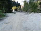
From the parking lot, head to the left road that passes by the dilapidated Nordio hut. The road begins to ascend moderately and leads us in switchbacks to a spot exposed to falling rocks. Despite the mesh netting installed slightly above the road, caution is required. It is best to pass this section as quickly as possible.
Afterwards, cross the stream and continue ascending north to a junction. Straight ahead the road goes to Lom saddle, while right branches the direct path to Ojstrnik. We turn right onto path marked 407 leading to Ojstrnik. After a short descent, the path crosses the stream and then steeply ascends through the forest. Soon the path from Lom saddle joins from the left.
The path continues ascending through a rather dark forest. The gradient then eases and the path brings us out of the forest onto the pastures of Planina Bistrica. Then follows another ten minutes of walking on a gentle meadow to the huts on the alpine pasture, which we can already see ahead.

Photos:
 1
1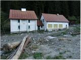 2
2 3
3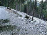 4
4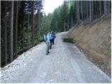 5
5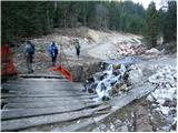 6
6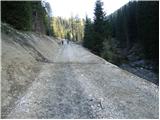 7
7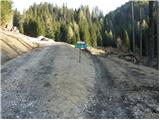 8
8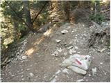 9
9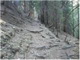 10
10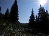 11
11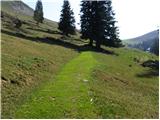 12
12 13
13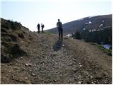 14
14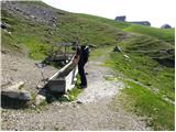 15
15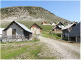 16
16
Discussion about the trip Rifugio Nordio - Planina Bistrica (Hutte Oisternig) (direct way)
To post a comment you must log in:
If you do not yet have a username, you must first
register.