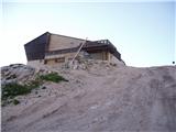
Rifugio Gilberti - Bivouac Marussich
Starting point: Rifugio Gilberti (1850 m)
| Latitude/Longitude: | 46,3874°N 13,4734°E |
| |
Walking time: 2 h
Difficulty: easy marked way
Elevation gain: 191 m
Elevation difference along the route: 350 m
Map: Julijske Alpe - zahodni del 1:50.000
Recommended equipment (summer):
Recommended equipment (winter): ice axe, crampons
Views: 7.172
 | 1 person like this post |
Access to starting point:
From Kranjska Gora over the border crossing Rateče we drive to Trbiž / Tarvisio. In Trbiž we continue left in the direction of Bovec and we follow the road to the crossroad near the lake Rabeljsko jezero. Here we continue right in the direction of Nevejski preval / Sella Nevea. This road, which is mostly ascending, we follow to a large parking lot at the bottom station of the cableway, which runs to the hut Gilberti.
Then we buy a ticket and take the cableway to the upper cableway station. From the upper cableway station to the hut Gilberti we have 5 minutes of walking on a transport-rescue road.
From Bovec, we drive to the border crossing Predel, from which we descend to the Italian side. Only a little after the lake Rabeljsko jezero we come to the crossroad, where we continue left in the direction of Nevejski preval / Sella Nevea. Further, follow the above description.
Route description:
From the mountain hut, we slightly descend (direction west) into a smaller valley, where there is a crossing. We continue right in the direction of S.Grubia on the path which runs between the main Kanin ridge on the left and Bela peč on the right. The path ahead is at first ascending gently through the valley, and then it starts ascending steeper and after a few minutes of ascent brings us to an old military fort on a saddle Bela peč. Behind the fort we continue slightly left in the direction of "bivacco" (right Bela peč 30 minutes very demanding path) on an old military mule track, which is already well destroyed. The path which is slightly descending and then again ascending runs on in parts steep slopes, which are in some parts slightly precipitous and exposed to falling stones (because the path is wide in dry doesn't cause problems). The path then brings us to a crossing, where the path on Visoki Kanin branches off to the left upwards. We continue on a mule track, which then crosses some gullies, which are late in the summer covered with snow. Nice and panoramic high mountain path, after 2 hours of walking from the hut Gilberti, brings us to the bivouac Marussich.

Along the route: Sella bela pec (2005m)
Photos:
 1
1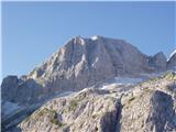 2
2 3
3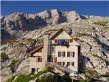 4
4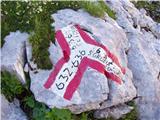 5
5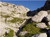 6
6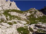 7
7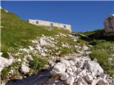 8
8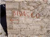 9
9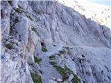 10
10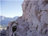 11
11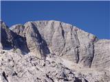 12
12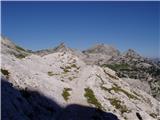 13
13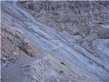 14
14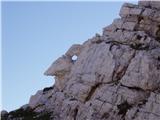 15
15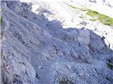 16
16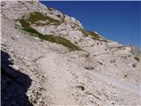 17
17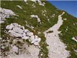 18
18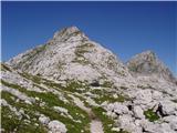 19
19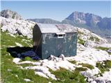 20
20
Discussion about the trip Rifugio Gilberti - Bivouac Marussich
|
| gams19. 08. 2017 |
 , does anyone know from experience, and it was this August, when in the morning does the gondola from Sella Nevea to Rif. Gilberti start running, thanks for the answer. , does anyone know from experience, and it was this August, when in the morning does the gondola from Sella Nevea to Rif. Gilberti start running, thanks for the answer.
|
|
|
|
| Gorska planika9. 08. 2017 |
Hi! I was here recently. I'm not sure exactly when it starts running, but I think the sign said at 9:00. Something like that...
|
|
|
|
| tulipan9. 08. 2017 |
From 8:30 to 17:30, every day!
|
|
|
|
| marusaa9. 07. 2018 |
Hi. I'm interested if there's snow on the path to the bivouac. Thanks in advance for the reply.
|
|
|
To post a comment you must log in:
If you do not yet have a username, you must first
register.