Starting point: Rezman (1000 m)
| Latitude/Longitude: | 46,3913°N 14,4688°E |
| |
Walking time: 2 h 15 min
Difficulty: partly demanding marked way
Elevation gain: 692 m
Elevation difference along the route: 750 m
Map: Karavanke - osrednji del 1:50.000
Recommended equipment (summer):
Recommended equipment (winter): ice axe, crampons
Views: 23.633
 | 2 people like this post |
Access to starting point:
From the highway Ljubljana - Jesenice, take the exit Kranj - east and follow the road ahead in the direction of "Zgornje Jezersko". Just a few 100 m ahead from the inn Kanonir, we will notice signposts for Stegovnik on the left side of the main road, which direct us onto a steep macadam road. We then follow this ascending road past the farm Rezman to the beginning of the footpath to Stegovnik.
We can park already a little lower on one of the parking spots by the road (at the beginning of the footpath there are no appropriate parking spots).
Route description:
Above the farm Rezman, the mountain markings for Stegovnik direct us right onto a wide ascending cart track, which we then follow past the transmitters to a marked junction. We continue right in the direction of Stegovnik on a somewhat narrower cart track, which further ascends transversely on the northeastern slopes of Bukovec. Higher, the path levels out, then in a gentle descent brings us to a smaller abandoned mountain pasture, on the edge of which there is a hunting cottage.
From the hunting cottage, we continue on the marked path, which behind the mountain pasture turns slightly to the left and then starts to ascend towards Močnikovo sedlo, which we reach after 15 minutes of further ascent. Here the markings direct us somewhat to the right, where after a few steps of further walking we step onto the marked junction.
We continue in the direction of Stegovnik (sharply left Bukovec, straight down Kanonir) on the path which after a few steps of easy descent joins a gently ascending cart track, which we then follow to the place where the markings direct us right onto a footpath that ascends parallel to the cart track. Further, the path approaches a torrent stream, where it turns right and steeply ascends along its right side (left bank). Higher, the path crosses the aforementioned stream and then levels out completely. There follows a few minutes of easy walking through dense forest, after which the path brings us to the saddle named Pri Lojtri, where there is also the next marked junction.
We continue in the direction of Stegovnik (left Javornik, right mountain pasture Brsnina) on the path which gradually starts to ascend ever more steeply. Further, a very steep path (in wet, danger of slipping), which continues along the collapsing wire fence, through increasingly sparse forest, soon brings us to the main ridge of Stegovnik. Here the path for a short time retreats from the ridge to the right side, where with the aid of a steel cable we cross an exposed ledge. The path then returns to the ridge, which with ever more beautiful views we follow to the summit, which we reach after a good 10 minutes of further walking.

Photos:
 1
1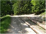 2
2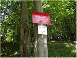 3
3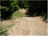 4
4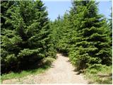 5
5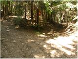 6
6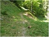 7
7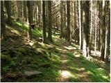 8
8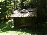 9
9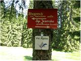 10
10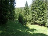 11
11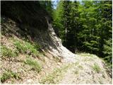 12
12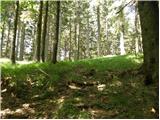 13
13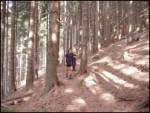 14
14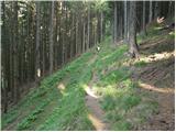 15
15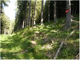 16
16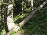 17
17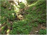 18
18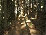 19
19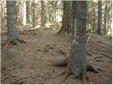 20
20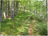 21
21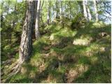 22
22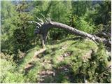 23
23 24
24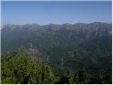 25
25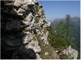 26
26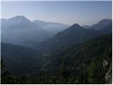 27
27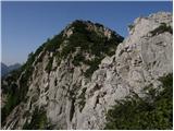 28
28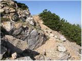 29
29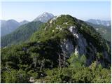 30
30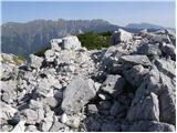 31
31
Discussion about the trip Rezman - Stegovnik
|
| klavdy61. 07. 2010 |
The more demanding part is passable without problems, the path is not too steep 
|
|
|
|
| donat3. 09. 2010 |
Nice afternoon hike, in front of the Rezman farm there's now a livestock gate, we can park next to it, but the farm is operating poorly since the previous owner died.
Poppies along the path have already faded a lot, at the summit the logbook is completely full, they're writing on the back cover already. Poor work P.D.Jezersko. Towards Kočna iced gullies were visible. l.p.
|
|
|
|
| asde14. 03. 2011 |
Hello,
on Saturday, 12.03.2011 we set off for Stegovnik. Trail start at Dom pod Storžičem, over Javorniško sedlo, then under M. Javornik.
Snow in shady spots up to 30cm, elsewhere 5-10cm.
Stegovnik itself is completely bare, but we couldn't find the path to the summit, markers are obviously on the ground covered by snow. The trail is otherwise very hard to follow, a bit of criticism for PD Tržič and the markers.
|
|
|
|
| podromk15. 03. 2011 |
What a beautiful ascent..congratulations
|
|
|
|
| laik23. 08. 2013 |
rak...exceptional report and definitely motivation for us "beginners" .....
|
|
|
|
| Rak24. 08. 2013 |
Laik - thanks for the opinion, I like that a lot, but I was sometimes in the same situation myself.
|
|
|
|
| laik25. 08. 2013 |
that's why we learn from the masters, to become "approximations" of them ...greetings
|
|
|
|
| gmirko29. 08. 2013 |
I have a question, is passage of the exposed ledge possible with a dog?
Thanks for the opinion
|
|
|
|
| Rak29. 08. 2013 |
Of course it is, but good to have it on a leash there, because dogs on exposed spots don't behave very "safely" towards the owner or anyone else. Personal experience, when my late Zlatko on Virnikov Grintovec literally pushed me at the narrowest point of the path to push ahead.
Good luck!
|
|
|
|
| z11. 08. 2014 |
The lower marked path under the Stegovnik ridge would need renovation. Very overgrown, poorly visible markings, indistinct path, further complicated by fallen trees. From the window direction, over the saddle and further under the wall, I lost the path halfway to Močnikovo sedlo. Unpleasant.
|
|
|
|
| Nicole7. 11. 2015 |
Today I was there with my 4-legged companion. Nice autumn excursion, wonderful view from the top. In the box there was only the stamp pad besides the logbook, no stamp (or I didn't find it?). From picture 26 onwards it wasn't too exposed for me, due to the bushes and enough space . .
|
|
|
|
| djimuzl2. 07. 2018 |
Yesterday, while going to Ruš, I also took this path. The most critical section is between Močnikovo sedlo and Lojtro, as there is a huge amount of fallen trees there, the path itself is barely traceable - pushing through the fallen giants is quite demanding. There is some fallen wood also from Rezman to the saddle, but the mentioned section is really a devastation
I have informed the responsible mountaineering association about the condition of the path.
|
|
|
|
| Luka_Mimi16. 09. 2018 |
There is also a path via Planina Javornik. Nice, calm, suitable for pregnant women and those who can't or shouldn't walk too much but still want to enjoy some mountains.
|
|
|
To post a comment you must log in:
If you do not yet have a username, you must first
register.