Starting point: Renče (45 m)
| Latitude/Longitude: | 45,8899°N 13,6695°E |
| |
Walking time: 2 h
Difficulty: easy marked way
Elevation gain: 598 m
Elevation difference along the route: 600 m
Map: Goriška 1:50.000
Recommended equipment (summer):
Recommended equipment (winter):
Views: 12.352
 | 3 people like this post |
Access to starting point:
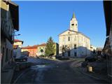
From the expressway Razdrto - Nova Gorica we take the exit Vogrsko and continue driving towards the village Volčja Draga. From Volčja Draga we continue towards the village Bilje, but only to the village Bukovica, where we turn left towards Renče. In Renče we park on the parking lot at the main square.
Route description:
From the parking lot at the main square we go left towards the building of the primary school; after 200 m at this building we turn right. Along the side road we walk to the first fork, where we turn right. The road ascends slightly, then at the first crossroads we turn right. After approximately 200 m, at the fork we turn right. We continue along the asphalt road, which soon turns into a forest road. At the next fork we turn right; the forest road soon ascends gently. Higher up we join the main transverse forest road, which runs in a longer gentle uniform ascent. When we come to the marked footpath that branches off to the right from the forest road, we turn onto it. After a few minutes' walk on the grassy slope, at the fork we turn right, where the footpath then runs in a steeper ascent. Along the footpath we again enter the coniferous forest. On this part of the path we are accompanied by signposts, which guide us towards the mountain hut on Trstelj. At the fork of the forest road, near the mountain hut, we turn right, after which we quickly reach the summit, from which a nice view opens up.

Photos:
 1
1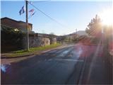 2
2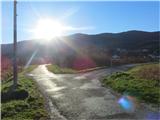 3
3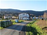 4
4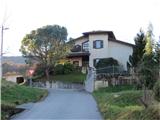 5
5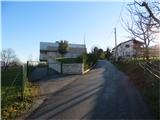 6
6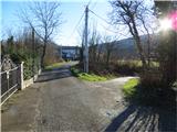 7
7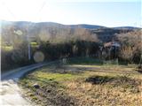 8
8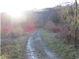 9
9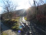 10
10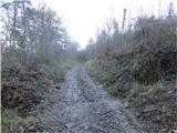 11
11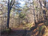 12
12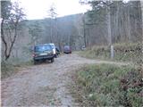 13
13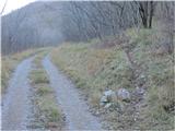 14
14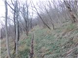 15
15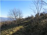 16
16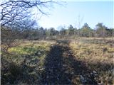 17
17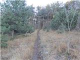 18
18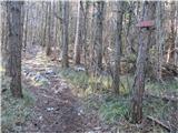 19
19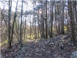 20
20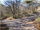 21
21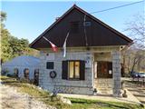 22
22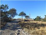 23
23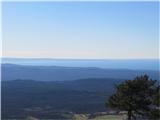 24
24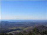 25
25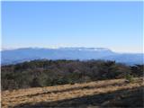 26
26 27
27 28
28
Discussion about the trip Renče - Trstelj
|
| molnik16. 05. 2016 |
At the intersection in the middle of Vovčje Draga, you need to turn right and then follow the signs for Renče.
Very nice path, but the path description from Renče to the forest caused me quite a few problems, so I suggest looking up the path from the school in Renče to Renški Podkraj 46 on Google. That is the last house and then the path goes into the forest - picture nine.
|
|
|
|
| pikica9213. 02. 2022 07:52:07 |
As the predecessor writes the path is marked very poorly, PD Nova Gorica I really can't praise from the school there is no marking at least half the path nothing, then some faded on the tree 2 signs with barely visible inscription...
|
|
|
|
| potpodnoge23. 07. 2022 18:59:05 |
Sometimes and in some places, which is not the custom, but it happens. That path markers know the path well and mark it in such a way that they think too little about those visitors who are there for the first time in certain sections of the paths. Otherwise, in a conversation once in the summer with the young caretakers, we received a well-meaning tip or rather, mentioned in the discussion, that people from Primorska don't go to the mountains in summer because it's too hot, but to the sea.
|
|
|
|
| pokobalin17. 06. 2023 22:04:26 |
You can't even reach the summit at all, as trees have fallen(?) along the path. Probably still from the fire.
|
|
|
|
| mirank18. 06. 2023 18:40:30 |
Where it burned on our side, you can go everywhere without a problem. I've been up there several times and always gone all the way - where before without a motorbike it wouldn't have been possible, everything is passable from Kremanc, from Vinišč or from Mohorinov.
|
|
|
To post a comment you must log in:
If you do not yet have a username, you must first
register.