Starting point: Reka (253 m)
| Latitude/Longitude: | 46,1175°N 13,9214°E |
| |
Walking time: 1 h 10 min
Difficulty: partly demanding marked way
Elevation gain: 197 m
Elevation difference along the route: 320 m
Map: Škofjeloško in Cerkljansko hribovje 1:50.000
Recommended equipment (summer): helmet
Recommended equipment (winter): helmet, ice axe, crampons
Views: 11.409
 | 3 people like this post |
Access to starting point:
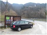
A) First, we drive to Idrija, and then we continue driving towards Tolmin. After some time the road brings us to a crossroads, where the road to Cerkno branches off to the right, and we still continue straight here, but we need to pay attention because we will soon get to the settlement Reka. Immediately after the end of the settlement, we first notice signs for Kojca and some 10 m ahead also for Šebrelje. Here a narrower road branches off to the left, which over a bridge through the river Idrijca brings us to a smaller parking lot by the information boards for the Archaeological Park Divje babe.
B) From Most na Soči or Podbrdo we drive to the settlement Bača pri Modreju, and then we continue driving towards Idrija. Only some 10 m before the settlement Reka starts we turn right over a bridge through the river Idrijca and then park on a smaller parking lot by the information boards.
Route description:
From the very starting point we can already see the church of St. Ivan, which stands on the top of a quite steep ridge and can serve for better orientation. From the starting point, we continue on the road which at first turns to the left and quickly brings us to a crossing at a hayrack. We continue right on the road to the last house where we then continue left and start ascending steeper on a grassy slope. Higher, the path brings us into the forest and continues to ascend. Occasionally a view opens up towards the peaks north from us and the path soon brings us to a smaller saddle. Further, the path runs on the southeastern side of the mountain and brings us on steep and on some spots also precipitous slopes. The path is otherwise nice and quite wide, but some caution is recommended. Further, the path becomes less demanding and brings us to the road.
We continue right and only a shorter walk follows on a gentle road to the church of St. Ivan.
From the church, we continue slightly left following the signs »Divje Babe«. The path starts quite steeply descending and becomes a little more demanding. The slope is very steep but the path is secured with a fence, so that the descent doesn't cause problems. We soon get to a smaller cave, where there are also benches and a table. From here follows a shorter descent to the main cave, where there are also numerous information boards.

Photos:
 1
1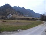 2
2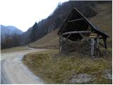 3
3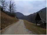 4
4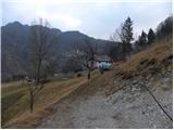 5
5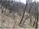 6
6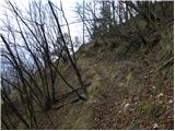 7
7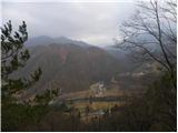 8
8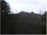 9
9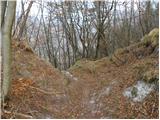 10
10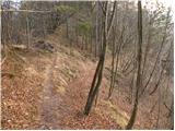 11
11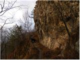 12
12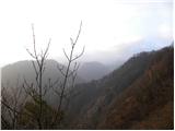 13
13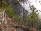 14
14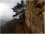 15
15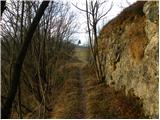 16
16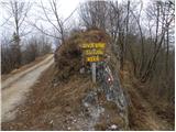 17
17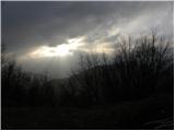 18
18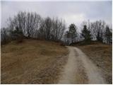 19
19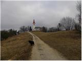 20
20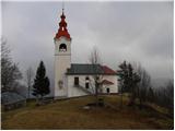 21
21 22
22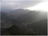 23
23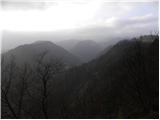 24
24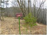 25
25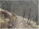 26
26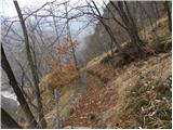 27
27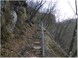 28
28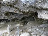 29
29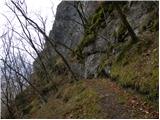 30
30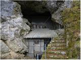 31
31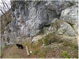 32
32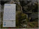 33
33
Discussion about the trip Reka - Divje babe
|
| dejan6829. 04. 2015 |
We were there on Saturday. On the guide's advice (for the cave) we started in Šebrelj because there is still quite a bit of fallen timber on the described path. Nice walk, although the weather played tricks a bit. I recommend it, suitable for a family outing.
|
|
|
|
| BorisM29. 04. 2015 |
Then your guide is very poorly informed or completely incompetent. I was up this path fourteen days ago and it is very nice, not even a twig lies on it let alone trees.
And one more thing, if you descend from sv. Ivan to Divje babe, you don't need to go back up, you can continue to the valley on an unmarked path, just follow it.
|
|
|
|
| dejan6830. 04. 2015 |
Or he just didn't feel like going uphill
|
|
|
|
| Lapuh20731. 08. 2020 |
For the end of summer and before thunderstorms, Divje babe was a good choice! Took the described route, which is nicely traceable, but at that first saddle I see they renovated the mule track. Now there's a nice path a bit east of the one described here. Below, shortly after start, in the sharp asphalt bend continue left and a couple of minutes later right up, nicely visible. Upper part super secured, nice category I views! Hospitality in the snack bar at sv. Ivan at a high level. And descent to the cave where that flute was found. Everything remains in good memory. We'll be back!
|
|
|
|
| Lapuh20731. 08. 2020 |
P.S. that hayrack in picture 3 has disappeared by today. Left towards the renovated mule track, right along the old marked path. Both paths meet at the saddle.
|
|
|
To post a comment you must log in:
If you do not yet have a username, you must first
register.