Razdrto - Vojkova koča na Nanosu (Janez way)
Starting point: Razdrto (575 m)
| Latitude/Longitude: | 45,7591°N 14,0619°E |
| |
Route name: Janez way
Walking time: 2 h
Difficulty: easy unmarked way
Elevation gain: 665 m
Elevation difference along the route: 665 m
Map: Nanos 1:50.000
Recommended equipment (summer): helmet
Recommended equipment (winter): helmet, ice axe, crampons
Views: 21.449
 | 3 people like this post |
Access to starting point:
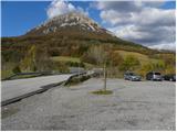
From the highway Ljubljana - Koper or Ljubljana - Nova Gorica, we take the exit Razdrto. We follow the road ahead into the village Razdrto and then in the centre of the village continue in the direction of the villages Strane and Veliko Ubeljsko. Just a little above the village, we arrive at a large parking lot where we park.
Route description:
From the parking lot, we cross the bridge over the highway, then at the junction continue left in the direction of Vojkova koča hut and Abrama. After about a dozen steps walking on the macadam road, the signs for Nanos direct us right onto a moderately steep footpath that begins to ascend across a panoramic grassy slope. After a short ascent, the path enters a belt of bushes, which higher up transitions into forest. The path then turns slightly to the left and leads us to a marked junction, where we continue right in the direction of "Nanos - steep path". Further on, we ascend moderately for some time, then the path gradually begins to ascend ever steeper. Higher up, we notice an interesting verse, but we follow the marked path for only a few more minutes to the nearby indistinct vantage point. At the "vantage" point, the marked path turns sharply right, while we continue straight on a much narrower but well-followable hunting path. The hunting path, in a gentle ascent, crosses relatively steep slopes and, after approximately 15 minutes of walking from where we left the marked path, brings us to an unmarked but clearly visible junction.
Here we continue right and proceed with the ascent along the quite steep so-called Janez Path. The steep path, which ascends the slope almost straight up, soon brings us out of the forest, where it becomes even steeper. We continue the ascent along a well-followable and very steep path that climbs the slopes of Rebrnic. The path, due to its considerable steepness exposed to falling rocks (the path otherwise runs across a grassy slope so there are not many rocks, but wildlife or anyone else can dislodge rocks), after approximately 30 minutes of steep ascent brings us to the edge of the Nanos Plateau, where it levels out. Here we turn sharply right and continue the ascent along a wide track that leads us toward the transmitters on Nanos. Just a little before the transmitters, the path turns left, descends into a strip of forest and then, past the monument to Janko Premrl Vojko, brings us to the Vojkova koča hut on Nanos.

Photos:
 1
1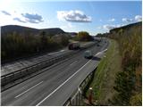 2
2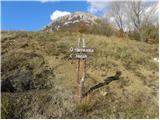 3
3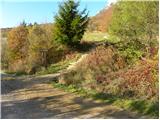 4
4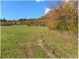 5
5 6
6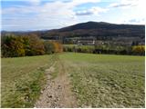 7
7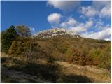 8
8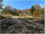 9
9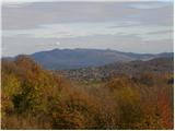 10
10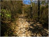 11
11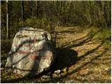 12
12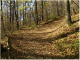 13
13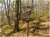 14
14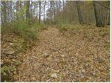 15
15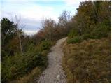 16
16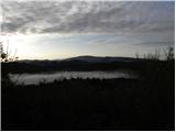 17
17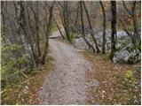 18
18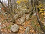 19
19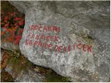 20
20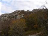 21
21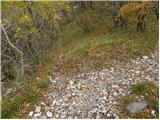 22
22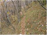 23
23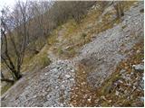 24
24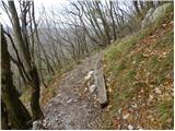 25
25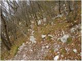 26
26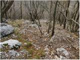 27
27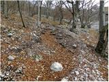 28
28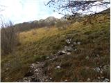 29
29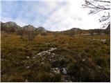 30
30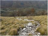 31
31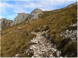 32
32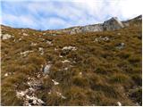 33
33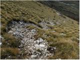 34
34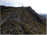 35
35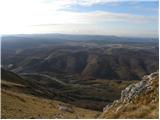 36
36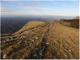 37
37 38
38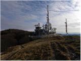 39
39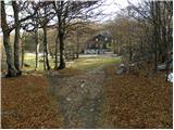 40
40 41
41
Discussion about the trip Razdrto - Vojkova koča na Nanosu (Janez way)
|
| nejkica1. 05. 2012 |
At the beginning it's a nice forested path, which then turns into a rocky section. The last good kilometer turns into a grassy slightly steeper section.
You enjoy the hike because nature is diverse at every step. I recommend the path as I have good experiences, but it is not recommended in bad weather conditions.
I enjoyed the path and warmly recommend it 
|
|
|
|
| Darxta18. 06. 2012 |
WARNING:
On Saturday we went up, great weather, but when we returned to the parking lot, the neighboring car had a broken window.
The parking lot is probably very attractive to various burglars, so I recommend not leaving anything valuable in visible places or put everything in the trunk, and close the windows completely. Better to have a 10 degrees hotter car and wait a bit longer to air it out than risk a break-in.
Best
|
|
|
To post a comment you must log in:
If you do not yet have a username, you must first
register.