Ravne - Bela peč (above Dovje)
Starting point: Ravne (1200 m)
| Latitude/Longitude: | 46,4678°N 13,9917°E |
| |
Walking time: 45 min
Difficulty: easy unmarked way
Elevation gain: 260 m
Elevation difference along the route: 260 m
Map: Kranjska Gora 1:30.000
Recommended equipment (summer):
Recommended equipment (winter): ice axe, crampons
Views: 1.140
 | 1 person like this post |
Access to starting point:
A) We leave the Gorenjska motorway at the Jesenice west (Hrušica) exit, and then we continue driving in the direction of Kranjska Gora. On the main road towards Kranjska Gora we drive to the first turn-off of the road towards Dovje, and through the settlement and above it, we follow the signs for Dovška Baba. Further, we drive for quite some time to the next crossroad, where we turn sharply left in the direction of Dovška Baba (straight Plavški Rovt). We follow this road, which then leads past the meadow named Ravne (some holiday cottages), to a gate which prohibits further driving. We can park already a little lower on one of the parking lots by the road (from Dovje to the starting point there is approximately 6.5 km).
B) First, we drive to Kranjska Gora, and then we continue driving towards Jesenice. We leave the main road towards Jesenice when signs for Dovje direct us to the left, and through the settlement and above it, we follow the signs for Dovška Baba. Further, we drive for quite some time to the next crossroad, where we turn sharply left in the direction of Dovška Baba (straight Plavški Rovt). We follow this road, which then leads past the meadow named Ravne (some holiday cottages), to a gate which prohibits further driving. We can park already a little lower on one of the parking lots by the road (from Dovje to the starting point there is approximately 6.5 km).
Route description:
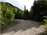
From the starting point, we continue on the road by which we have parked, and it quickly brings us to a gate and a traffic sign, which prohibit further driving. At first from the road a view opens up a little, and then we gradually ascend to the saddle between Bela peč and Dovška Baba, where at the notification sign "Kako varno prečiti pašnike" (How to safely cross the pastures), we continue left on a marked path which leads towards Dovje. We leave the marked path, which turns left and continues parallel with the road, already after a few steps and continue straight on an unmarked footpath which starts ascending towards Bela peč. Occasionally a pretty steep path, where mainly in wet conditions additional caution is needed, brings us higher on or by the ridge, where the footpath flattens a little, and only a few minutes of walking separate us from the top.
Description and pictures refer to the condition in May 2020.
Photos:
 1
1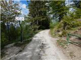 2
2 3
3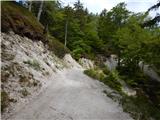 4
4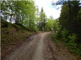 5
5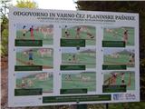 6
6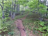 7
7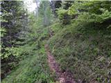 8
8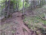 9
9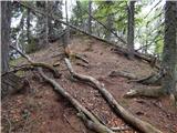 10
10 11
11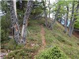 12
12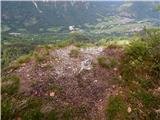 13
13 14
14
Discussion about the trip Ravne - Bela peč (above Dovje)
|
| Inja123421. 08. 2022 18:26:40 |
You can park where it says the road ahead is only for parcel owners and walk to the barrier - electric shepherd, where there's a sign for Planina Dovška Rožca, 50m before the barrier - electric fence gate, turn left into the forest, steep path with only one marker at the start. After 20 min you reach Bela peč. Now there's a bench up there. I set off for Dovška Baba and accidentally came up here, but it's worth it... then I returned to the road and 100m further after the electric shepherd found the path left into the forest for Dovška Baba and went there too. All together 2.5 hours.
|
|
|
To post a comment you must log in:
If you do not yet have a username, you must first
register.