Ravenska Kočna - Jezerska Kočna (Frischauf way)
Starting point: Ravenska Kočna (1000 m)
| Latitude/Longitude: | 46,385°N 14,5364°E |
| |
Route name: Frischauf way
Walking time: 6 h 30 min
Difficulty: very difficult marked way
Elevation gain: 1540 m
Elevation difference along the route: 1665 m
Map: Kamniške in Savinjske Alpe 1:50.000
Recommended equipment (summer): helmet, self belay set
Recommended equipment (winter): helmet, self belay set, ice axe, crampons
Views: 22.852
 | 4 people like this post |
Access to starting point:
From the Ljubljana - Jesenice highway, take the exit Kranj - East and follow the road ahead in the direction of Jezersko. In Zgornje Jezersko, just a little behind the gas station, we will notice a road which branches off to the right from the main road (direction Planšarsko jezero). The road then leads us past the mentioned lake and behind it steeply ascends for a short time. Higher up, the road flattens and at the beginning of a large meadow loses the asphalt covering. We then follow the macadam road to a larger marked parking lot.
Route description:
From the parking lot, we continue on a macadam road following the signs »Češka koča, Ledine« and after approximately 15 minutes of walking, we come to a cargo cableway.
At the cableway, the path goes behind the bottom station of the cableway in the direction of the mountain hut Češka koča and at first gently ascends on a wide path, which in a few minutes brings us to a bigger clearing. The path over this clearing is usually quite muddy, therefore be careful. After 20 minutes of walking, the path brings us to an indistinct small ridge, where there is a bench. The path then continues through the forest and after a further 20 minutes brings us to a junction, where from the right the path from the meadow (lower starting point) joins. We continue left and already after a few further steps we are at the next junction, where from the right the path from Makekove Kočne (neighbouring valley) joins. The path then leaves the forest and passes onto scenic slopes, where with the help of some steel cables and a ladder we ascend towards the mountain hut Češka koča (Hudičevi klanci). This part of the path when dry is not difficult and does not pose a greater danger (greater caution is needed in late autumn, when the gullies are icy and in winter, when there is snow). The path then flattens and brings us to Mrzla dolina (1500m), where cold air often lingers. Only a good 5 minutes of moderate ascent follows and the path brings us to the mountain hut Češka koča na Spodnjih Ravneh.
From the hut, we continue right on the path in the direction of Kočna, Grintovec and Vratca (left Kranjska koča through Žrelo). After a short ascent, we come to flat ground with sign H (intended for helicopter landing). The path ahead runs on initially gentle scree, which is partly overgrown with dwarf pines. In the lower part of the scree, the path to Vratca branches off to the right, and we continue straight in the direction of Kočna and Grintovec. After approximately half an hour of walking from the hut, we come to the next junction. We continue on the left path in the direction of Grintovec (right Kočna - Kremžarjeva pot) on a path that quickly brings us to the start of the wall. Here we put on our helmets and begin the climbing section of the path. The climbing at first is not difficult, but the ascent is dangerous due to loose stones on the path (risk of slipping). The wall along which we ascend then becomes steeper, and the fixed protections are increasingly frequent. Climbing follows on natural passages through grooves, gullies and ledges. Throughout the ascent, beautiful views open up on Jezersko and the surrounding peaks. After less than two hours of "climbing" we step out of the wall onto Mlinarsko sedlo, from where a view opens towards the south. Here we are at a junction, where we head right (left Dolgi hrbet and Skuta, straight down to bivak pod Grintovcem) and continue walking on and along an initially non-exposed ridge. The path then passes to the shady side of the ridge, where we reach the next junction. We continue right in the direction of Zdolška škrbina and Kočna (left Grintovec) on a path that runs along the northern side of Grintovec. After a short traverse, the path begins to descend towards Zdolška škrbina. On the more difficult sections, fixed protections assist us. The path then brings us to Zdolška škrbina, where the descent ends. We continue straight towards the summit of Jezerska Kočna (right Češka koča, where we can descend, left Kokrsko sedlo) on a path that quickly brings us to one of the most interesting passages in the Slovenian mountains. The path brings us to a pot-bellied passage through which we must crawl. The ceiling above us is so low that there is no other way (watch your head). The path ahead leads onto a short scree field after which we step onto a steeper path, where some pegs and steel cables assist us. We then follow this increasingly scenic path to the somewhat spacious summit.
Ravenska Kočna - Češka koča 1:30, Češka koča - Mlinarsko sedlo 2:45, Mlinarsko sedlo - Vrh 2:15.

The trip can be extended to the following destinations: Kokrska Kočna
Photos:
 1
1 2
2 3
3 4
4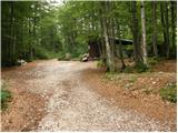 5
5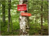 6
6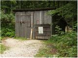 7
7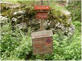 8
8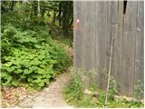 9
9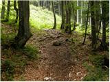 10
10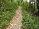 11
11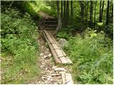 12
12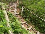 13
13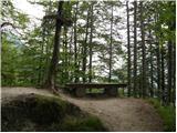 14
14 15
15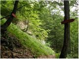 16
16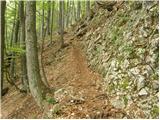 17
17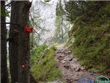 18
18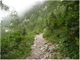 19
19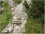 20
20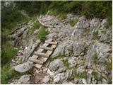 21
21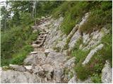 22
22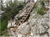 23
23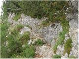 24
24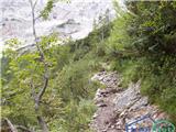 25
25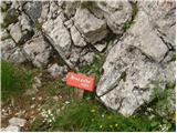 26
26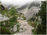 27
27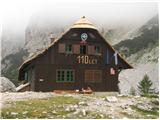 28
28 29
29 30
30 31
31 32
32 33
33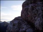 34
34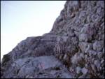 35
35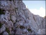 36
36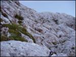 37
37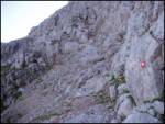 38
38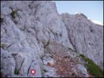 39
39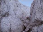 40
40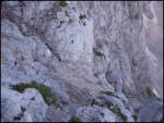 41
41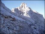 42
42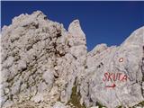 43
43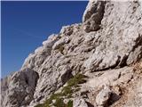 44
44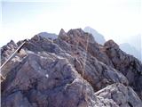 45
45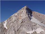 46
46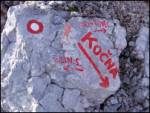 47
47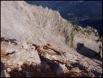 48
48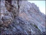 49
49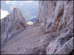 50
50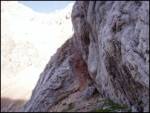 51
51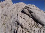 52
52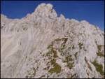 53
53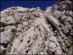 54
54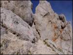 55
55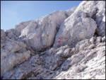 56
56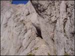 57
57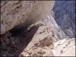 58
58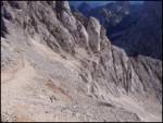 59
59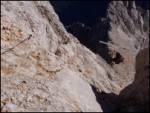 60
60 61
61
Discussion about the trip Ravenska Kočna - Jezerska Kočna (Frischauf way)
|
| Gost7. 11. 2007 |
Not worth going via MLINARSKO SEDLO, the path is much longer than the usual one. Recommend the usual path.
|
|
|
|
| Gost9. 11. 2007 |
Our Grintovci are smaller so for big adventurers you need to extend a bit. Very nice tour, especially I like that the hiking times are appropriate and everyone can assess how to reach the top GOOD LUCK
|
|
|
|
| katja8712. 08. 2013 |
On Sunday, 11.8.2013, we went up this path to the summit
We did a circular tour: Ravenska Kočna - Češka koča - Frischaufova pot - Mlinarsko sedlo - Grintovec - Zdolška škrbina - Jezerska Kočna - Kremžarjeva pot - Češka koča - Ravenska Kočna.
The tour was exceptionally beautiful and varied, taking us 12 hours. Most of the path is climbing, well secured at more exposed spots. We had a via ferrata set with us, but used it only at two places, the rest of the path it was more in the way. No snow on the path.
Pictures from the hike can be seen on the website of Planinsko društvo Matica Murska Sobota: http://www.mojalbum.com/pdmaticams/20130811-grintovec-in-jezerska-kocna/razgled-na-kocno-grintovec-in-kalski-greben-od-leve-proti-desni/20989386
|
|
|
|
| Tussyx18. 08. 2013 |
We did the same circular tour today, wire ropes are not frequent, but in the right places. We needed only 8 and a half hours for the whole tour. Down Kremžarjeva we skipped the last part of the path (to the junction) over scree. Down Kremžarjeva we skipped the last part of the path (to the junction) over scree.
|
|
|
|
| primzySTAR2. 08. 2019 |
#Katja87 inspired me, yesterday I set off on a circular tour, which was slightly different.
Ravenska Kočna - Češka koča - Kremžarjeva pot - Jezerska Kočna - Kokrška Kočna - Zdolška Škrbina - Grintovec - Frischaufova pot - Češka koča - Ravenska Kočna.
The tour is definitely strenuous (lots of climbing or walking on scree) but very beautiful. Concentration needed all the time. Everywhere secured and marked. Despite sunny forecast, mostly foggy. For the whole thing I needed just under 10 hours
Tour definitely more suitable for more experienced hikers.
But I would point out something:
The text says:
Continue on the left path towards Grintovec (right Kočna - Kremžarjeva pot) on the path that quickly brings us to the start of the wall. Here we put on helmets and start the climbing part of the path.
From that junction to the wall, there are no marks for quite a while, probably lost in the scree. I followed the trodden path through scree and after about 500m found a mark. However, if you come from this direction as described here, you have two very large marks before entering the wall, visible from afar.
|
|
|
To post a comment you must log in:
If you do not yet have a username, you must first
register.