Rateče - Dom na Tromeji (by road)
Starting point: Rateče (865 m)
| Latitude/Longitude: | 46,4979°N 13,7118°E |
| |
Route name: by road
Walking time: 1 h
Difficulty: easy marked way
Elevation gain: 280 m
Elevation difference along the route: 300 m
Map: Kranjska Gora 1:30.000
Recommended equipment (summer):
Recommended equipment (winter):
Views: 19.570
 | 3 people like this post |
Access to starting point:
First, we drive to Kranjska Gora, and then we continue driving towards Rateče. At the crossroad, where the road to Planica branches off to the left, and right to Rateče, we continue straight. We drive into Rateče at the next crossroad, which is located some 10 meters before the gas station. At the restaurant Mojmir we continue straight and then after 10 meters sharply left onto the road in the direction of Tromeja. The road then ascends above the village, and we park at an appropriate place by the road.
Route description:
From the starting point, we continue on the road by which we have parked, and it soon turns considerably right and then ascends transversely towards the east. With a view of the peaks of the Julian Alps, the road gradually flattens and brings us into the forest, where a marked footpath joins from the right.
We continue on the road, which becomes steeper, and we ascend along it for some time through the forest. Higher up, we cross a panoramic meadow, and the path then returns to the forest and brings us to a marked junction. Here we continue right (straight Peč - Tromeja) and along the road, which begins to descend gently; after 3 minutes of further walking, we arrive at the mountain hut Dom na Tromeji.
Photos:
 1
1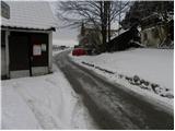 2
2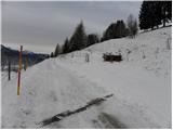 3
3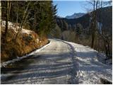 4
4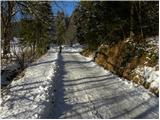 5
5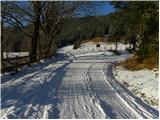 6
6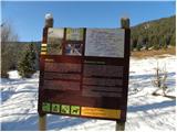 7
7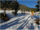 8
8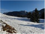 9
9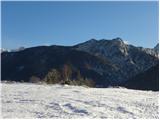 10
10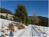 11
11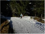 12
12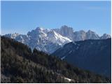 13
13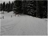 14
14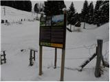 15
15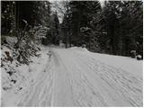 16
16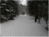 17
17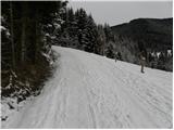 18
18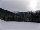 19
19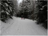 20
20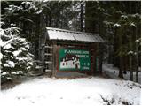 21
21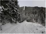 22
22 23
23 24
24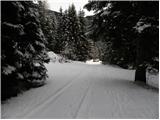 25
25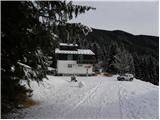 26
26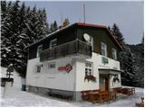 27
27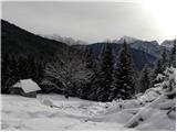 28
28
Discussion about the trip Rateče - Dom na Tromeji (by road)
|
| julius20. 01. 2015 |
Dom na Tromeji was not open in autumn. It looked abandoned.
|
|
|
|
| francimedved20. 01. 2015 |
Interesting that they closed it, too little visitors.
|
|
|
|
| Janez Seliškar21. 01. 2015 |
Somewhat unfortunate title of the post, it's still about 1 hour walk to Tromeja.
|
|
|
|
| čeveljc23. 01. 2015 |
Probably only the dom below Tromeja is meant, not the top of Tromeja, so those few minutes are correct.
|
|
|
|
| Janez Seliškar23. 01. 2015 |
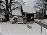
This trip description refers to Dom Tromeja, which we see e.g. in photo No. 27, and the information board by the road in photo No. 21.
|
|
|
|
| Lunatic26. 01. 2015 |
The hut (former customs post) has been taken back by the army, now it's decaying... 
|
|
|
|
| gmirko14. 07. 2018 |
It's really deteriorating. Sadly, no one cleans up around the hut, as it's quite unsightly. What a shame. Nearby runs a nice and well-marked path (tourist association), which was quite visited today, judging by the greetings mostly by foreign hikers who probably won't take away the best impressions.
|
|
|
|
| transformer13034. 03. 2025 12:01:23 |
Hello
How is the hut at Tromeja now? Is it open or still falling apart? Thanks for the reply.
|
|
|
|
| DVas5. 03. 2025 09:14:34 |
It doesn't operate as far as I know.
|
|
|
To post a comment you must log in:
If you do not yet have a username, you must first
register.