Raspet - Dom na Poreznu (on ridge of Cimprovka)
Starting point: Raspet (1050 m)
| Latitude/Longitude: | 46,1705°N 14,0217°E |
| |
Route name: on ridge of Cimprovka
Walking time: 2 h 40 min
Difficulty: easy marked way
Elevation gain: 540 m
Elevation difference along the route: 660 m
Map: Škofjeloško in Cerkljansko hribovje 1:50.000
Recommended equipment (summer):
Recommended equipment (winter): ice axe, crampons
Views: 6.130
 | 1 person like this post |
Access to starting point:
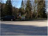
A) First, we drive to Škofja Loka, then continue driving towards Železniki and Podbrdo. After Železniki, or just before the beginning of Zali Log, signs for Davča and ski center Cerkno direct us left onto the road that starts ascending along the Davča river. We follow this road, which higher up has quite a few intersections, all the way towards the ski center Cerkno. When we arrive at the mentioned ski center, we continue driving another few hundred meters to the large macadam parking lot Tuškov Grič. Here we turn sharply right onto the road towards Davških slapov, Porezen, and sport fishing. The road ahead ascends moderately, then flattens out and leads us for some time across panoramic meadows. A short descent follows, then a crossing to the intersection at Razpotje (1068 m), where we park in the smaller parking area by the information boards.
B) From Bohinjska Bistrica or Podbrdo, we first drive into the valley of the Selška Sora river, then at the intersection after the end of the settlement Zali Log turn right towards Davča and continue on the road that starts ascending along the Davča river. We follow this road, which higher up has quite a few intersections, all the way towards the ski center Cerkno. When we arrive at the mentioned ski center, we continue driving another few hundred meters to the large macadam parking lot Tuškov Grič. Here we turn sharply right onto the road towards Davških slapov, Porezen, and sport fishing. The road ahead ascends moderately, then flattens out and leads us for some time across panoramic meadows. A short descent follows, then a crossing to the intersection at Razpotje (1068 m), where we park in the smaller parking area by the information boards.
C) From Poljanska dolina, we first drive to Hotavlje, from there continue driving towards the ski center Cerkno. Further, we drive through the villages Kopačnica, Leskovica, and Robidnica. When we have passed all the mentioned villages, we arrive at the large parking lot Počivalo (parking lot by the ski center Cerkno), behind which the road starts descending. After a short descent we arrive at the next intersection, where we continue right (left down to Cerkno). We continue driving on the road that ascends transversely, and quickly arrive at the parking lot Tuškov Grič. Here we continue slightly left onto the road towards Davških slapov, Porezen, and sport fishing. The road ahead ascends moderately, then flattens out and leads us for some time across panoramic meadows. A short descent follows, then a crossing to the intersection at Razpotje (1068 m), where we park in the smaller parking area by the information boards.
D) From the road Idrija - Tolmin, we head towards the settlement Cerkno, then continue driving towards the ski center Cerkno. Higher up we arrive at an intersection, where the road to the nearby parking lot Počivalo branches off to the right, and we continue left towards Davča. A short transverse ascent follows and the road brings us to the parking lot Tuškov Grič. Here we continue slightly left onto the road towards Davških slapov, Porezen, and sport fishing. The road ahead ascends moderately, then flattens out and leads us for some time across panoramic meadows. A short descent follows, then a crossing to the intersection at Razpotje (1068 m), where we park in the smaller parking area by the information boards.
Route description:
From the parking lot, we head onto the cart track towards Kope. The cart track, which continues across a larger grassy slope from which a nice view opens onto the ridge of Cimprovka with Kopa, first descends gently, then enters the forest where it first crosses a streamlet, then starts to ascend more steeply. The path, which is not marked with Knafelc blazes but with smaller wooden signposts on which a ski curve is drawn, ascends relatively steeply for some time, then brings us to a poorly marked junction, where we continue on the upper right cart track, which after a few minutes of further ascent brings us to the saddle between Črtov rob and Prvič.
Here, where we approach very closely to the forest road leading to Porezen, we continue slightly left and continue the ascent towards Kopa and also Porezen. We continue on the wide cart track, which gradually narrows and higher up turns into a pleasant mountain path, on which we quickly ascend to the next saddle.
From the panoramic saddle we continue slightly right into the forest and follow the ridge of Cimprovka. The already occasionally sparse forest soon thins out even more, and the relatively panoramic path quickly brings us to a marked junction, where we continue right towards Porezen (left Kopa 3 minutes).
The path ahead starts to descend steeply across a panoramic grassy slope, then gradually flattens and brings us to a larger meadow and the pass Vrše, where it again approaches the road closely. We continue parallel to the road (signs for Porezen otherwise direct us onto the road) and continue in a moderate ascent through sparse forest. Higher up the forest ends, and the path continues parallel to the road for some 10 m. When the road makes a right turn, the signpost for Porezen directs us left onto a gradually steeper slope, across which we mainly descend gently. Somewhat lower, the path from Franja hospital joins from the left, and we continue straight ahead and descend to the pass Velbnik. Here a nice view opens to the left, and we continue on the marked path in the already familiar direction. The path further bypasses the summit Brdce on the left western side and behind it joins the path from the village Poče.
Here we continue to the nearby forest road (slightly left along the ridge to the summit of Porezen - possible circular route) and follow it to the left.
We continue on the road, which ascends transversely through a strip of forest, then turns slightly right and brings us across increasingly panoramic slopes to the northeastern ridge of Porezen, where the path from Petrovo Brdo also joins.

Along the route: Vrše (1300m), Velbnik (1331m)
The trip can be extended to the following destinations: Porezen
Photos:
 1
1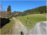 2
2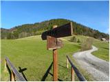 3
3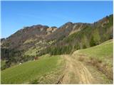 4
4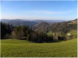 5
5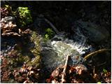 6
6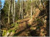 7
7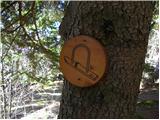 8
8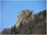 9
9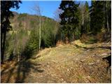 10
10 11
11 12
12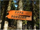 13
13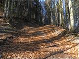 14
14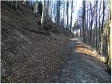 15
15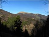 16
16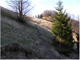 17
17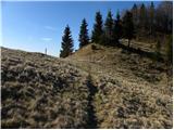 18
18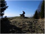 19
19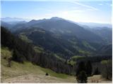 20
20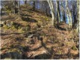 21
21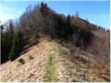 22
22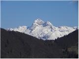 23
23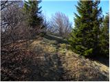 24
24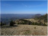 25
25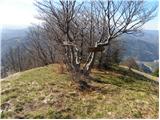 26
26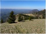 27
27 28
28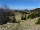 29
29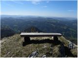 30
30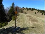 31
31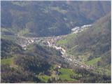 32
32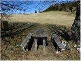 33
33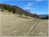 34
34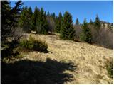 35
35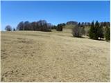 36
36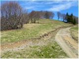 37
37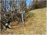 38
38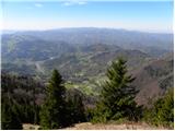 39
39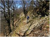 40
40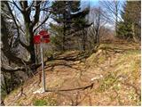 41
41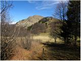 42
42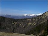 43
43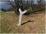 44
44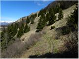 45
45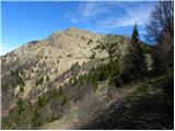 46
46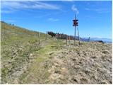 47
47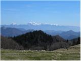 48
48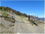 49
49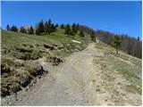 50
50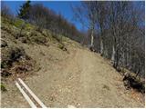 51
51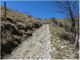 52
52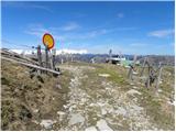 53
53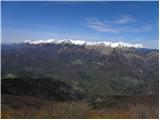 54
54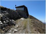 55
55
Discussion about the trip Raspet - Dom na Poreznu (on ridge of Cimprovka)
|
| marinka6724. 09. 2013 |
Can anyone tell me how long it takes to hike to Porezen from Franja Hospital? Is the path marked? We would combine both into a one-day trip if possible.
Thanks for the info.
|
|
|
|
| otiv24. 09. 2013 |
Good three hours for sure, since we start at the foot of Porezen. The path is marked, as we follow SPP.
|
|
|
|
| miri24. 09. 2013 |
PB Franja - Robidensko brdo - Črni vrh
Črni vrh - Porezen
You can also combine with car.
|
|
|
|
| miri24. 09. 2013 |
marinka67 check PD Idrija ICPP (Idrijsko-Črkljanska planinska pot). You have all stages, including this one you're asking about. Happy hiking and keep your eyes open.
|
|
|
|
| mpurg25. 09. 2013 |
in three hours you're at the top, unless you're picking mushrooms along the way 
From Franja (from parking over bridge past farm) go towards Poljane village, there at the end of village turn right across meadow into forest. path is marked, but in spring when I was last on this path the marks were a bit faded. From forest you reach a forest road which right leads to Novake, you continue straight uphill towards Labinjske lehe...from there on everything is well marked.
hope I didn't complicate too much 
|
|
|
|
| mpurg25. 09. 2013 |
in three hours you're at the top, unless you're picking mushrooms along the way
From Franja (from parking over bridge past farm) go towards Poljane village, there at the end of village turn right across meadow into forest. path is marked, but in spring when I was last on this path the marks were a bit faded. From forest you reach a forest road which right leads to Novake, you continue straight uphill towards Labinjske lehe...from there on everything is well marked.
hope I didn't complicate too much
|
|
|
To post a comment you must log in:
If you do not yet have a username, you must first
register.