Starting point: Radušnik (1040 m)
| Latitude/Longitude: | 46,3947°N 14,7617°E |
| |
Walking time: 3 h 10 min
Difficulty: easy marked way
Elevation gain: 1022 m
Elevation difference along the route: 1040 m
Map: Kamniške in Savinjske Alpe 1:50.000
Recommended equipment (summer):
Recommended equipment (winter): ice axe, crampons
Views: 51.225
 | 4 people like this post |
Access to starting point:
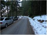
From Mozirje we drive towards Logarska dolina, but only to the village Strmec (village between Ljubno and Luče), where signs for Snežna jama on Raduha point us to the right on a narrower ascending road. We then follow the mentioned road to a marked crossroad (the crossroad is located at an altitude of approximately 750 m), where signs for Luče (panoramic road) point us to the left (right Snežna jama). The road continues to ascend for some time, then brings us to a smaller hamlet, where we continue sharply right towards the farm Radušnik. Here the road ascends even steeper for a short time, then flattens a little and in a moderate ascent brings us to the farm Radušnik. Because there are no appropriate parking spots in front of the mentioned farm, it is better to park a little lower, on one of the appropriate places by the road.
Route description:
From the spot where we have parked, we first walk to the farm Radušnik, then continue on a wide marked cart track, which we follow only for a short time, as signs for Koča na Loki then direct us left onto a somewhat narrower and steeper cart track. Further we ascend on the mentioned cart track, which has a few smaller branchings, so we carefully follow the blazes so as not to stray from the right path. Higher the cart track temporarily changes into a steep footpath, then we join another cart track, on which in a few minutes of further walking we arrive at a forest road, which we only cross. Here a path from the mountain pasture Kosmačeve Rastke joins from the right, and we continue on a somewhat wider cart track, which further ascends gently to occasionally moderately. Higher the path brings us to the road leading towards Snežna jama, which we reach right at the spot where a forest road closed to public traffic branches off to the right upwards, on which in 15 minutes of further walking we arrive at Koča na Loki pod Raduho.
From the hut we continue on the marked path in the direction of Raduha, which already after a few tens of steps splits into two parts. We continue slightly left (slightly right Durce) on the path that ascends gently along the left edge of the valley. The path soon turns left and steeply ascends through a belt of sparse forest. The steepness soon eases, and the path leads us through a few smaller meadows into the belt of dwarf pines, where it further ascends moderately to occasionally steeply. After approximately one hour of walking from Koča na Loki, a path from Durce joins from the right, and we continue left on the transverse path in the direction of Raduha. The increasingly scenic path bypasses the summit of Mala Raduha on the south side, then brings us to the main ridge, from which a nice view opens onto the northern side.
We continue on the marked path, to which a climbing path from Koča na Grohatu soon joins from the right. The path ahead again begins to ascend more steeply and then after a few minutes of further walking brings us to the 2062 m high summit.
Radušnik - Koča na Loki pod Raduho 1:30, Koča na Loki pod Raduho - Velika Raduha 1:40.
Description and pictures refer to the condition in 2010 (December).

Photos:
 1
1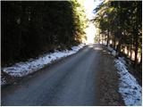 2
2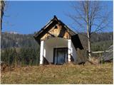 3
3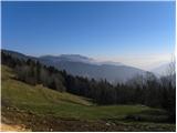 4
4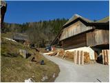 5
5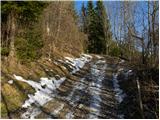 6
6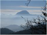 7
7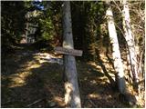 8
8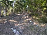 9
9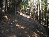 10
10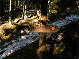 11
11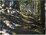 12
12 13
13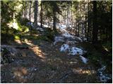 14
14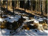 15
15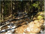 16
16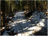 17
17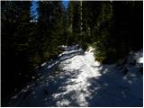 18
18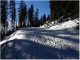 19
19 20
20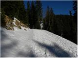 21
21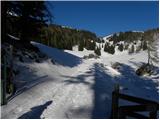 22
22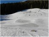 23
23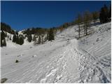 24
24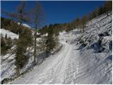 25
25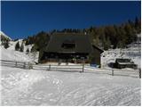 26
26 27
27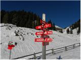 28
28 29
29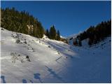 30
30 31
31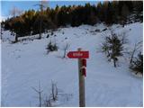 32
32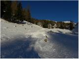 33
33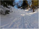 34
34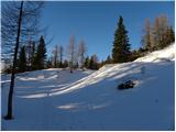 35
35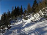 36
36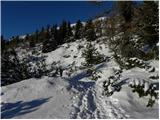 37
37 38
38 39
39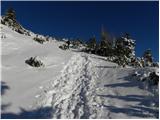 40
40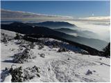 41
41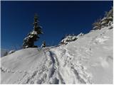 42
42 43
43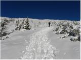 44
44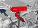 45
45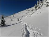 46
46 47
47 48
48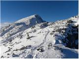 49
49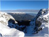 50
50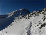 51
51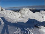 52
52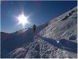 53
53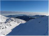 54
54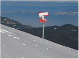 55
55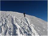 56
56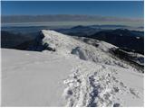 57
57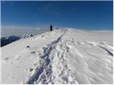 58
58 59
59 60
60
Discussion about the trip Radušnik - Velika Raduha
|
| kozo10. 02. 2011 |
On 8.2.2011 I was with friends on Raduha. Weather more than excellent. At the top we sat for 2 hours in short sleeves. The hut keeper at Koča na Loki is very friendly and communicative. Overall it was great. Best regards Bojan
|
|
|
|
| veja51. 03. 2013 |
Hi!
What are the conditions like these days on the path to Raduha from Radušnik? Is it trodden at all?
Thanks for the information.
|
|
|
|
| duš12. 03. 2013 |
on Saturday it would probably be doable - sun and -10  confused: confused:
|
|
|
|
| zile6712. 03. 2013 |
Hey, is anyone interested in a hike to Raduha this Saturday?
|
|
|
|
| INŽ12. 03. 2013 |
We'll try with touring skis
|
|
|
|
| ada14. 03. 2013 |
According to my info, the path from Radušnik is well trodden, same from Luč. Snow starts around 1000m. On Saturday there should be nice weather as per the forecast! Lp
|
|
|
|
| duš16. 03. 2013 |
Today at the summit among the first, we broke trail nicely, a bit below the summit it was very icy (crampons), views beautiful and lots of sun, hut open, now it's already well trodden.
|
|
|
|
| ZoranV17. 03. 2013 |
Raduha with a shovel 
My buddy with me lost a blue ice axe yesterday. If some honest mountaineer found it, they can report here or in private messages.
Thanks.
|
|
|
|
| Kokta16. 03. 2014 |
There is no signpost in picture no. 8.
|
|
|
|
| katja8718. 03. 2014 |
On Sunday, 16.3.2014, we set off on this path to the summit
The day was gorgeous, views fantastic and there was no shortage of great company at the top 
The path is well trodden, crampons not needed as the snow is soft. For the ascent we needed a good three hours.
You can see pictures from the hike on the website of Planinsko društvo Matica Murska Sobota: http://www.mojalbum.com/pdmaticams/20140316-raduha-2062m/pot-skozi-gozd/21558059
|
|
|
|
| Stamp13. 04. 2017 |
On Saturday we went up via Pl. Loka, down via Pl. Arta. I don't know if due to poorer health, little sleep or exhausted fitness from running the day before - but it didn't go well for me, and we spent much more than 2h45min for up..
At the start we got a bit confused - we followed the Pl. map, not the markers. Obviously we have a very old map 
|
|
|
|
| geppo14. 04. 2017 |
I think the normal time from Radušnik to the top of Raduha is 3h to 3:30min, if you also take a short break at the hut.
best regards
|
|
|
|
| Stamp14. 04. 2017 |
Yes, we had a short break at the Koča, only then for Brinjevec etc., and a small one at the junction for Durce and total 3h30..
Even if we had been faster and not stopped - still hard to reach the 2h45 mentioned above..
I'm not in condition...
|
|
|
|
| frajer21. 05. 2018 |
Hello...
today I walked this path. At the beginning it's quite muddy because they're hauling timber, otherwise the path is dry. I had a bit of trouble finding the markers between Radušnik and the junction to Rastke. The first part was a bit unpleasant for me, the second part much nicer. The path is dry and normally walkable from start to finish. Enjoy...
|
|
|
|
| garmont6. 12. 2018 |
I think the ascent time stated above is too short. The direction sign under the Radušnik farm also claims...3.15 hours. 
|
|
|
|
| Tadej6. 12. 2018 |
Thanks for the notice, I have changed it.
|
|
|
|
| geppo7. 12. 2018 |
Look under the conditions for Raduha, I described it two days ago, tomorrow they will already be different...
lp
|
|
|
|
| golica26. 02. 2019 |
Has anyone been to Raduha these days from Radušnik, the road there is probably nice. Is there still a lot of snow from Loka to the top? Conditions?
Thanks
|
|
|
|
| michael6626. 02. 2019 |
I was there on Sunday. To Radušnik the road is of course dry. Snow on the path starts above 1300 m. From Loka to the top there is snow continuously, on Sunday frozen conditions for walking super. Crampons (at least small ones) come in handy, snow is considerably less compared to previous years. But it was well trodden.
|
|
|
|
| golica27. 02. 2019 |
thanks for the info, we're heading out these days
|
|
|
|
| frajer18. 10. 2020 |
Walked today... trail o.k., parking lot under the hut at Loki is clear, snow starts at the hut. Not much snow and it's melting along the way so there's some mud too... pretty much walking on the summer trail. On the ridge there's a bit more snow ca 20-30 cm.
|
|
|
|
| lepenatka2. 01. 2021 |
Today hiking to Raduha was a real feat.
Touring skiers and snowshoers enjoyed it more
No crowds
Stay healthy and happy 2021!
|
|
|
|
| rokjohan129. 01. 2021 |
So the path is not trodden or is it slippery? I planned to go this way tomorrow. Better if I drive to Loka or as far as possible by car? Thanks
|
|
|
|
| m3pisnik29. 01. 2021 |
The path is quite trodden, only it gets slippery here and there.
You can't drive to Loka, from Radusnik up it's phenomenal.
|
|
|
|
| Janezs29. 01. 2021 |
rokjohan1
I think you don't know much about Raduha. You can't drive to Loka even in summer. Maybe I'm wrong??
|
|
|
|
| rokjohan129. 01. 2021 |
I know you can drive to the sharp bend before climbing to the hut. I've often seen parked cars there. Otherwise I walk from Radušnik. I wrote a bit misleadingly
|
|
|
|
| Slavko Patačko6. 03. 2023 10:53:00 |
Hello everyone. On Saturday (11. 3. 2023.) I'm leading a group of hikers (two cars) to Raduha from Radušnik. Please provide information if the road to Radušnik is in driving condition?
|
|
|
|
| golica9. 03. 2023 12:22:16 |
Has anyone been to Raduha these days? How much snow from Koča na Loki onwards? Surely the path is well trodden? Thanks for info, I see someone asking about the road to Radušnik, I think it's surely normally drivable
|
|
|
|
| Janez Seliškar9. 03. 2023 13:18:10 |
On Saturday there's Arničev pohod, so don't worry about the path's passability.
|
|
|
|
| garmont9. 03. 2023 13:52:59 |
On Saturday, 18.3.2023.
|
|
|
|
| golica9. 03. 2023 18:28:07 |
yes, I know it's next Saturday
|
|
|
To post a comment you must log in:
If you do not yet have a username, you must first
register.