Radlje ob Dravi - Bricnik
Starting point: Radlje ob Dravi (370 m)
| Latitude/Longitude: | 46,6164°N 15,2108°E |
| |
Walking time: 2 h 30 min
Difficulty: easy marked way
Elevation gain: 647 m
Elevation difference along the route: 675 m
Map: Pohorje - izletniška karta 1:50.000
Recommended equipment (summer):
Recommended equipment (winter): crampons
Views: 3.650
 | 1 person like this post |
Access to starting point:
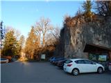
From the road Dravograd - Maribor, in Radlje ob Dravi, from the crossroad at the store Lidl, we drive in the direction of the center of the settlement and the mountain pass Radeljski prelaz. After the crossroad, we drive past the store Hofer and past the turn-off of the road to the left towards Sveti Tri Kralji, and at the next crossroad left towards Austria. Immediately after the crossroad, we go once again left and park on a larger asphalt parking lot near the mansion Dvorec Radlje.
Route description:
At the parking lot signs for Sveti Tri Kralji and Bricnik point us on the path towards the mansion Dvorec Radlje, and from there we go quickly right downwards and on a wide path we descend to an asphalt road which we follow to the right. Next follows a walk on Samostanska ulica, where we go past a few houses, and at the crossroads we follow the blazes. Further, we walk on the asphalt road which leads us through the valley of the stream Radeljski potok, and from the crossroad by numerous signposts we go slightly left in the direction of a marked path. A few minutes ahead the asphalt ends, and the road higher turns right so that it leaves the valley. The path ahead leads us also past a religious symbol, and behind it we soon go left, because blazes point us on a footpath. Next follows an ascent through the forest, where we soon cross a macadam road, and when next time we reach the macadam road we reach it right at the crossroad.
We continue on the upper road towards Bricnik. Next follows a left hairpin turn, and behind it we get to a smaller hamlet, where the road turns back to the right. Next follows also a walk past the homestead Sitar, above which a beautiful view opens up, and then the path which continues on a cart track passes into the forest. Higher on the left side a nice view opens up, which reaches from Uršlja gora to Peca, and in good visibility all the way to Kamniško-Savinjske Alpe. With nice views we reach homestead Navšnik, where from the right side joins the path from Kapunarja or homestead Razdevšek, which is situated in the valley of the stream Radeljski potok. A few steps above the crossing we continue right and we start ascending diagonally on a macadam road, and at the nearby crossroad we go left. Next follows a diagonal ascent towards the left, and during the crossing the road branches off to the left towards the homestead Pušej. We continue straight, and when we reach the ridge we reach the marked crossing.
We continue straight towards Bricnik (sharply right Sveti Tri Kralji), at first with nice views, and then the road goes temporarily into the forest. When after the recycling spot we get to a marked crossing, we continue slightly left on a marked but poorly visible path which through the hayfield ascends to the homestead Zgornji Pernat (sharply left homestead Dobnik, left Zavetišče Onuk - Glavar, straight sv. Anton, and to the right leads the cart track into the forest). Before the homestead we on the right side bypass the chapel, and after the homestead we ascend through a hayfield to the edge of the forest, where the path again becomes more distinct and passes into the forest. Through the forest we at first ascend more steeply, and then we reach the eastern to northeastern ridge of Bricnik, on which we gently to moderately ascend through the forest. The path, which is surrounded by blueberries, at the crossings we follow in the direction of the blazes, and we walk on it all the way to the 1017 meters high Bricnik.
Description and pictures refer to the condition in the year 2019 (March).

Photos:
 1
1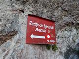 2
2 3
3 4
4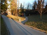 5
5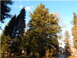 6
6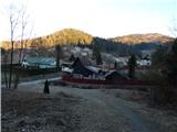 7
7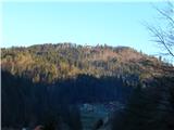 8
8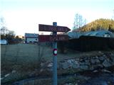 9
9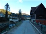 10
10 11
11 12
12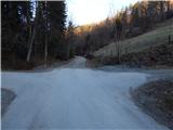 13
13 14
14 15
15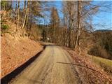 16
16 17
17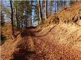 18
18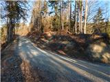 19
19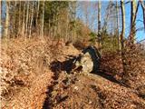 20
20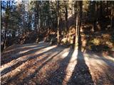 21
21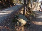 22
22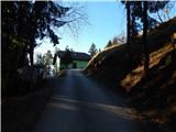 23
23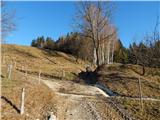 24
24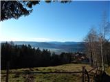 25
25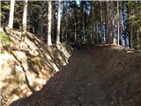 26
26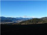 27
27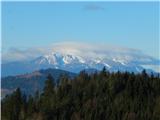 28
28 29
29 30
30 31
31 32
32 33
33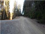 34
34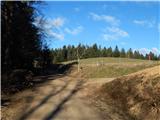 35
35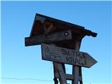 36
36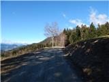 37
37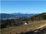 38
38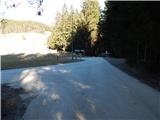 39
39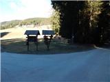 40
40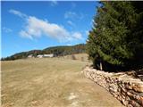 41
41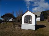 42
42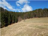 43
43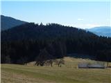 44
44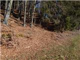 45
45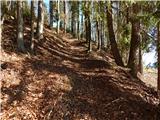 46
46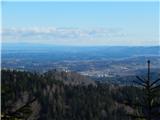 47
47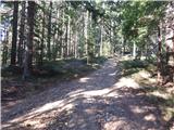 48
48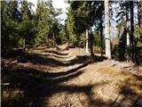 49
49 50
50 51
51 52
52 53
53
Discussion about the trip Radlje ob Dravi - Bricnik
To post a comment you must log in:
If you do not yet have a username, you must first
register.