Radenci (Zdravilišče Radenci) - Gravel pit at Petanjci embankment
Starting point: Radenci (Zdravilišče Radenci) (199 m)
| Latitude/Longitude: | 46,64238°N 16,04557°E |
| |
Walking time: 15 min
Difficulty: easy unmarked way
Elevation gain: 1 m
Elevation difference along the route: 10 m
Map:
Recommended equipment (summer):
Recommended equipment (winter):
Views: 132
 | 1 person like this post |
Access to starting point:
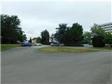
We drive to Radenci, and then we follow the signs for Zdravilišče Radenci health resort. The described route starts at the parking lot next to Zdravilišče Radenci, where parking is permitted only for guests of the health resort.
Route description:
From Zdravilišče Radenci we follow the marked path towards Tišina and Murska Sobota; the trail first leads through Park Radenci, where we follow the blazes. After a few minutes we reach the sidewalk along the main road, turn right and continue across the bridge over the river Mura.
On the other side of the Mura River the marked path turns right, but we continue straight ahead, then carefully cross the main road and continue along the path Gor pa dol kre Mure. The path ahead leads us upstream along the Mura River; at the nearby path junction we choose the right branch, that is, the one that continues along the right side of the flood embankment. A few more minutes of walking follow and we reach the Gramoznica pri nasipu Petanjci, which we notice on the right side of the path.
Description and photographs refer to conditions in July 2025.
Photos:
 1
1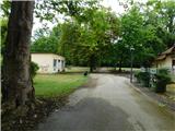 2
2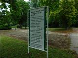 3
3 4
4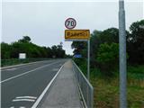 5
5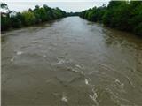 6
6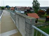 7
7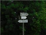 8
8 9
9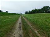 10
10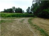 11
11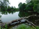 12
12
Discussion about the trip Radenci (Zdravilišče Radenci) - Gravel pit at Petanjci embankment
To post a comment you must log in:
If you do not yet have a username, you must first
register.