Preval Prosca - Koreno (steep path)
Starting point: Preval Prosca (423 m)
| Latitude/Longitude: | 46,0327°N 14,319°E |
| |
Route name: steep path
Walking time: 1 h
Difficulty: easy marked way
Elevation gain: 306 m
Elevation difference along the route: 306 m
Map: Ljubljana - okolica 1:50.000
Recommended equipment (summer):
Recommended equipment (winter):
Views: 7.034
 | 1 person like this post |
Access to starting point:
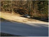
From Dobrova we drive towards Horjul or vice versa. When we arrive at the village of Zaklanec, we turn right (from the direction of Dobrova) towards Polhov Gradec. We follow the ascending road to a smaller saddle, where beside the road we notice mountain signposts and next to them a parking lot.
We can also reach here from Polhov Gradec.
Route description:
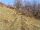
From the parking lot we cross the road and arrive at the mountain signs. Here we head onto the path towards Koreno "along the ridge". The path initially runs along a cart track, which after a few minutes of walking brings us to a junction of two cart tracks. We continue left on the marked cart track, which then brings us out of the forest onto a clearing, after which the cart track turns into a footpath. The path ahead becomes very steep and ascends straight up the ridge. After a while the steepness eases and the path brings us to a larger pleasant clearing.
The path then crosses a shorter stretch of forest and then brings us to a larger grassy slope, where we come to a cart track. When we step onto the cart track we continue right to the spot where it starts to descend. Right at the top of a smaller saddle we turn left and after a few steps we reach a bench, where we notice markings that were very scarce on the meadow through which we walked. The path then continues along the cart track, which after a few minutes brings us to the village. When we go around the first (last) houses in the village we come to a poorly marked crossroads, where we continue right along the asphalt road, which descends for a short time and soon brings us to the next marked crossroads. Here we continue left further along the asphalt road, which after 15 minutes brings us to the open-door farm pr'Lenart. Just a few steps further we reach the logbook box.
From the box we continue along the road in the direction of "razglednik" to the church on the top of Koreno. Behind the church we notice a panorama panel, a bench and a table, which we reach in a few steps of scenic walking along the summit grassy slope.

Photos:
 1
1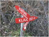 2
2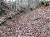 3
3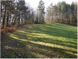 4
4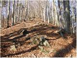 5
56
 7
7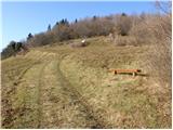 8
8 9
9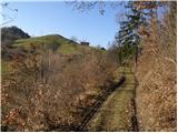 10
10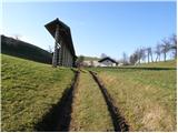 11
11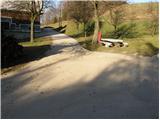 12
12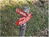 13
13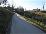 14
14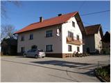 15
15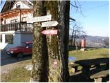 16
16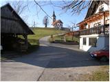 17
17 18
18
Discussion about the trip Preval Prosca - Koreno (steep path)
To post a comment you must log in:
If you do not yet have a username, you must first
register.