Preval Prosca - Koreno (gentle path)
Starting point: Preval Prosca (423 m)
| Latitude/Longitude: | 46,0327°N 14,319°E |
| |
Route name: gentle path
Walking time: 1 h 15 min
Difficulty: easy marked way
Elevation gain: 306 m
Elevation difference along the route: 320 m
Map: Ljubljana - okolica 1:50.000
Recommended equipment (summer):
Recommended equipment (winter):
Views: 10.861
 | 5 people like this post |
Access to starting point:
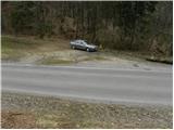
From Dobrova we drive towards Horjul or vice versa. When we come to the village Zaklanec we turn right (from the direction of Dobrova) in the direction of Polhov Gradec. We follow the ascending road to a smaller saddle, where next to the road we notice mountain signposts and a parking lot beside them.
We can also come here from Polhov Gradec.
Route description:
From the saddle Prosca we continue on the asphalt road towards Polhov Gradec (direction Koreno longer path), and after a few steps we come to a smaller crossroad, where we continue left. Further we ascend on an asphalt road, which after 500 m brings us to a smaller hamlet, where the asphalt ends.
We continue between houses on a panoramic macadam road, which higher passes into the forest. The moderately steep road leads us further across a steep grassy slope, then returns to the forest, where it continues all the way to a lonely hut, behind which a marked path from Polhov Gradec joins from the right.
We continue left in the direction of Koreno, and continue further on a moderately steep macadam road, which higher brings us to a marked junction, where a steep path joins. We continue right on the asphalt road, which over partly panoramic slopes brings us in the next few minutes to the open-door farm pr'Lenart. From here we continue straight in the direction of "razglednik" and continue the ascent on a narrow and increasingly panoramic road, which quickly brings us to the church of St. Mohor and Fortunatus. Further we continue past a cross on a panoramic grassy ridge, along which in a few dozen steps of further walking we ascend to the logbook box on the top of Koreno.

Photos:
 1
1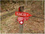 2
2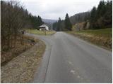 3
3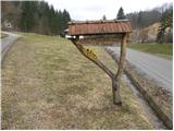 4
4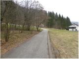 5
5 6
6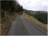 7
7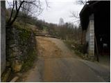 8
8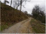 9
9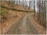 10
10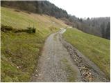 11
11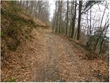 12
12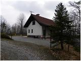 13
13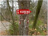 14
14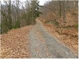 15
15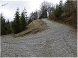 16
16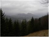 17
17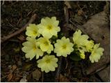 18
18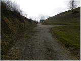 19
19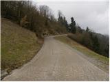 20
20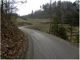 21
21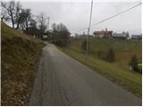 22
22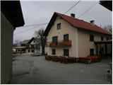 23
23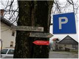 24
24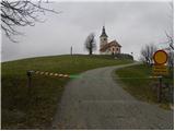 25
25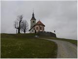 26
26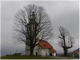 27
27 28
28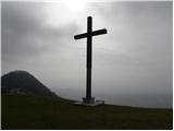 29
29 30
30
Discussion about the trip Preval Prosca - Koreno (gentle path)
|
| Gost3. 12. 2007 |
MT-I suggest to Koreno from Zaklanec at the water reservoir along the road to Polhov Gradec. Follow the well-marked trail through the forest uphill. When you reach the asphalt road, go left past the shrine to the hamlet of Pečovje, then turn right on the forest trail towards Koreno across the meadow and through the forest to the meadow below the village of Slevica. At the hamlet of Slevica turn left on the marked trail to Koreno where there is a stamp with a logbook at the open doors homestead. In good weather nice 360-degree panorama. Elevation gain ca. +350m, time ca. 1h
|
|
|
|
| Lisica31. 12. 2010 |
This was a nice trip for me today.  When you reach the top of the hill (out of the forest) the path splits (you can go right or left). Better go right and not left towards the houses (like I did). They have big loose dogs + the path is poorly marked. The logbook was right at the end of the entries, without covers - falling apart! When you reach the top of the hill (out of the forest) the path splits (you can go right or left). Better go right and not left towards the houses (like I did). They have big loose dogs + the path is poorly marked. The logbook was right at the end of the entries, without covers - falling apart!  The markers along the path are in pretty bad condition. The markers along the path are in pretty bad condition.
|
|
|
|
| janez52031. 12. 2020 |
Quite a decent path. In winter, the marks are not visible at all, and there are also no signposts.
So this is more of an unmarked path.
|
|
|
To post a comment you must log in:
If you do not yet have a username, you must first
register.