Preserje - Sveti Jožef (Mlečnik)
Starting point: Preserje (400 m)
| Latitude/Longitude: | 45,9613°N 14,4205°E |
| |
Walking time: 15 min
Difficulty: easy unmarked way
Elevation gain: 41 m
Elevation difference along the route: 55 m
Map: Ljubljana - okolica 1:50.000
Recommended equipment (summer):
Recommended equipment (winter):
Views: 4.633
 | 1 person like this post |
Access to starting point:
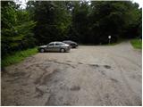
From the highway Ljubljana - Koper we take the exit Brezovica, then we continue driving in the direction of Podpeči. In Podpeči, from where roads from Črna vas and Ig also join, we continue right in the direction of Krim, Rakitna and Borovnica. We follow the road towards Borovnica for a short time, then signs for Rakitna direct us left uphill onto a somewhat narrower and especially steep road, which we then follow to a smaller saddle. On the mentioned saddle we turn left and after 100 m we park on the marked parking lot.
Route description:
From the parking lot, by which there are mountain signposts for Sveta Ana, Jezero, Podpeči, Krim, Planinica and Ledena jama cave, we return 100 m back to the main road, there we continue left towards Preserje and Rakitna. We follow the road, which is slightly descending, to the fire station, and right at this spot we leave the main road and turn right onto a narrower road which continues by the religious symbol (cross). The asphalt road ascends past a few houses, when the asphalt ends, on the left side we will notice a poor forest road which ascends across a grassy hayfield. With views of Sveta Ana and Krim we ascend to a smaller intersection, where a cart track branches off sharply to the left to the nearby water tank, and we continue straight on the initially barely visible grassy cart track. The cart track quickly takes us into the forest, through which in 3 minutes of further walking we ascend to Mlečnik, a peak in the middle of which stands the church of St. Joseph from the 17th century.

Photos:
 1
1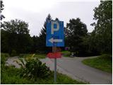 2
2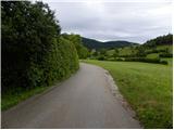 3
3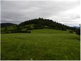 4
4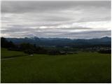 5
5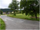 6
6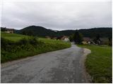 7
7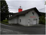 8
8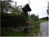 9
9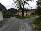 10
10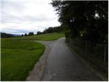 11
11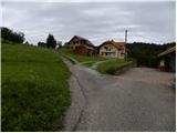 12
12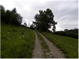 13
13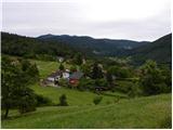 14
14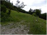 15
15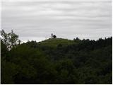 16
16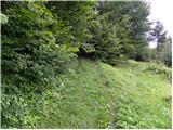 17
17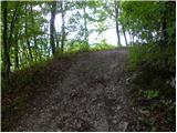 18
18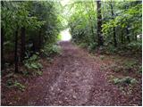 19
19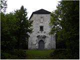 20
20
Discussion about the trip Preserje - Sveti Jožef (Mlečnik)
To post a comment you must log in:
If you do not yet have a username, you must first
register.