Prelože pri Lokvi - Veliko Gradišče
Starting point: Prelože pri Lokvi (480 m)
| Latitude/Longitude: | 45,6581°N 13,935°E |
| |
Walking time: 45 min
Difficulty: easy marked way
Elevation gain: 262 m
Elevation difference along the route: 262 m
Map:
Recommended equipment (summer):
Recommended equipment (winter):
Views: 6.128
 | 2 people like this post |
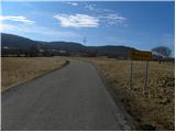
Access to starting point:
From the highway Ljubljana - Koper we take the exit Divača, and then we continue driving towards Divača. Just before Divača we turn left towards the village Lokev, and in Lokev sharply left in the direction of Prelože. Further, we drive a little less than 200 meters to the next crossroad, from where we continue right in the direction of the village Prelože and the peaks Veliko Gradišče and Kokoš. When the village Lokev ends, the road starts ascending and quickly brings us to the village Prelože pri Lokvi, where we start our path. In the mentioned village there are no appropriate parking spots, and also lower along the road there are not many options for parking.
Route description:
From the starting point, we first walk to the village Prelože pri Lokvi, and from there we continue on a marked path, initially along the road. Above the village the asphalt ends, the macadam road ahead quickly changes into a rough cart track. Higher up, the cart track, which moderately ascends through the forest, ascends a little steeper and brings us to a junction at the spring Vroček.
Here we continue left (right Kokoš) and ascend along the cart track to the nearby junction, where we continue sharply right. We continue the ascent on a somewhat less steep mountain path, which continues through the forest, then turns right and in a few minutes of further walking ascends to the panoramic peak.
Along the route: Vroček (645m)
Photos:
 1
1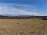 2
2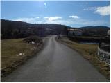 3
3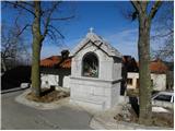 4
4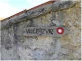 5
5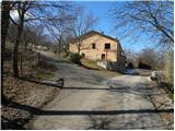 6
6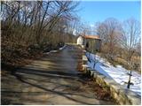 7
7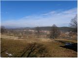 8
8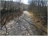 9
9 10
10 11
11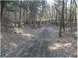 12
12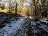 13
13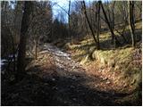 14
14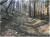 15
15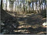 16
16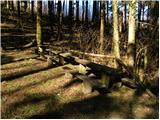 17
17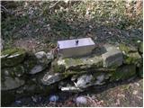 18
18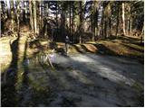 19
19 20
20 21
21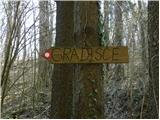 22
22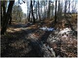 23
23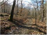 24
24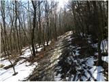 25
25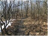 26
26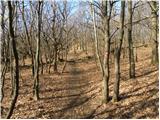 27
27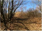 28
28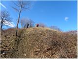 29
29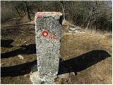 30
30 31
31
Discussion about the trip Prelože pri Lokvi - Veliko Gradišče
|
| bruny30. 04. 2012 |
While hiking to Veliko Gradišče I had practically the whole time  the feeling from the spring onwards that the summit is more besieged by cyclists than hikers, runners, walkers... Dozens of ,,bicycle tracks,, and only here and there a shoe print. It looks similar on the upper winter photos too... the feeling from the spring onwards that the summit is more besieged by cyclists than hikers, runners, walkers... Dozens of ,,bicycle tracks,, and only here and there a shoe print. It looks similar on the upper winter photos too...
|
|
|
|
| B230. 04. 2012 |
According to the Mountain Trails Act, riding mountain bikes, motorcycles and similar "junk" is prohibited! The fine is from 100 to 1200 EUR... No one abides by it, there are no controls either... Under the auspices of PZS "touring cycling" is spreading - and what can we expect from that???
|
|
|
|
| SunnyDay5. 05. 2014 |
There's space for a few cars also in the village Prelože by the trough for watering livestock, where the road is wide enough. That's a bit above the chapel (in photo no. 4) or a bit below the signpost in photo no. 5.
|
|
|
To post a comment you must log in:
If you do not yet have a username, you must first
register.