Prelaz Vrhe - Source of Sotla
Starting point: Prelaz Vrhe (426 m)
| Latitude/Longitude: | 46,2583°N 15,7586°E |
| |
Walking time: 1 h 30 min
Difficulty: easy marked way
Elevation gain: 214 m
Elevation difference along the route: 315 m
Map:
Recommended equipment (summer):
Recommended equipment (winter):
Views: 9.434
 | 2 people like this post |
Access to starting point:
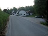
From the highway Ljubljana - Maribor, we take the exit Dramlje and follow the road ahead in the direction of Šentjur, Rogaška Slatina and Rogatec. In Rogatec, signs for Donačka gora direct us to the left onto a somewhat narrower road, which we then follow towards the village Žetale. On a smaller pass, right at the spot where the municipality of Rogatec ends, we will notice a somewhat larger parking lot on the right side, where we park.
Route description:
From the parking lot, we first walk to the pass, then continue on the main road in the direction of the source of Sotla. Already after a few steps of descent on the road, at the very beginning of the village Čermožiše, signs for the source of Sotla direct us to the right onto a macadam road, which we follow for only a few dozen meters. Here we will notice a marked cart track which turns right from the macadam road and starts to ascend moderately through the forest. We continue the ascent on the well-marked cart track, which higher up brings us to a forest road, which we follow to the left; it quickly brings us to the hunting cottage (Koserjeva koča).
Immediately after the cottage we leave the macadam road, as the blazes direct us left onto a footpath which starts to ascend more steeply through dense forest. The path soon brings us to a wide ridge of Maclja, where it flattens, then continues with some shorter ascents and descents. When a nice view opens up on Donačka gora, we leave the ridge and continue slightly to the right on a cart track that starts to descend. After a few minutes of descent we come to the next junction, where we continue sharply left (slightly right to Trlično and Lipovec). Further on we gently ascend on a grassy cart track, then signs for the source of Sotla direct us right onto a path, along which in one minute of further walking we descend to the source.

Along the route: Koserjeva koča (650m)
Photos:
 1
1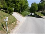 2
2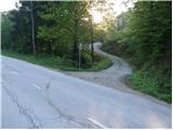 3
3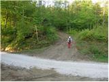 4
4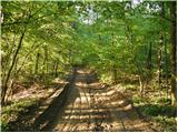 5
5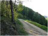 6
6 7
7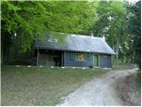 8
8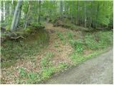 9
9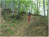 10
10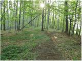 11
11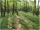 12
12 13
13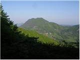 14
14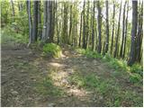 15
15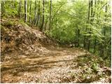 16
16 17
17 18
18 19
19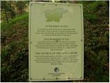 20
20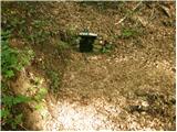 21
21
Discussion about the trip Prelaz Vrhe - Source of Sotla
|
| capin21. 06. 2011 |
After a long time to Izvir Sotle from Prelaz Vrhe. Path to the hunting hut steep and muddy, further along the Maclja ridge real pleasure. How many mushrooms I picked up on the path I won't tell because it seems to me that Šerpa is prowling around there (if by chance not at Donačka) L.p.
|
|
|
|
| Marx23. 07. 2011 |
Very precise description. Interesting, although I'm from Croatia, but to Izvir I always go from Prelaz Vrhe, I have never gone from the Macelj place myself.
But, how to get to the highest peak of Maceljska gora (And which one is exactly the highest, Belinovec or some other?)?
|
|
|
To post a comment you must log in:
If you do not yet have a username, you must first
register.