Starting point: Pred Belo (571 m)
| Latitude/Longitude: | 46,3188°N 14,6005°E |
| |
Walking time: 6 h 45 min
Difficulty: difficult marked way
Elevation gain: 1779 m
Elevation difference along the route: 1900 m
Map: Kamniške in Savinjske Alpe 1:50.000
Recommended equipment (summer): helmet
Recommended equipment (winter): helmet, ice axe, crampons
Views: 18.434
 | 2 people like this post |
Access to starting point:
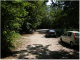
We drive to Kamnik and follow the road ahead towards the valley of Kamniška Bistrica. Approximately 2 km after the lower station of the cable car to Velika planina, we will notice on the right side of the road a parking lot and mountain signposts for Presedljaj, Konj and Korošica (the parking lot is located after the bridge).
Route description:
From the parking lot, we head onto the path in the direction of Presedljaj, Korošica, Konj and Ojstrica. Already after a few meters the path turns to the right, where at first it barely ascends, then it starts descending and after a few minutes joins a wide cart track. We continue the ascent on a gentle cart track, which soon crosses a torrent, and then ascends gently to moderately towards the head of the valley Kamniška Bela.
After a good 30 minutes of walking from the starting point, we come to a marked junction, where we continue right on the marked path (left to waterfall Orglice and Korošica via Šraj pesek). The cart track soon after the junction changes into an increasingly steep footpath, which leads us further through dense forest. Higher, the path turns slightly to the left and crosses a torrent gully. A little further, the path over Najnar štant branches off to the left almost unnoticeably (a demanding and exposed path that leads to Korošica, higher it joins the path over Šraj pesek), and we continue straight on the marked path, which starts to ascend in numerous switchbacks. Higher, the path steeply ascends for a short time and brings us to a nice viewpoint with a table and bench.
The path ahead slightly descends, crosses a steep slope and brings us to a torrent gully. Here the path turns to the left side of the slope, ascends at first with the help of some pegs and higher steel cables, then returns to the forest, where it steeply ascends for some time. Higher, the path temporarily flattens, then steeply ascends again and brings us to the saddle Presedljaj in a few minutes of further walking, where there is a marked junction.
We continue left in the direction of Korošica (right Konj) on the path which starts ascending along the left side of an indistinct ridge. After a few minutes, the path turns to the right and flattens. We continue on a partly quite overgrown footpath, which gently ascends through a belt of dwarf pines. A little further, the path crosses an exposed slope above the valley Lučka Bela, where there is also a memorial plaque to the deceased mountaineer. Just a few meters behind the memorial plaque, the slope flattens and brings us to an unmarked junction, where an unmarked path towards Vršiči and Vežica branches off to the left.
We continue straight on the marked path, which heads north and with a few shorter ascents and descents quickly brings us to the place where we join the more trodden path from the valley Lučka Bela. Here we continue left and past the branch-off of the path to Lučkega Dedca walk to Prag (1910 m).
From Prag we continue straight and follow the wide footpath, which starts descending transversely towards the green plain of Korošica. After 10 minutes of descent, the path flattens and only a few steps of easy walking separate us from Kocbekov dom.
From Kocbekov dom we continue on the marked path in the direction of Ojstrica. The path already a few meters above the hut enters the belt of dwarf pines, where it gradually starts ascending ever steeper. After a good 20 minutes of ascent from Kocbekov dom, the path flattens and transitions to grassy slopes, which are soon replaced by scree. The path ahead crosses two successive gullies, then starts ascending more steeply on an increasingly panoramic slope. The path ahead leads us past two less noticeable junctions (in both cases we continue right in the direction of Ojstrica, left Planjava and Škarje) and gradually starts turning more and more to the right. Higher, the path becomes even steeper and transitions to a quite scree-covered slope. Further, the path flattens for a short time and through a narrow passage brings us to the main ridge of the Kamniško-Savinjske Alpe. Once on the ridge, we continue right on a very steep path, which ascends further over rugged rock. We follow this very steep path, aided by some pegs, all the way to the summit of Ojstrica, which we reach after approximately 15 minutes of further walking (in the final section there is a high risk of falling rocks).

Photos:
 1
1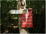 2
2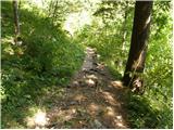 3
3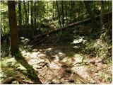 4
4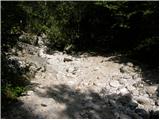 5
5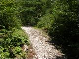 6
6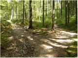 7
7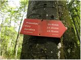 8
8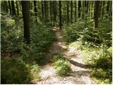 9
9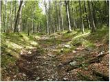 10
10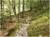 11
11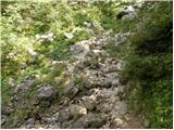 12
12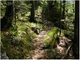 13
13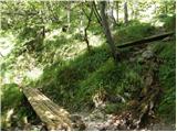 14
14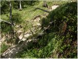 15
15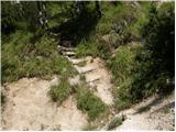 16
16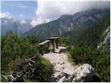 17
17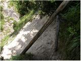 18
18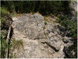 19
19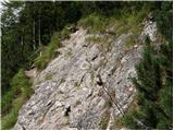 20
20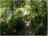 21
21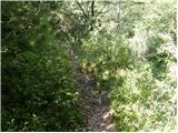 22
22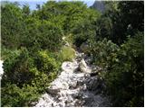 23
23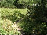 24
24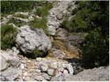 25
25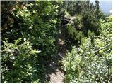 26
26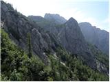 27
27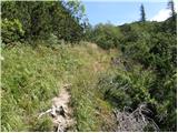 28
28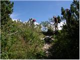 29
29 30
30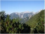 31
31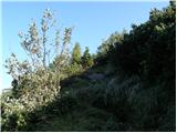 32
32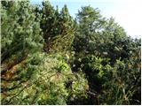 33
33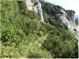 34
34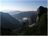 35
35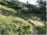 36
36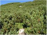 37
37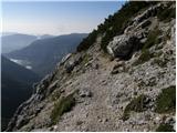 38
38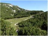 39
39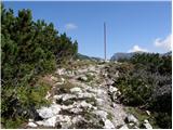 40
40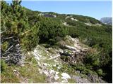 41
41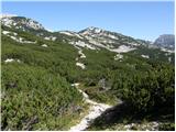 42
42 43
43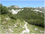 44
44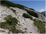 45
45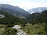 46
46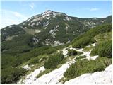 47
47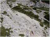 48
48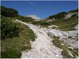 49
49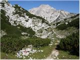 50
50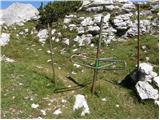 51
51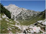 52
52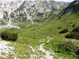 53
53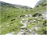 54
54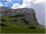 55
55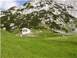 56
56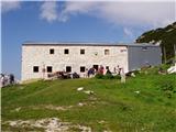 57
57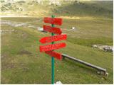 58
58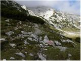 59
59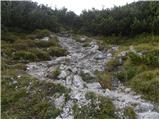 60
60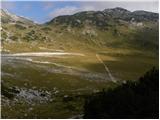 61
61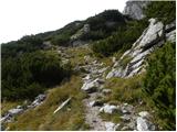 62
62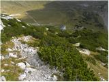 63
63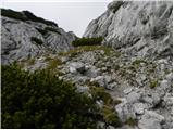 64
64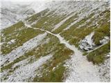 65
65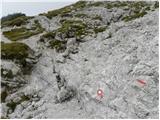 66
66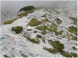 67
67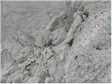 68
68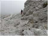 69
69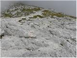 70
70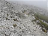 71
71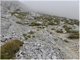 72
72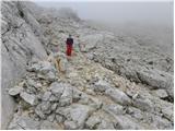 73
73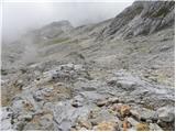 74
74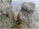 75
75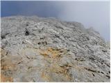 76
76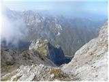 77
77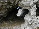 78
78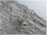 79
79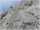 80
80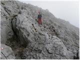 81
81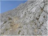 82
82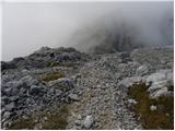 83
83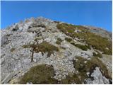 84
84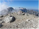 85
85
Discussion about the trip Pred Belo - Ojstrica
|
| klm22. 07. 2010 |
Actually, I don't know how long this path should take, but I myself needed 2:25 h to stand on top of Ojstrica, meanwhile I took some nice photos. Otherwise, the weather is fantastic like yesterday. Two things I would highlight after the tour: the first is the caretaker of Kocbekov dom on Korošica. She's a lady with character, backbone, extremely pleasant hut keeper, who has been the caretaker of the mentioned hut for many years. She gave me isotonic drinks and water for free, and it was very pleasant to chat with her. I get the same homely feeling every time I meet her. The second thing I would highlight is the ascent to Ojstrica itself. Since I'm somewhat time-constrained, I try to choose some shortcut. The ascent to the mentioned summit from Kocbekov dom described above offers pleasant grade I climbing in the summit part if we go directissimo, so we reach the top in ridiculously short time. The rock is excellent!
|
|
|
|
| mukica22. 07. 2010 |
You must have a very fast pace to do this tour in such a short time , since it's almost from Kamniška Bistrica or was the starting point somewhere else , since it's almost from Kamniška Bistrica or was the starting point somewhere else
|
|
|
|
| klm22. 07. 2010 |
Yes from Bistrica. I'm a mountain runner otherwise, but now I'm on "vacation", meaning I wander the hills with a camera and enjoy. Slower is almost impossible - runner's deformation though. When I ran this trail in the past, time was a few seconds under 2h, but then I felt pretty stupid-no impressions or memories of the tour done, just fatigue.
|
|
|
|
| mala planina17. 10. 2011 |
The path can really be halved. CRITICISM-pines along the path are awful. (CAN SOMEONE CUT THEM DOWN?)
|
|
|
|
| Loni17. 10. 2011 |
Interesting, but have those pines grown so much since August, they didn't seem problematic to me at all, it was possible to pass comfortably by.
|
|
|
|
| urbancek24. 06. 2012 |
These times are not quite normal, I agree with klm and malo planina... Well physically prepared hikers return to the valley in 6h 45min without major stops. I today with normal constant walking got back to the car after 7h 30min (in between half an hour for lunch, stop at Korošica and also at L. Dedcu) Criticism still goes to the scree that would need a motorbike I today with normal constant walking got back to the car after 7h 30min (in between half an hour for lunch, stop at Korošica and also at L. Dedcu) Criticism still goes to the scree that would need a motorbike Lp! Lp!
|
|
|
|
| kicho7. 10. 2012 |
yesterday I went on this path. The scree is still in the same condition and since I'm a bit tall, I almost had to go on all fours
Otherwise a nice trip with nice weather.
best regards
|
|
|
|
| 23maja17. 07. 2013 |
When I went up Belo-Korošica-Ojstrica on 7.7.2013, the scree was cleared (no more junipers or they are no longer problematic). The timetable is more realistic than unrealistic, I needed a good 5 hours to the summit with two stops. Reaching the top in 3 hours is not realistic even for a well-prepared hiker  But full respect for such a time! But full respect for such a time!
|
|
|
|
| janez.novak17. 07. 2013 |
May 23 - is this trail well marked, can you miss it somewhere?
|
|
|
|
| ljubitelj gora7. 08. 2014 |
At Korošica there is flowing water, if anyone is interested, but I don't know if it's drinkable. The path from the valley to here is really long and strenuous. But I went at Slap Orglice through the jump and Šraj pesek and to the top of Mala Ojstrica/Ojstrica. Returned via the above-described path but before that I was also at the saddle under Škarij and further towards Lučka Baba, but it started thundering (it sounded terrible because you are indirectly in contact with the clouds) and so I descended quickly/safely back to Korošica, I crossed one snowfield under the other lower path, but no problem, it's not that steep, the snow had also melted 2-3 cm. At Korošica the weather improved but unfortunately time caught up with me and I went towards Presedljaj and into the valley.
|
|
|
|
| živjo7. 09. 2014 |
I too stopped at the hut on the return from Ojstrica where I enjoyed excellent service and pleasant chat. Super tour and hats off to the hut keeper at Korošica.
|
|
|
|
| Daiblo2.0 7. 10. 2019 |
Trip completed on 6. 10. 2019 without major incidents, but requires some notes:
1.) Comment No. 1 by user “klm” is irrelevant to everyone except mountain runners.
2.) The trip requires sufficient physical fitness, as confirmed by yesterday's parameters: 4h 50min to the summit, 9h 30min for the whole trip, 2000m ascent, approx. 16km length.
3.) Near the ruins of Kocbekov dom on Korošica there is running water (tap) and a shelter standing on three locked containers, which do not serve as bivouac!
4.) The path from the summit to Korošica is crumbly and dangerous for slipping, helmet use is highly recommended.
Good luck with further mountaineering activities.
|
|
|
|
| Maticc7. 06. 2020 |
I also wonder how a comment from someone who does mountain running is relevant to the average hiker and what sense it makes. Such a time is certainly more misleading than the official 6'45, because it's almost an hour.
|
|
|
To post a comment you must log in:
If you do not yet have a username, you must first
register.